Google Earth for Media
With its distinctive swooping motion and ability to zoom into any location, Google Earth is a top mapping choice for media professionals worldwide. Google Earth includes satellite imagery of the entire world (with 75% of the world's population at high resolution), hundreds of 3D cities, and archives of historical imagery — all available for media use.
Since media organizations have special requirements, we offer the licensing, software, and content to make the most of mapping shots. We make it easy to build simple context shots for breaking news or sophisticated geo-infographics for analysis. From live TV news to syndicated dramas to websites, Google Earth is a great way to add a sophisticated look to any media show or broadcast.
Featured Case Study
Within 36 hours of the Haiti earthquake in January 2010, Google compiled, prepared, and distributed satellite imagery of Port-au-Prince for rescue organizations and news outlets. This imagery helped save hundreds of lives, and was featured prominently in news clips around the world.
The Google Earth team works closely with imagery and content providers to prepare rapid-response images and other geographical data to both first responders and the media.
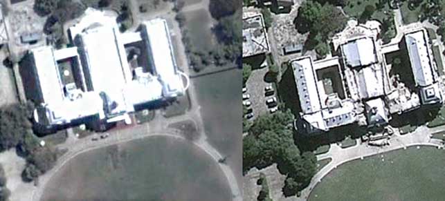
Pre-earthquake photos of Port-au-Prince on the left, GeoEye satellite photos of the same locations taken on 13 January 2010 on the right, the day after the catastrophic earthquake.
Explore Google Earth for Media
Tools for media
Export high-res movies, build timelines, and other essentials for storytelling.
Permission and licensing
Learn what you can do with Google Earth and Maps, and how to get a license.