Summary

| Quick Facts: Cartographers and Photogrammetrists | |
|---|---|
|
$54,510 per year
$26.21 per hour |
|
| Bachelor’s degree | |
| None | |
| None | |
| 13,800 | |
| 22% (Faster than average) | |
| 3,100 | |
What Cartographers and Photogrammetrists Do
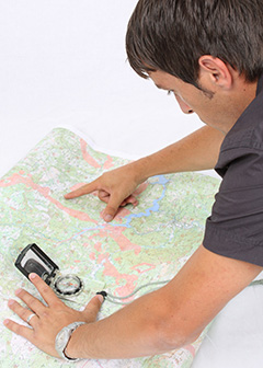
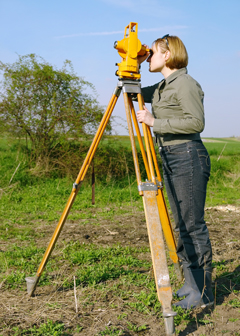
Cartographers and photogrammetrists measure, analyze, and interpret geographic information to create maps and charts for political, cultural, educational, and other purposes. Cartographers are general mapmakers, and photogrammetrists are specialized mapmakers who use aerial photographs to create maps.
Work Environment
Cartographers and photogrammetrists spend most of their time using computers while working in offices. Cartographers typically do fieldwork to collect and verify data used in creating maps. Photogrammetrists do fieldwork to plan ground control for an aerial survey and to validate interpretations.
How to Become a Cartographer or Photogrammetrist
A bachelor’s degree in cartography, geography, or a related field is the most common path of entry into this occupation. Cartographers and photogrammetrists must be licensed in some states.
Pay
The median annual wage of cartographers and photogrammetrists was $54,510 in May 2010.
Job Outlook
Employment of cartographers and photogrammetrists is expected to grow 22 percent from 2010 to 2020, faster than the average for all occupations. Increasing use of maps for national security and local government planning will fuel most of the growth.
Similar Occupations
Compare the job duties, education, job growth, and pay of cartographers and photogrammetrists with similar occupations.
O*NET
O*NET provides comprehensive information on key characteristics of workers and occupations.
Contacts for More Information
Learn more about cartographers and photogrammetrists by contacting these additional resources.