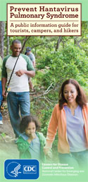
Prevent Hantavirus Pulmonary Syndrome (HPS) [PDF - 443KB]
A public information guide for tourists, campers, and hikers.
Yosemite National Park Hantavirus Infection Case Count Maps
Updated: September 14, 2012
Current Case Count (State of Residence) Map*

*n=9 for whom information was reported as of September 13, 2012
As of September 13, the National Park Service (NPS) has announced a total of 9 confirmed cases of hantavirus infection in people who recently visited Yosemite National Park. The visitors to Yosemite are residents of: California (7), Pennsylvania (1), and West Virginia (1).
« Read the full Outbreak Investigation
Previous Case Count Maps
September 6, 2012: Case Count (State of Residence) Map*

*n=8 for whom information was reported as of September 6, 2012
As of September 6, the National Park Service (NPS) has announced a total of 8 confirmed cases of hantavirus infection in people who recently visited Yosemite National Park. The visitors to Yosemite are residents of: California (6), Pennsylvania (1), and West Virginia (1).
Get email updates
To receive email updates about this page, enter your email address:
Contact Us:
- Centers for Disease Control and Prevention
Viral Special Pathogens Branch
1600 Clifton Rd
Atlanta, GA 30333 - Hantavirus Hotline
(877) 232-3322
(404) 639-1510 - 800-CDC-INFO
(800-232-4636)
TTY: (888) 232-6348 - cdcinfo@cdc.gov
- About VSPB (Viral Special Pathogens Branch)