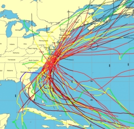
NOAA Provides Easy Access to Historical Atlantic Hurricane Tracks
Website provides storm paths by ZIP code; includes population trends, storm history
 An updated NOAA website lets everyone from reporters to city planners
track local historical storm activity, review specific storm tracks and
obtain information about a particular storm’s landfall. NOAA’s Historical Hurricane Tracks
website and mapping application generates customized, downloadable
maps based on more than 150 years of Atlantic hurricane data.
The Historical Hurricane Tracks tool, developed by NOAA’s Coastal Services Center in partnership with the National Hurricane Center, allows users to search by U.S. ZIP code, state or county, storm name or year, or latitude and longitude points. With the search results, users can generate a map showing the storm track accompanied by a table of related information. Read more | Larger graphic

