
US Forest Service and NASA Team up on Climate Change Early Warning System for Forests
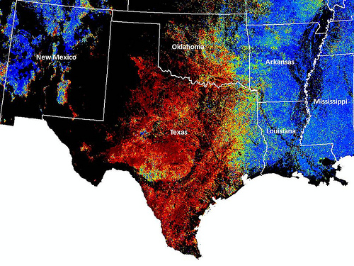
ForWarn maps normal forest conditions as blue and change from normal as shades that range from green to red. This map shows that the greater part of Texas and Oklahoma were experiencing severe forest stress in late September of 2011 from the effects of drought and wildfire.
The Forest Service recently unveiled a product that helps natural resource managers rapidly detect, identify and respond to unexpected changes in the nation’s forests by using web-based tools.
The satellite-based monitoring and assessment tool aptly called ForWarn, recognizes and tracks potential forest disturbances caused by insects, diseases, wildfires, extreme weather, or other natural or human-caused events believed by many scientists to be caused in part by climate change. Read more »
Tags: Climate Change, Forestry, ForWarn, NASA, Texas