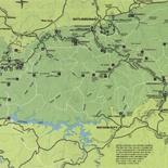
![[Map of parts of Caroline, Hanover, and Henrico counties, Va. west of the Mattaponi River and the Richmond, Fredericksburg, and Potomac Railroad].](https://cybercemetery.unt.edu/archive/oilspill/20121020065536im_/http://www.loc.gov/collections/static/hotchkiss-maps/images/cwh00025.jpg)
![[December 21, 1944], HQ Twelfth Army Group situation map.](https://cybercemetery.unt.edu/archive/oilspill/20121020065536im_/http://www.loc.gov/collections/static/world-war-II-maps-military-situation-maps-from-1944-to-1945/images/ict21200.jpg)
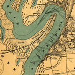

![[Sketch of the battles of Chancellorsville, Salem Church, and Fredericksburg], May 2, 3, and 4, 1863](https://cybercemetery.unt.edu/archive/oilspill/20121020065536im_/http://www.loc.gov/collections/static/civil-war-maps/images/cwh00129.jpg)
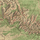


![[Rough sketch of the Rich Mountain battle area extending from Beverly, W. Va. to Clarksburg].](https://cybercemetery.unt.edu/archive/oilspill/20121020065536im_/http://www.loc.gov/collections/static/hotchkiss-maps/images/cwh00078.jpg)
Results
Refined by:
Original Format: Map-

Landsat image mosaic of Antarctica (LIMA) /
Geographic coordinates shown in red.
Contributor: BAS Mapping and Geographic Information Centre Site: American Memory-cultural - Main Catalog Original Format: Map Date: 2007 View catalog record -

Letts's bird's eye view of the approaches to India /
Relief shown pictorially.
Contributor: Payne, W. H. Site: American Memory-cultural - Main Catalog Original Format: Map View catalog record -

Map illustrating the operations of U.S. Forces against Vicksburg /
Also shows the tracks of Genl. Grant, General Blair, and Admiral Porter, and sites of Union victories.
Contributor: United States Coast Survey Site: American Memory-cultural - Main Catalog Original Format: Map Date: 1863 View catalog record -
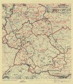
[June 28, 1945], HQ Twelfth Army Group situation map.
Available also through the Library of Congress web site as a raster image.
Contributor: Allied Forces. Army Group, 12th. Engineer Section Site: American Memory-cultural - Main Catalog Original Format: Map Date: 1945-06-28 View catalog record -

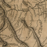
[Lake Champlain and Lake George, and the country between the Hudson and the lakes on the west, and Connecticut River on the east.
Scale ca. 1:640,000.
Contributor: Medcalfe Site: American Memory-cultural - Main Catalog Original Format: Map Date: 1777 View catalog record -
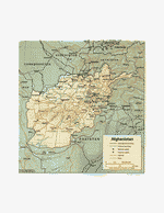
Afghanistan.
"Base 802044 (R00493) 6-93."
Contributor: United States. Central Intelligence Agency Site: American Memory-cultural - Main Catalog Original Format: Map Date: 1993 View catalog record -

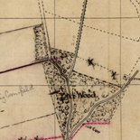
[Sketch of the cavalry engagement of General Lomax near Gordonsville, Virginia, Dec. 24th, 1864].
Shows Confederate troop positions and movements and names of some residents.
Site: American Memory-cultural - Main Catalog Original Format: Map Date: 1864 View catalog record -

A map of the state of Virginia, constructed in conformity to law from the late surveys authorized by the legislature and other original and authentic ...
Relief shown by hachures. Depths shown by soundings.
Contributor: Böÿe, Herman - Böÿe, Herman Site: American Memory-cultural - Main Catalog Original Format: Map Date: 1859 View catalog record -

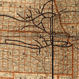
Map showing the Grand Rapids & Indiana Railroad, and its connections.
Scale ca. 1:4,000,000.
Contributor: G.W. & C.B. Colton & Co Site: American Memory-cultural - Main Catalog Original Format: Map Date: 1871 View catalog record -
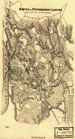
Battle of Pittsburgh Landing [i.e., Shiloh]
Scale not given.
Contributor: Coppee, Henry Site: American Memory-cultural - Main Catalog Original Format: Map Date: 1866 View catalog record -
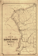
Map of Hancock County Virginia, 1852.
Relief shown by hachures.
Site: American Memory-cultural - Main Catalog Original Format: Map Date: 1852 View catalog record -
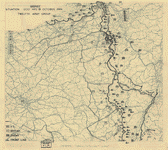
[October 18, 1944], HQ Twelfth Army Group situation map.
Available also through the Library of Congress web site as a raster image.
Contributor: Allied Forces. Army Group, 12th. Engineer Section Site: American Memory-cultural - Main Catalog Original Format: Map Date: 1944-10-18 View catalog record -


R/V Cape Henlopen, 24-30 May, 1994 CH 94-12 : sidescan sonar survey QMIPS data archive / Catalog Record - Electronic Resource Available
Computer program and data.
Site: Main Catalog Original Format: Map Date: 1996 -
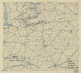
[August 16, 1944], HQ Twelfth Army Group situation map.
Available also through the Library of Congress web site as a raster image.
Contributor: Allied Forces. Army Group, 12th. Engineer Section Site: American Memory-cultural - Main Catalog Original Format: Map Date: 1944-08-16 View catalog record -

Bird's eye view of Maysville, Colo. Chaffee County 1882.
Perspective map not drawn to scale.
Contributor: Stoner, J. J. Site: American Memory-cultural - Main Catalog Original Format: Map Date: 1882 View catalog record -

Topographical sketch of Corinth, Mississippi and its environs: showing the enemy's entrenchments, and the approach of the U.S. forces/
Relief shown by hachures.
Contributor: Michler, N. Site: American Memory-cultural - Main Catalog Original Format: Map Date: 1862 View catalog record -

Costa Rica.
Relief shown by shading.
Contributor: United States. Central Intelligence Agency Site: American Memory-cultural - Main Catalog Original Format: Map Date: 1970 View catalog record -

Skeleton map of rail-roads between Cape Canso and St. Louis,
Scale ca. 1:3,375,000.
Contributor: Boston (Mass.). Engineering Dept Site: American Memory-cultural - Main Catalog Original Format: Map Date: 1851 View catalog record -
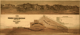
View of the Panamint Range Mountains, mines, mills and town site ; Sherman Town, property of the Panamint Mining & Concentration Works.
Available also through the Library of Congress web site as a raster image.
Contributor: Britton, Rey & Co Site: American Memory-cultural - Main Catalog Original Format: Map Date: 1875 View catalog record -

A plan of the city and environs of Philadelphia,
Scale ca. 1:42,000.
Contributor: Scull, Nicholas Site: American Memory-cultural - Main Catalog Original Format: Map Date: 1777 View catalog record