Map
Sanborn Fire Insurance Map from Hazleton, Luzerne County, Pennsylvania.
Views

| Format |
Map |
|---|---|
| Dates |
1895 |
| Location |
Hazleton Luzerne County Pennsylvania |
| Language |
English |
- Title
- Sanborn Fire Insurance Map from Hazleton, Luzerne County, Pennsylvania.
- Description
-
24 Sheet(s). Dec 1895.
- Created Published
- Sanborn Map Company, Dec 1895
- Notes
-
-
24 Sheet(s).
-
-
Dec 1895.
- Repository
- Library of Congress Geography and Map Division Washington, D.C. 20540-4650 USA
- Digital Id
-
http://www.loc.gov/item/sanborn07714_003
-
http://hdl.loc.gov/loc.gmd/g3824hm.07714003
Rights & Access
The maps in the Map Collections materials were either published prior to 1922, produced by the United States government, or both (see catalogue records that accompany each map for information regarding date of publication and source). The Library of Congress is providing access to these materials for educational and research purposes and is not aware of any U.S. copyright protection (see Title 17 of the United States Code) or any other restrictions in the Map Collection materials.
Note that the written permission of the copyright owners and/or other rights holders (such as publicity and/or privacy rights) is required for distribution, reproduction, or other use of protected items beyond that allowed by fair use or other statutory exemptions. Responsibility for making an independent legal assessment of an item and securing any necessary permissions ultimately rests with persons desiring to use the item.
More about Copyright and other Restrictions
For guidance about compiling full citations consult Citing Primary Sources.
Part of...
-
Sanborn Maps
[50014]
-
Geography And Maps Division
[60803]
-
American Memory
[1120694]
More maps like this
-
 Sanborn Fire Insurance Map from Hazleton, Luzerne County, Pennsylvania.
Site:
American Memory-cultural
Original Format:
Map
Date:
1884-01-01
Sanborn Fire Insurance Map from Hazleton, Luzerne County, Pennsylvania.
Site:
American Memory-cultural
Original Format:
Map
Date:
1884-01-01
-
 Sanborn Fire Insurance Map from Hazleton, Luzerne County, Pennsylvania.
Site:
American Memory-cultural
Original Format:
Map
Date:
1891-01-01
Sanborn Fire Insurance Map from Hazleton, Luzerne County, Pennsylvania.
Site:
American Memory-cultural
Original Format:
Map
Date:
1891-01-01
-
 Sanborn Fire Insurance Map from Hazleton, Luzerne County, Pennsylvania.
Site:
American Memory-cultural
Original Format:
Map
Date:
1900-01-01
Sanborn Fire Insurance Map from Hazleton, Luzerne County, Pennsylvania.
Site:
American Memory-cultural
Original Format:
Map
Date:
1900-01-01
-
 Sanborn Fire Insurance Map from Hazleton, Luzerne County, Pennsylvania.
Site:
American Memory-cultural
Original Format:
Map
Date:
1905-01-01
Sanborn Fire Insurance Map from Hazleton, Luzerne County, Pennsylvania.
Site:
American Memory-cultural
Original Format:
Map
Date:
1905-01-01
-
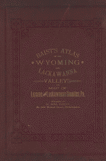 Atlas of the Wyoming and Lackawanna Valleys and map of Luzerne and Lackawanna counties, Penna. : from actual surveys, official records & private plans /
Contributor:
Baist, G. Wm
Site:
American Memory-cultural, Main Catalog
Original Format:
Map
Date:
1894
View catalog record
Atlas of the Wyoming and Lackawanna Valleys and map of Luzerne and Lackawanna counties, Penna. : from actual surveys, official records & private plans /
Contributor:
Baist, G. Wm
Site:
American Memory-cultural, Main Catalog
Original Format:
Map
Date:
1894
View catalog record
-

 A new and accurate map of the Province of Pennsylvania, in North America : from the best authorities.
Site:
Main Catalog
Original Format:
Map
Date:
1780
A new and accurate map of the Province of Pennsylvania, in North America : from the best authorities.
Site:
Main Catalog
Original Format:
Map
Date:
1780
-
 Mr. Armstrong's rough draft of the country to the west of Susquehanna.
Contributor:
Armstrong, John
Site:
American Memory-cultural, Main Catalog
Original Format:
Map
Date:
1755
View catalog record
Mr. Armstrong's rough draft of the country to the west of Susquehanna.
Contributor:
Armstrong, John
Site:
American Memory-cultural, Main Catalog
Original Format:
Map
Date:
1755
View catalog record
-
 Map of the Pennsylvania Railroad and its connections.
Contributor:
Patterson, S. C.
Site:
American Memory-cultural, Main Catalog
Original Format:
Map
Date:
1889
View catalog record
Map of the Pennsylvania Railroad and its connections.
Contributor:
Patterson, S. C.
Site:
American Memory-cultural, Main Catalog
Original Format:
Map
Date:
1889
View catalog record
-
 Sketch map of the Phila. and Readg. Rail Road and its branches, May, 1873.
Contributor:
Fay, T. V.
Site:
American Memory-cultural, Main Catalog
Original Format:
Map
Date:
1873
View catalog record
Sketch map of the Phila. and Readg. Rail Road and its branches, May, 1873.
Contributor:
Fay, T. V.
Site:
American Memory-cultural, Main Catalog
Original Format:
Map
Date:
1873
View catalog record
-
 Pennsylvania.
Contributor:
Finley, A.
Site:
American Memory-cultural, Main Catalog
Original Format:
Map
Date:
1829
View catalog record
Pennsylvania.
Contributor:
Finley, A.
Site:
American Memory-cultural, Main Catalog
Original Format:
Map
Date:
1829
View catalog record
-
 Barringtons new and reliable railroad map and shippers & travellers guide of Pennsylvania, Engrd. by Ths. Leonhardt, showing the name of every city, town and ...
Contributor:
Duncan, Jacob M.
Site:
American Memory-cultural, Main Catalog
Original Format:
Map
Date:
1860
View catalog record
Barringtons new and reliable railroad map and shippers & travellers guide of Pennsylvania, Engrd. by Ths. Leonhardt, showing the name of every city, town and ...
Contributor:
Duncan, Jacob M.
Site:
American Memory-cultural, Main Catalog
Original Format:
Map
Date:
1860
View catalog record
-
 Topographical plan & profile of the Philadelphia and Reading Rail Road. J. Knight. Sc.
Contributor:
Osborne, R. B.
Site:
American Memory-cultural, Main Catalog
Original Format:
Map
Date:
1838
View catalog record
Topographical plan & profile of the Philadelphia and Reading Rail Road. J. Knight. Sc.
Contributor:
Osborne, R. B.
Site:
American Memory-cultural, Main Catalog
Original Format:
Map
Date:
1838
View catalog record
-
 Industrial & political map of Pennsylvania : exhibiting the population, the principal resources of each county, and the valuation of property, the several congressional districts, ...
Contributor:
Biddle, Edward C.
Site:
American Memory-cultural, Main Catalog
Original Format:
Map
Date:
1844
View catalog record
Industrial & political map of Pennsylvania : exhibiting the population, the principal resources of each county, and the valuation of property, the several congressional districts, ...
Contributor:
Biddle, Edward C.
Site:
American Memory-cultural, Main Catalog
Original Format:
Map
Date:
1844
View catalog record
-
 George Washington's map, accompanying his "journal to the Ohio", 1754.
Contributor:
Washington, George
Site:
American Memory-cultural, Main Catalog
Original Format:
Map
Date:
1927
View catalog record
George Washington's map, accompanying his "journal to the Ohio", 1754.
Contributor:
Washington, George
Site:
American Memory-cultural, Main Catalog
Original Format:
Map
Date:
1927
View catalog record
-
 [Base map of Pennsylvania].
Site:
American Memory-cultural, Main Catalog
Original Format:
Map
Date:
1893
View catalog record
[Base map of Pennsylvania].
Site:
American Memory-cultural, Main Catalog
Original Format:
Map
Date:
1893
View catalog record
-
 Map of the proposed Lock Haven & Tyrone Rail Road, by J. M. McMinn, Esqr. Civil Engineer.
Contributor:
McMinn, J. M.
Site:
American Memory-cultural, Main Catalog
Original Format:
Map
Date:
1858
View catalog record
Map of the proposed Lock Haven & Tyrone Rail Road, by J. M. McMinn, Esqr. Civil Engineer.
Contributor:
McMinn, J. M.
Site:
American Memory-cultural, Main Catalog
Original Format:
Map
Date:
1858
View catalog record
You might also like
-
 Members of joint labor-management committees at Hazleton, July 30th
Contributor:
Palmer, Alfred T., Perlitch, William, United States. Office for Emergency Management
Site:
Prints & Photographs
Original Format:
Photo, Print, Drawing
Date:
1941
Members of joint labor-management committees at Hazleton, July 30th
Contributor:
Palmer, Alfred T., Perlitch, William, United States. Office for Emergency Management
Site:
Prints & Photographs
Original Format:
Photo, Print, Drawing
Date:
1941
-
 Members of joint labor-management committees at Hazleton, July 30th
Contributor:
Palmer, Alfred T., Perlitch, William, United States. Office of War Information
Site:
Prints & Photographs
Original Format:
Photo, Print, Drawing
Date:
1941
Members of joint labor-management committees at Hazleton, July 30th
Contributor:
Palmer, Alfred T., Perlitch, William, United States. Office of War Information
Site:
Prints & Photographs
Original Format:
Photo, Print, Drawing
Date:
1941
-
 Earl Williams, torpedoed sailor, speaking before labor-management committee members at Hazleton, July 30th
Contributor:
Palmer, Alfred T., Perlitch, William, United States. Office of War Information
Site:
Prints & Photographs
Original Format:
Photo, Print, Drawing
Date:
1941
Earl Williams, torpedoed sailor, speaking before labor-management committee members at Hazleton, July 30th
Contributor:
Palmer, Alfred T., Perlitch, William, United States. Office of War Information
Site:
Prints & Photographs
Original Format:
Photo, Print, Drawing
Date:
1941
-
 Earl Schenck, naval consultant, speaking before labor-management committee members at Hazleton, July 30th
Contributor:
Palmer, Alfred T., Perlitch, William, United States. Office of War Information
Site:
Prints & Photographs
Original Format:
Photo, Print, Drawing
Date:
1941
Earl Schenck, naval consultant, speaking before labor-management committee members at Hazleton, July 30th
Contributor:
Palmer, Alfred T., Perlitch, William, United States. Office of War Information
Site:
Prints & Photographs
Original Format:
Photo, Print, Drawing
Date:
1941