

![[December 23, 1944], HQ Twelfth Army Group situation map.](https://cybercemetery.unt.edu/archive/oilspill/20121025074452im_/http://www.loc.gov/collections/static/world-war-II-maps-military-situation-maps-from-1944-to-1945/images/ict21202.jpg)

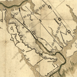
![[Rough sketch of the Rich Mountain battle area extending from Beverly, W. Va. to Clarksburg].](https://cybercemetery.unt.edu/archive/oilspill/20121025074452im_/http://www.loc.gov/collections/static/hotchkiss-maps/images/cwh00078.jpg)


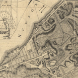
![Map of the Rappahannock River from [sic] Port Royal to Richards Ferry](https://cybercemetery.unt.edu/archive/oilspill/20121025074452im_/http://www.loc.gov/collections/static/civil-war-maps/images/cw0619600.jpg)


![[Sketch of the Manassas battlefield].](https://cybercemetery.unt.edu/archive/oilspill/20121025074452im_/http://www.loc.gov/collections/static/hotchkiss-maps/images/cwh00108.jpg)

![Plan général du Fort Septentrional du Detour des Anglois, tel qu'il est présentement : [Louisiana]](https://cybercemetery.unt.edu/archive/oilspill/20121025074452im_/http://www.loc.gov/collections/static/louisiana-european-explorations-and-the-louisiana-purchase/images/lh000949.jpg)


![[Base map of Pennsylvania].](https://cybercemetery.unt.edu/archive/oilspill/20121025074452im_/http://www.loc.gov/collections/static/hotchkiss-maps/images/cwh00207.jpg)


Results
-

Map showing completed canals in Southern Drainage District to June 1, 1934.
From the Model Land Company records.
Site: American Memory-cultural Original Format: Map Date: 1934-06-01 -

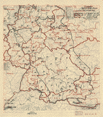
[October 28, 1944], HQ Twelfth Army Group situation map.
Available also through the Library of Congress web site as a raster image.
Contributor: Allied Forces. Army Group, 12th. Engineer Section Site: American Memory-cultural - Main Catalog Original Format: Map Date: 1944-10-28 View catalog record -

Egyptian-Israeli disengagement lines, January 1974. 1-74.
Scale ca. 1:400,000.
Contributor: United States. Central Intelligence Agency Site: American Memory-cultural - Main Catalog Original Format: Map Date: 1974 View catalog record -

Index sheet of battlefield maps for Fredericksburg, Spottsylvania C. H., Wilderness, Chancellorsville, Virginia. [1862-64] To accompany report of the Battlefield Commission created by Act of ...
Scale ca. 1:135,000.
Site: American Memory-cultural - Main Catalog Original Format: Map Date: 1925 View catalog record -

[October 12, 1944], HQ Twelfth Army Group situation map.
Available also through the Library of Congress web site as a raster image.
Contributor: Allied Forces. Army Group, 12th. Engineer Section Site: American Memory-cultural - Main Catalog Original Format: Map Date: 1944-10-12 View catalog record -

Washington, property of Sidney Bieber and heirs showing portion there of occupied by tracks of P.B & W.R.R. Co. /
Covers part of area now occupied by Congressional Cemetery, Barney Circle S.E., and Conrail right-of-way.
Contributor: Philadelphia, Baltimore & Washington Railroad Company. Maryland Division Site: American Memory-cultural - Main Catalog Original Format: Map Date: 1906 View catalog record -

Overview - Railroad Maps 1828 To 1900
The Railroad maps represent an important historical record, illustrating the growth of travel and settlement as well as the development of industry and agriculture in the United States. They depict the development ...
Site: LOC.gov web pages Original Format: Map - Web Page Date: 1998-10-19 -

Distance map United States, Mexico and Canada.
Includes distances for railroads, airways and ocean travel.
Contributor: F. E. Gallup Map Co Site: American Memory-cultural - Main Catalog Original Format: Map Date: 1919 View catalog record -

Kōbe: Municipal water supply sources /
Relief shown by contours and spot heights.
Site: American Memory-cultural - Main Catalog Original Format: Map Date: 1945 View catalog record -
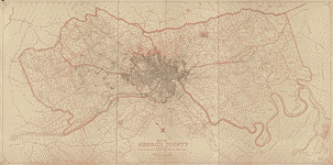
Map of Henrico County, Virginia /
Shows names of some residents.
Contributor: T. Crawford Redd & Brother Site: American Memory-cultural - Main Catalog Original Format: Map Date: 1916 View catalog record -

[January 10, 1945], HQ Twelfth Army Group situation map.
Available also through the Library of Congress web site as a raster image.
Contributor: Allied Forces. Army Group, 12th. Engineer Section Site: American Memory-cultural - Main Catalog Original Format: Map Date: 1945-01-10 View catalog record -
[June 6, 1945], HQ Twelfth Army Group situation map.
Available also through the Library of Congress web site as a raster image.
Contributor: Allied Forces. Army Group, 12th. Engineer Section Site: American Memory-cultural - Main Catalog Original Format: Map Date: 1945-06-06 View catalog record -
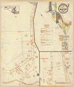
Sanborn Fire Insurance Map from Barton, Allegany County, Maryland.
4 Sheet(s). Nov 1921.
Site: American Memory-cultural Original Format: Map Date: 1921-01-01 -

[July 15, 1945], HQ Twelfth Army Group situation map.
Available also through the Library of Congress web site as a raster image.
Contributor: Allied Forces. Army Group, 12th. Engineer Section Site: American Memory-cultural - Main Catalog Original Format: Map Date: 1945-07-15 View catalog record -

[November 8, 1944], HQ Twelfth Army Group situation map.
Available also through the Library of Congress web site as a raster image.
Contributor: Allied Forces. Army Group, 12th. Engineer Section Site: American Memory-cultural - Main Catalog Original Format: Map Date: 1944-11-08 View catalog record -
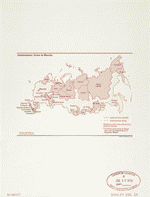
Autonomous areas in Russia.
Shows autonomous republics and districts (okruga).
Contributor: United States. Central Intelligence Agency Site: American Memory-cultural - Main Catalog Original Format: Map Date: 1996 View catalog record -

Slovakia.
"Base 802220 (R01166) 2-94".
Contributor: United States. Central Intelligence Agency Site: American Memory-cultural - Main Catalog Original Format: Map Date: 1994 View catalog record -

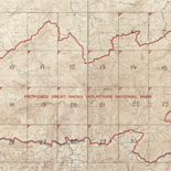
Great Smoky Mountains National Park.
Available also through the Library of Congress web site as a raster image.
Contributor: United States. National Park Service Site: American Memory-cultural - Main Catalog Original Format: Map Date: 1935 View catalog record -

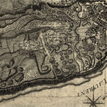
The battlefield of Chancellorsville
"Showing general conditions on the night of May 2, 1863, from 9 to 10 p.m. when Stonewall Jackson was mortally wounded."--page caption.
Contributor: Carter, Robert Goldthwaite Site: American Memory-cultural Original Format: Map Date: 1900 -
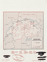
Switzerland, administrative divisions.
Available also through the Library of Congress Web site as a raster image.
Contributor: United States. Central Intelligence Agency Site: American Memory-cultural - Main Catalog Original Format: Map Date: 1973 View catalog record
Refine your search
Original Format
- Map
- Web Page [14]
Online Format
Date
Site
Contributor
- United States. Central Intelligence Agency [912]
- Allied Forces. Army Group, 12Th. Engineer Section [419]
- Fowler, T. M. [90]
- United States. National Park Service [79]
- Geological Survey (U.S.) [60]
- Hughes & Bailey [26]
- Geo. A. Ogle & Co [23]
- Rand Mcnally And Company [18]
- United States. Central Intelligence Agency] [18]
- Cinquin, Rene [13]
-
More Contributors