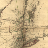
![[Base map of Alabama].](https://cybercemetery.unt.edu/archive/oilspill/20120921145136im_/http://www.loc.gov/collections/static/hotchkiss-maps/images/cwh00201.jpg)
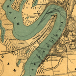
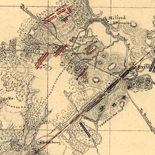
![[Detailed map of part of Virginia from Alexandria to the Potomac River above Washington, D.C. 1886].](https://cybercemetery.unt.edu/archive/oilspill/20120921145136im_/http://www.loc.gov/collections/static/civil-war-maps/images/cw0523000.jpg)

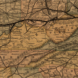
![[January 15, 1945], HQ Twelfth Army Group situation map.](https://cybercemetery.unt.edu/archive/oilspill/20120921145136im_/http://www.loc.gov/collections/static/world-war-II-maps-military-situation-maps-from-1944-to-1945/images/ict21225.jpg)


![Carte particulière d'une partie de la Louisianne ou les fleuve et rivierres [i.e. rivières] onts etés relevé a l'estime & les routtes [i.e. routes] par terre relevé & mesurées aux pas, par les Srs. Broutin, de Vergés, ingénieurs & Saucier dessinateur](https://cybercemetery.unt.edu/archive/oilspill/20120921145136im_/http://www.loc.gov/collections/static/louisiana-european-explorations-and-the-louisiana-purchase/images/ct000681.jpg)
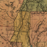
![[December 16, 1944], HQ Twelfth Army Group situation map.](https://cybercemetery.unt.edu/archive/oilspill/20120921145136im_/http://www.loc.gov/collections/static/world-war-II-maps-military-situation-maps-from-1944-to-1945/images/ict21195.jpg)


Results
-

Map of a part of Louisiana and Mississippi : illustrating the operations of the U.S. Forces in the Department of the Gulf /
Covers the area west to east from Alexandria, La. to Pearl River, and north to south from Vidalia, La. to Atchafalaya Bay.
Contributor: United States Coast Survey Site: American Memory-cultural - Main Catalog Original Format: Map Date: 1863 View catalog record -

Reconnoissance [sic] of Cape Lookout shoals
Scale 1:80,000.
Contributor: United States Coast Survey Site: American Memory-cultural - Main Catalog Original Format: Map Date: 1864 View catalog record -

Chesapeake Bay. Sheet 6, from the mouth of York River to the entrance to bay.
Scale 1:80,000.
Contributor: United States Coast Survey Site: American Memory-cultural - Main Catalog Original Format: Map Date: 1863 View catalog record -

Core Sound and Straits, North Carolina.
Scale 1:40,000.
Contributor: United States Coast Survey Site: American Memory-cultural - Main Catalog Original Format: Map Date: 1864 View catalog record -

Atlantic coast of the United States (in four sheets) : sheet no. III, Cape Hatteras to Mosquito Inlet.
LC Civil War maps (2nd ed.), 47.42
Contributor: United States Coast Survey Site: American Memory-cultural - Main Catalog Original Format: Map Date: 1863 View catalog record -

General chart of the coast. No. IV, from Cape May to Cape Henry. From a trigonometrical survey under the direction of F. R. Hassler and ...
Scale 1:400,000.
Contributor: United States Coast Survey Site: American Memory-cultural - Main Catalog Original Format: Map Date: 1862 View catalog record -


Southern Georgia and part of South Carolina / Catalog Record - Electronic Resource Available
Relief shown by hachures.
Contributor: United States Coast Survey Site: Main Catalog Original Format: Map Date: 1865 -

Sketch showing the positions of the beacons on the Florida reefs
Scale 1:400,000.
Contributor: United States Coast Survey Site: American Memory-cultural - Main Catalog Original Format: Map Date: 1861 View catalog record -

Entrance to San Francisco Bay, California : from a trigonometrical survey under the direction of A.D. Bache, Superintendent of the Survey of the Coast of ...
Relief shown in hachures. Depths shown by contours and soundings.
Contributor: United States Coast Survey Site: American Memory-cultural - Main Catalog Original Format: Map Date: 1859 View catalog record -

Preliminary edition of general chart of the coast no. X, Sraits of Florida from Key Biscayne to Marquesas Keys
Scale 1:400,000.
Contributor: United States Coast Survey Site: American Memory-cultural - Main Catalog Original Format: Map Date: 1862 View catalog record -

Map of a reconnoissance [sic] of the approaches to Philadelphia showing the positions and lines of defence on the west front of the city /
Topographic map of western Philadelphia and small adjacent parts of Montgomery and Delaware counties showing 1st- and 2nd-order Civil War earthworks and batteries.
Contributor: United States Coast Survey Site: American Memory-cultural - Main Catalog Original Format: Map Date: 1863 View catalog record -

Mouths of Roanoke River, North Carolina
Scale 1:30,000.
Contributor: United States Coast Survey Site: American Memory-cultural - Main Catalog Original Format: Map Date: 1864 View catalog record -

Preliminary chart of Port Royal entrance. Beaufort, Chechessee, and Colleton Rivers, South Carolina
Scale 1:60,000.
Contributor: United States Coast Survey Site: American Memory-cultural - Main Catalog Original Format: Map Date: 1862 View catalog record -

Preliminary chart of Beaufort River, Station Creek, Story and Harbor Rivers forming inside passage between Port Royal and St. Helena Sounds, South Carolina
1:40,000.
Contributor: United States Coast Survey Site: American Memory-cultural - Main Catalog Original Format: Map Date: 1864 View catalog record -

Order of attack on Fort Fisher by the Squadron under command of Rear Admiral D. D. Porter, U.S.N. in the combined naval and military operations ...
Scale ca. 1:10,100.
Contributor: United States Coast Survey Site: American Memory-cultural - Main Catalog Original Format: Map Date: 1865 View catalog record -

Beaufort harbor, North Carolina. Re-survey in June and July 1862. Corrected up to April 20th 1864
Scale 1:20,000.
Contributor: United States Coast Survey Site: American Memory-cultural - Main Catalog Original Format: Map Date: 1864 View catalog record -

Atlantic coast of the United States (in four sheets) : sheet no. IV, Mosquito Inlet to Key West.
LC Civil War maps (2nd ed.), 47.48
Contributor: United States Coast Survey Site: American Memory-cultural - Main Catalog Original Format: Map Date: 1863 View catalog record -

Atlantic coast of the United States (in four sheets) : sheet no. II, Nantucket to Cape Hatteras.
LC Civil War maps (2nd ed.), 47.37
Contributor: United States Coast Survey Site: American Memory-cultural - Main Catalog Original Format: Map Date: 1863 View catalog record -

Sketch of the coast of North Carolina from Oregon Inlet to Ocracoke Inlet.
Scale 1:200,000.
Contributor: United States Coast Survey Site: American Memory-cultural - Main Catalog Original Format: Map Date: 1861 View catalog record -

Map of the city of Richmond, Virginia /
LC Civil War Maps (2nd ed.), 645.6
Contributor: United States Coast Survey Site: American Memory-cultural - Main Catalog Original Format: Map Date: 1864 View catalog record
Refine your search
Original Format
- Map
Online Format
Site
- Main Catalog
- American Memory-cultural [103]