![A map of the most inhabited part of New England... Thomas Jefferys, [London] Thos. Jefferys, 1755.](https://cybercemetery.unt.edu/archive/oilspill/20121025065653im_/http://www.loc.gov/collections/static/american-revolutionary-war-maps/images/ar079700.jpg)


![[January 15, 1945], HQ Twelfth Army Group situation map.](https://cybercemetery.unt.edu/archive/oilspill/20121025065653im_/http://www.loc.gov/collections/static/world-war-II-maps-military-situation-maps-from-1944-to-1945/images/ict21225.jpg)
![[Sketch of the battles of Chancellorsville, Salem Church, and Fredericksburg], May 2, 3, and 4, 1863](https://cybercemetery.unt.edu/archive/oilspill/20121025065653im_/http://www.loc.gov/collections/static/civil-war-maps/images/cwh00129.jpg)

![[Map of parts of Caroline, Hanover, and Henrico counties, Va. west of the Mattaponi River and the Richmond, Fredericksburg, and Potomac Railroad].](https://cybercemetery.unt.edu/archive/oilspill/20121025065653im_/http://www.loc.gov/collections/static/hotchkiss-maps/images/cwh00025.jpg)
Results
-

Sanborn Fire Insurance Map from Barton, Allegany County, Maryland.
4 Sheet(s). Nov 1921.
Site: American Memory-cultural Original Format: Map Date: 1921-01-01 -

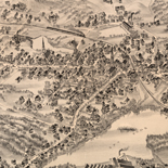
Birds eye view of Rising Sun, Cecil County, Maryland 1907.
Perspective map not drawn to scale.
Contributor: Fowler, T. M. Site: American Memory-cultural - Main Catalog Original Format: Map Date: 1907 View catalog record -

Map of the battlefield of Antietam
Scale ca. 1:10,560.
Contributor: Antietam Battlefield Board Site: American Memory-cultural - Main Catalog Original Format: Map Date: 1898 View catalog record -

Section of the northern course of the canal from the tide in the Elk River at Frenchtown to the forked [oak] in Mr. Rudulph's swamp ...
Relief shown by shading, hachures, and spot heights.
Contributor: Latrobe, Benjamin Henry Site: American Memory-cultural - Main Catalog Original Format: Map Date: 1803 View catalog record -

Topographical sketch of the environs of Washington, D.C. : (survey of locality for public park & site for a presidential mansion) /
Covers territory of present-day Rock Creek Park and adjacent areas.
Contributor: Michler, N. Site: American Memory-cultural - Main Catalog Original Format: Map Date: 1901 View catalog record -

Plan of the Battle of Antietam, Maryland.
Color coding indicates the locations of Union and Confederate forces.
Contributor: Sneden, Robert Knox Site: American Memory-cultural Original Format: Map Date: 1862 -

Map of the Reading & Columbia Rail Road connecting New York via the Jersey Central, Reading and Columbia, with Baltimore and Washington, together with Western ...
Scale ca. 1:600,000.
Contributor: Kase, S. P. Site: American Memory-cultural - Main Catalog Original Format: Map View catalog record -

Sifton, Praed's new map of Virginia and Maryland to illustrate the campaigns of 1861 to 1864.
Scale 1:633,600.
Contributor: Sifton, Praed & Company, Ltd Site: American Memory-cultural - Main Catalog Original Format: Map Date: 1912 View catalog record -

Sanborn Fire Insurance Map from Annapolis, Anne Arundel County, Maryland.
Includes Eastport. 26 Sheet(s). Oct 1921.
Site: American Memory-cultural Original Format: Map Date: 1921-01-01 -

Map of the State of Maryland.
Scale ca. 1:350,000.
Contributor: Lucas, Fielding Site: American Memory-cultural - Main Catalog Original Format: Map Date: 1841 View catalog record -

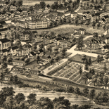
Lloyd's Baltimore elevated building map : of the five hundred million business district of Baltimore /
Pictorial map of Baltimore city center containing 3-dimensional drawings of numerous office buildings.
Contributor: Lloyd, James T. Site: American Memory-cultural - Main Catalog Original Format: Map Date: 1891 View catalog record -

Map of Anacostia River in the District of Columbia and Maryland /
Depths shown by contours and soundings.
Contributor: Hains, Peter C. Site: American Memory-cultural - Main Catalog Original Format: Map Date: 1891 View catalog record -

Johnson's Virginia, Delaware, Maryland & West Virginia
"Entered according to Act of Congress in the year 1864, by A.J. Johnson, in the Clerk's Office of the District Court of the United States for the Southern District of New York."
Contributor: Johnson, A. J. Site: American Memory-cultural Original Format: Map Date: 1864 -

The Battle of Crampton's Gap 5 miles south of Turner's Gap, South Mountain, Md. September 14th 1862.
Color coding indicates the location Union and Confederate forces.
Contributor: Sneden, Robert Knox Site: American Memory-cultural Original Format: Map Date: 1861 -

Battle of the Antietam fought September 16 & 17, 1862
Scale 1:10,560.
Contributor: Roebling, Washington A. Site: American Memory-cultural - Main Catalog Original Format: Map Date: 1862 View catalog record -

Experimental survey for the Eastern Shore Rail Road, Maryland, drawn by W. H. Emory & J. McClelland Asst. Civ. Engs., made under the direction of ...
Scale ca. 1:128,000.
Contributor: Emory, William H. Site: American Memory-cultural - Main Catalog Original Format: Map Date: 1853 View catalog record -

Atlas of the battlefield of Antietam /
Relief shown by contour lines.
Contributor: Antietam Battlefield Board Site: American Memory-cultural - Main Catalog Original Format: Map Date: 1904 View catalog record -

Battle of the Antietam.
NOTE: Researchers will be served a color photocopy of this diary page.
Contributor: Sneden, Robert Knox Site: American Memory-cultural Original Format: Map Date: 1861 -

A new map of Virginia, Mary-Land, and the improved parts of Pennsylvania & New Jersey.
Relief shown pictorially.
Contributor: Senex, John Site: American Memory-cultural - Main Catalog Original Format: Map Date: 1719 View catalog record -

Bacon's new map of the seat of war in Virginia and Maryland. Showing the interesting localities around Richmond, Washington, Baltimore &c.
Scale ca. 1:804,000.
Contributor: Bacon & Co Site: American Memory-cultural - Main Catalog Original Format: Map Date: 1864 View catalog record
Refine your search
Original Format
- Map
- Web Page [1]
Online Format
Contributor
- Sneden, Robert Knox [24]
- Martenet, Simon J. [9]
- Antietam Battlefield Board [8]
- Nicholson, W. L. [7]
- Hotchkiss, Jedediah [6]
- United States. Army. Corps of Engineers [6]
- Michler, N. [5]
- United States. Topographical Bureau [5]
- United States. National Park Service [5]
- Fowler, T. M. [5]
-
More Contributors