

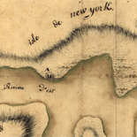
![Amérique septentrion.lle [i.e. septentrionale] : composée, corigée, et augmētée, sur les iournaux, mémoires, et observations les plus justes qui en ón'́etes.tes en l'année 1685 & 1686, par plusieurs particuliés](https://cybercemetery.unt.edu/archive/oilspill/20121025072754im_/http://www.loc.gov/collections/static/discovery-and-exploration/images/ct000667.jpg)

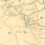
![Carte particulière d'une partie de la Louisianne ou les fleuve et rivierres [i.e. rivières] onts etés relevé a l'estime & les routtes [i.e. routes] par terre relevé & mesurées aux pas, par les Srs. Broutin, de Vergés, ingénieurs & Saucier dessinateur](https://cybercemetery.unt.edu/archive/oilspill/20121025072754im_/http://www.loc.gov/collections/static/louisiana-european-explorations-and-the-louisiana-purchase/images/ct000681.jpg)


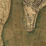
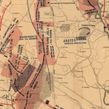
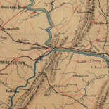
![[Map of parts of Caroline, Hanover, and Henrico counties, Va. west of the Mattaponi River and the Richmond, Fredericksburg, and Potomac Railroad].](https://cybercemetery.unt.edu/archive/oilspill/20121025072754im_/http://www.loc.gov/collections/static/hotchkiss-maps/images/cwh00025.jpg)


Results
-

Texas Coast showing points of occupation of expedition under Maj. Gen. N.P. Banks : Nov'r 1863.
Shows towns, rivers, roads, selected shipwrecks, and Civil War "Points of occupation" marked by U.S. flags.
Site: American Memory-cultural - Main Catalog Original Format: Map Date: 1863 View catalog record -

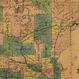
Rusk Co., Texas /
Shows land ownership.
Contributor: Pressler, Chas. W. Site: American Memory-cultural - Main Catalog Original Format: Map Date: 1895 View catalog record -

Map of Erath County /
Blueprint
Contributor: Rosenberg, E. von Site: American Memory-cultural - Main Catalog Original Format: Map Date: 1896 View catalog record -

Texas /
Relief shown by hachures.
Site: American Memory-cultural - Main Catalog Original Format: Map Date: 1846 View catalog record -

Sterling Co.
Shows land ownership.
Contributor: Texas. General Land Office Site: American Memory-cultural Original Format: Map Date: 1892 -

Sanborn Fire Insurance Map from Beeville, Bee County, Texas.
7 Sheet(s). Mar 1914.
Site: American Memory-cultural Original Format: Map Date: 1914-01-01 -

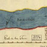
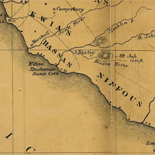
Map of the Red River in Louisiana from the Spanish camp where the exploring party of the U.S. was met by the Spanish troops to ...
Also shows cities and towns, Indian settlements, and features in the region along the Red River.
Contributor: King, N. Site: American Memory-cultural - Main Catalog Original Format: Map Date: 1975 View catalog record -

Navarro County /
Shows landownership.
Contributor: Beaumont, G. N. Site: American Memory-cultural - Main Catalog Original Format: Map Date: 1880 View catalog record -

Map of Blanco County / General Land Office Mar 1880.
Shows land ownership.
Contributor: Texas. General Land Office Site: American Memory-cultural Original Format: Map Date: 1880 -

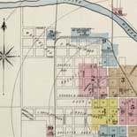
Tarrant County, Texas.
Available also through the Library of Congress Web site as a raster image.
Site: American Memory-cultural - Main Catalog Original Format: Map View catalog record -

Aransas Co.
Shows land ownership.
Contributor: Texas. General Land Office Site: American Memory-cultural - Main Catalog Original Format: Map Date: 1880 View catalog record -

Sanborn Fire Insurance Map from Aransas Pass, San Patricio County, Texas.
6 Sheet(s). Jul 1915.
Site: American Memory-cultural Original Format: Map Date: 1915-01-01 -

The railroad system of Texas on September 1st, 1883 /
Relief shown by hachures.
Contributor: Hensoldt, E. A. Site: American Memory-cultural - Main Catalog Original Format: Map Date: 1883 View catalog record -

Map of Jack County, State of Texas : exhibiting the extent of public surveys land grants and all other official information compiled from official surveys ...
Relief shown by hachures.
Contributor: Roessler, A. R. Site: American Memory-cultural - Main Catalog Original Format: Map Date: 1876 View catalog record -

Texas railroads.
Scale 1:2,154,240.
Contributor: Rand McNally and Company Site: American Memory-cultural - Main Catalog Original Format: Map Date: 1900 View catalog record -

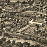
Denison, Grayson County, Texas 1891.
Perspective map not drawn to scale.
Contributor: Fowler, T. M. Site: American Memory-cultural - Main Catalog Original Format: Map Date: 1891 View catalog record -

Map of Van Zandt Co., Texas.
Shows land ownership.
Contributor: Texas. General Land Office Site: American Memory-cultural - Main Catalog Original Format: Map Date: 1884 View catalog record -

Dickens County.
Shows land ownership.
Contributor: Texas. General Land Office Site: American Memory-cultural - Main Catalog Original Format: Map Date: 1891 View catalog record -

County map of Texas, and Indian Territory.
Relief shown by hachures.
Contributor: H.H. Lloyd & Co Site: American Memory-cultural - Main Catalog Original Format: Map Date: 1875 View catalog record -

Sanborn Fire Insurance Map from Big Spring, Howard County, Texas.
1 Sheet(s). Feb 1885.
Site: American Memory-cultural Original Format: Map Date: 1885-01-01