![Amérique septentrion.lle [i.e. septentrionale] : composée, corigée, et augmētée, sur les iournaux, mémoires, et observations les plus justes qui en ón'́etes.tes en l'année 1685 & 1686, par plusieurs particuliés](https://cybercemetery.unt.edu/archive/oilspill/20121025063859im_/http://www.loc.gov/collections/static/discovery-and-exploration/images/ct000667.jpg)
![[January 1, 1945], HQ Twelfth Army Group situation map.](https://cybercemetery.unt.edu/archive/oilspill/20121025063859im_/http://www.loc.gov/collections/static/world-war-II-maps-military-situation-maps-from-1944-to-1945/images/ict21211.jpg)
![Plan général du Fort Septentrional du Detour des Anglois, tel qu'il est présentement : [Louisiana]](https://cybercemetery.unt.edu/archive/oilspill/20121025063859im_/http://www.loc.gov/collections/static/louisiana-european-explorations-and-the-louisiana-purchase/images/lh000949.jpg)

![[January 3, 1945], HQ Twelfth Army Group situation map.](https://cybercemetery.unt.edu/archive/oilspill/20121025063859im_/http://www.loc.gov/collections/static/world-war-II-maps-military-situation-maps-from-1944-to-1945/images/ict21213.jpg)
![[December 23, 1944], HQ Twelfth Army Group situation map.](https://cybercemetery.unt.edu/archive/oilspill/20121025063859im_/http://www.loc.gov/collections/static/world-war-II-maps-military-situation-maps-from-1944-to-1945/images/ict21202.jpg)


![[Plan of Fort Henry and its outworks.]](https://cybercemetery.unt.edu/archive/oilspill/20121025063859im_/http://www.loc.gov/collections/static/civil-war-maps/images/cw0414000.jpg)


![[December 21, 1944], HQ Twelfth Army Group situation map.](https://cybercemetery.unt.edu/archive/oilspill/20121025063859im_/http://www.loc.gov/collections/static/world-war-II-maps-military-situation-maps-from-1944-to-1945/images/ict21200.jpg)
![[Base map of Pennsylvania].](https://cybercemetery.unt.edu/archive/oilspill/20121025063859im_/http://www.loc.gov/collections/static/hotchkiss-maps/images/cwh00207.jpg)


Results
-

To His Excellency Genl. Washington, Commander in Chief of the armies of the United States of America, this plan of the investment of York and ...
Scale ca. 1:14,400.
Contributor: Bauman, Sebastian Site: American Memory-cultural - Main Catalog Original Format: Map Date: 1782 View catalog record -

Index sheet of battlefield maps for Fredericksburg, Spottsylvania C. H., Wilderness, Chancellorsville, Virginia. [1862-64] To accompany report of the Battlefield Commission created by Act of ...
Scale ca. 1:135,000.
Site: American Memory-cultural - Main Catalog Original Format: Map Date: 1925 View catalog record -

Map of the battlefield of Bull Run, Virginia. Brig. Gen. Irvin McDowell commanding the U.S. forces, Gen. [P.] G. T. Beauregard commanding the Confederate forces, ...
Scale 1:21,120.
Contributor: United States. Army. Corps of Engineers Site: American Memory-cultural - Main Catalog Original Format: Map Date: 1877 View catalog record -

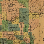
Map of Botetourt County /
Relief shown by hachures.
Contributor: Izard, Walter Site: American Memory-cultural Original Format: Map Date: 1865 -

[Five sketches along the Valley Pike in the vicinity of Fishers Hill, Strasburg, Cottontown, Mount Hope, Toms Brook, etc.].
Shows names of some residents.
Site: American Memory-cultural - Main Catalog Original Format: Map View catalog record -

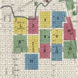
Map of Henrico County, Virginia /
Shows names of some residents.
Contributor: T. Crawford Redd & Brother Site: American Memory-cultural - Main Catalog Original Format: Map Date: 1916 View catalog record -

Battle fields of Fisher's Hill [22 Sept. 1864] and Cedar Creek [19 Oct. 1864], Virginia /
Relief shown by contour lines, hachures, and spot elevations.
Contributor: Gillespie, G. L. Site: American Memory-cultural - Main Catalog Original Format: Map Date: 1873 View catalog record -

The important strategic movements in Virginia. Scene of operations in front of Richmond, in the Valley and on the line of the upper Potomac-the threatened ...
Scale not given.
Site: American Memory-cultural - Main Catalog Original Format: Map Date: 1862 View catalog record -

The battlefield of Chancellorsville
"Showing general conditions on the night of May 2, 1863, from 9 to 10 p.m. when Stonewall Jackson was mortally wounded."--page caption.
Contributor: Carter, Robert Goldthwaite Site: American Memory-cultural Original Format: Map Date: 1900 -

[Maps illustrating the Gettysburg campaign. June 3-July 3, 1863].
Various scales.
Contributor: Wells, Jacob Site: American Memory-cultural - Main Catalog Original Format: Map Date: 1886-01-01 View catalog record -
Map of n. eastern Virginia and vicinity of Washington
Scale 1:63,360.
Contributor: United States. Army. Corps of Topographical Engineers Site: American Memory-cultural - Main Catalog Original Format: Map Date: 1862 View catalog record -

[Map of portion of Fredericksburg, Spotsylvania County, Virginia] /
One of a series of five maps drawn by Col. Normand Smith showing battle lines. Original maps are included in Personal Papers Collection, accession 24417, Gaines Family Papers, 1776-1905.
Contributor: Smith, Normand Site: American Memory-cultural Original Format: Map -

Lloyd's official map of the state of Virginia from actual surveys by order of the executive, 1828 & 1859 /
Relief shown by hachures.
Contributor: Lloyd, James T. Site: American Memory-cultural - Main Catalog Original Format: Map Date: 1862 View catalog record -

Plan of Fort Magruder, Battlefield of Williamsburg, Virginia. Sketched the day after the battle 6th May 1862.
Color coding indicates the location of Union and Confederate forces.
Contributor: Sneden, Robert Knox Site: American Memory-cultural Original Format: Map Date: 1861 -

Petersburg National Military Park, Virginia.
Scale ca. 1:87,000.
Contributor: United States. National Park Service Site: American Memory-cultural - Main Catalog Original Format: Map Date: 1959 View catalog record -

2nd Battle of Bull Run, Va. position of both armies, 6 p.m. Aug. 26th 1862, showing Jackson's flank march.
"Copy of map made for Maj Genl S.P. Heintzelman, 3rd Army Corps Aug 27th 1862" - Page caption.
Contributor: Sneden, Robert Knox Site: American Memory-cultural Original Format: Map Date: 1861 -

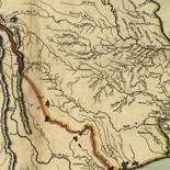
[Map of the Rappahannock River below Fredericksburg, showing Port Royal, Moss Neck, Corbin's Neck, etc.].
Shows fortifications, Confederate troop positions, etc. and names of some residents.
Site: American Memory-cultural - Main Catalog Original Format: Map Date: 1862 View catalog record -
Map of Fluvanna Co. Va.
"Map from the Confederate Engineer Bureau in Richmond, Va. General J.F. Gilmer, Chief Engineer[.] Presented to the Virginia Historical Society by his only daughter, Mrs. J.F. Minis, Sav[ana]h, Ga."--Note on map.
Site: American Memory-cultural Original Format: Map Date: 1863 -

Map covering the field of operations of the Army of the Potomac
Scale ca. 1:650,000.
Contributor: Preston, Noble D. Site: American Memory-cultural - Main Catalog Original Format: Map Date: 1905 View catalog record -

J.H. Colton's topographical map of seat of war in Virginia, Maryland, &c. /
Relief shown by hachures.
Contributor: J.H. Colton & Co Site: American Memory-cultural - Main Catalog Original Format: Map View catalog record