

![Sketch-book of positions of forces of 2nd Corps A.N.Va., campaigns of 1864 : [Virginia]](https://cybercemetery.unt.edu/archive/oilspill/20121025072411im_/http://www.loc.gov/collections/static/hotchkiss-maps/images/cwh00003.jpg)
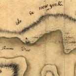
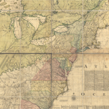
![Plano. I descripcion de la costa, desde el Cavo Cañaveral, hasta cerca de la boca de la Vir[g]inia, contando, costa de Florida, Georgia y Carolinas del S, y N, con todos sus puertos, este[ros ... ]letas, baxos, islas y rios; segun las vlti[mas not]icias, hata [sic] oy Octubre de 1756.](https://cybercemetery.unt.edu/archive/oilspill/20121025072411im_/http://www.loc.gov/collections/static/american-revolutionary-war-maps/images/ct000339.jpg)
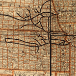
![A correct map of a section of the United States showing the allignment [sic] of the Pittsburgh, Marion, and Chicago Railway between Chewton, Penna. and Marion, Ohio and connections.](https://cybercemetery.unt.edu/archive/oilspill/20121025072411im_/http://www.loc.gov/collections/static/railroad-maps-1828-to-1900/images/rr005350.jpg)
![Map of the Rappahannock River from [sic] Port Royal to Richards Ferry](https://cybercemetery.unt.edu/archive/oilspill/20121025072411im_/http://www.loc.gov/collections/static/civil-war-maps/images/cw0619600.jpg)


![[December 18, 1944], HQ Twelfth Army Group situation map.](https://cybercemetery.unt.edu/archive/oilspill/20121025072411im_/http://www.loc.gov/collections/static/world-war-II-maps-military-situation-maps-from-1944-to-1945/images/ict21197.jpg)
Results
-

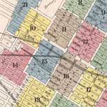
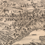
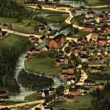
Map of the village of Lockport, Niagara Co., N.Y. /
Wall map.
Contributor: Callan, Bernard Site: American Memory-cultural - Main Catalog Original Format: Map Date: 1851 View catalog record -

Map of Botetourt County /
Relief shown by hachures.
Contributor: Izard, Walter Site: American Memory-cultural Original Format: Map Date: 1865 -

Map of Colbert County, Alabama /
Cadastral map showing landowners' names, school districts, voting precincts, and commissioners districts.
Contributor: Bacon, Delos H. Site: American Memory-cultural - Main Catalog Original Format: Map Date: 1896 View catalog record -

Rusk Co., Texas /
Shows land ownership.
Contributor: Pressler, Chas. W. Site: American Memory-cultural - Main Catalog Original Format: Map Date: 1895 View catalog record -

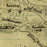
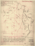
[Five sketches along the Valley Pike in the vicinity of Fishers Hill, Strasburg, Cottontown, Mount Hope, Toms Brook, etc.].
Shows names of some residents.
Site: American Memory-cultural - Main Catalog Original Format: Map View catalog record -

Map of Henrico County, Virginia /
Shows names of some residents.
Contributor: T. Crawford Redd & Brother Site: American Memory-cultural - Main Catalog Original Format: Map Date: 1916 View catalog record -

Map of Erath County /
Blueprint
Contributor: Rosenberg, E. von Site: American Memory-cultural - Main Catalog Original Format: Map Date: 1896 View catalog record -

Sterling Co.
Shows land ownership.
Contributor: Texas. General Land Office Site: American Memory-cultural Original Format: Map Date: 1892 -

A map of the county of Pike, Pennsylvania : shewing the location and form of the original surveys with the numbers by which they are ...
Shows warrant-deed survey areas (numbered).
Contributor: Cross, John T. Site: American Memory-cultural Original Format: Map Date: 1856 -

Astbury's map of Clatsop Co., Ore., Aug. 1895 /
Relief shown by hachures.
Contributor: Astbury, R. C. F. Site: American Memory-cultural - Main Catalog Original Format: Map Date: 1895 View catalog record -

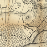
[Map of the Rappahannock River below Fredericksburg, showing Port Royal, Moss Neck, Corbin's Neck, etc.].
Shows fortifications, Confederate troop positions, etc. and names of some residents.
Site: American Memory-cultural - Main Catalog Original Format: Map Date: 1862 View catalog record -

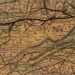
Map[s] illustrating the military operations of the Atlanta campaign ... 1864 /
Relief shown by hachures.
Site: American Memory-cultural - Main Catalog Original Format: Map Date: 1875 View catalog record -

Navarro County /
Shows landownership.
Contributor: Beaumont, G. N. Site: American Memory-cultural - Main Catalog Original Format: Map Date: 1880 View catalog record -

Map of Blanco County / General Land Office Mar 1880.
Shows land ownership.
Contributor: Texas. General Land Office Site: American Memory-cultural Original Format: Map Date: 1880 -

Aransas Co.
Shows land ownership.
Contributor: Texas. General Land Office Site: American Memory-cultural - Main Catalog Original Format: Map Date: 1880 View catalog record -

Map of Yolo county, California / compiled from official and recent surveys by J.S. Henning.
Relief shown by hachures.
Contributor: Henning, J. S. Site: American Memory-cultural - Main Catalog Original Format: Map Date: 1871 View catalog record -

Map of Jack County, State of Texas : exhibiting the extent of public surveys land grants and all other official information compiled from official surveys ...
Relief shown by hachures.
Contributor: Roessler, A. R. Site: American Memory-cultural - Main Catalog Original Format: Map Date: 1876 View catalog record -

Map of Prairie County, Arkansas /
Shows the names of some residents.
Contributor: Thweatt, J. G. Site: American Memory-cultural - Main Catalog Original Format: Map Date: 1892 View catalog record -

Map of Story County, Iowa : drawn from actual surveys and the county records.
Landowners identified.
Contributor: Warner & Foote Site: American Memory-cultural - Main Catalog Original Format: Map Date: 1883 View catalog record -
Plat of the partition of Moore & Beckley survey of 170,038 a. in the counties of Giles & Logan, Virginia.
"Surveyed for Andrew Moore & John Beckley, Nov. 2nd, 1794."
Site: American Memory-cultural - Main Catalog Original Format: Map View catalog record
Refine your search
Original Format
- Map