![[January 18, 1945], HQ Twelfth Army Group situation map.](https://cybercemetery.unt.edu/archive/oilspill/20121025071800im_/http://www.loc.gov/collections/static/world-war-II-maps-military-situation-maps-from-1944-to-1945/images/ict21228.jpg)
![[December 18, 1944], HQ Twelfth Army Group situation map.](https://cybercemetery.unt.edu/archive/oilspill/20121025071800im_/http://www.loc.gov/collections/static/world-war-II-maps-military-situation-maps-from-1944-to-1945/images/ict21197.jpg)
![[December 21, 1944], HQ Twelfth Army Group situation map.](https://cybercemetery.unt.edu/archive/oilspill/20121025071800im_/http://www.loc.gov/collections/static/world-war-II-maps-military-situation-maps-from-1944-to-1945/images/ict21200.jpg)
![[Sketch of the battles of Chancellorsville, Salem Church, and Fredericksburg], May 2, 3, and 4, 1863](https://cybercemetery.unt.edu/archive/oilspill/20121025071800im_/http://www.loc.gov/collections/static/civil-war-maps/images/cwh00129.jpg)
Results
-

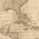
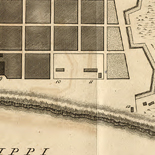
A plan of the city and environs of Philadelphia : with the works and encampments of His Majesty's forces under the command of Lieutenant General ...
Scale ca. 1:21,000.
Contributor: Faden, William Site: American Memory-cultural - Main Catalog Original Format: Map Date: 1779 View catalog record -

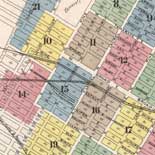
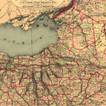
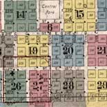
Map of Fayette Co., Pa.
LC Land ownership maps, 746
Site: American Memory-cultural - Main Catalog Original Format: Map View catalog record -

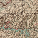
Topographical map of Pike County, Pennsylvania.
LC Land ownership maps, 786
Site: American Memory-cultural Original Format: Map -

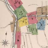
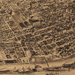
Edinboro, Pa. 1898.
Perspective map not drawn to scale.
Contributor: O'Brien, John J. Site: American Memory-cultural - Main Catalog Original Format: Map Date: 1898 View catalog record -

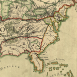
[Maps illustrating the Gettysburg campaign. June 3-July 3, 1863].
Various scales.
Contributor: Wells, Jacob Site: American Memory-cultural - Main Catalog Original Format: Map Date: 1886-01-01 View catalog record -

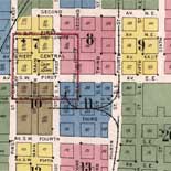
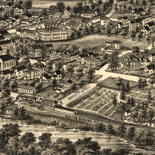
Downingtown, Chester County, Pennsylvania 1893.
Perspective map not drawn to scale.
Contributor: Fowler, T. M. Site: American Memory-cultural - Main Catalog Original Format: Map Date: 1893 View catalog record -

Mahanoy City, Pennsylvania.
Perspective map not drawn to scale.
Contributor: Fowler, T. M. Site: American Memory-cultural - Main Catalog Original Format: Map Date: 1889 View catalog record -

Factoryville, Wyoming County, Penn'a /
Bird's-eye view.
Contributor: Fowler, T. M. Site: American Memory-cultural - Main Catalog Original Format: Map Date: 1891 View catalog record -

Moosic, Pennsylvania 1892 /
Perspective map not drawn to scale.
Contributor: Fowler, T. M. Site: American Memory-cultural - Main Catalog Original Format: Map Date: 1892 View catalog record -

Gettysburg July 2nd The Union and Rebel forces in the cemetery.
"Night of July 2nd."
Contributor: Sneden, Robert Knox Site: American Memory-cultural Original Format: Map Date: 1861 -

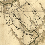
A map of the county of Pike, Pennsylvania : shewing the location and form of the original surveys with the numbers by which they are ...
Shows warrant-deed survey areas (numbered).
Contributor: Cross, John T. Site: American Memory-cultural Original Format: Map Date: 1856 -

Somerset, Pennsylvania 1900.
Perspective map not drawn to scale.
Contributor: Fowler, T. M. Site: American Memory-cultural - Main Catalog Original Format: Map Date: 1900 View catalog record -

Map of the battle field of Gettysburg. [July 1st, 2nd, and 3rd 1863].
[Scale 1:15,840].
Contributor: J.B. Lippincott Company Site: American Memory-cultural - Main Catalog Original Format: Map Date: 1863 View catalog record -

Edwardsville, Pa. 1892.
Perspective map not drawn to scale.
Contributor: Fowler, T. M. Site: American Memory-cultural - Main Catalog Original Format: Map Date: 1892 View catalog record -

Gettysburg battle-field. Battle fought at Gettysburg, Pa., July 1st, 2d & 3d, 1863 by the Federal and Confederate armies, commanded respectively by Genl. G. G. ...
LC Civil War Maps (2nd ed.), 324
Contributor: Bachelder, John B. Site: American Memory-cultural - Main Catalog Original Format: Map Date: 1863 View catalog record -

Map of the Reading & Columbia Rail Road connecting New York via the Jersey Central, Reading and Columbia, with Baltimore and Washington, together with Western ...
Scale ca. 1:600,000.
Contributor: Kase, S. P. Site: American Memory-cultural - Main Catalog Original Format: Map View catalog record -

Map showing the positions occupied by the Tenth New York Cavalry in the cavalry engagements on the right flank at Gettysburg, Penn. : on July ...
Union positions are indicated in black and Confederate positions in red.
Contributor: Preston, Noble D. Site: American Memory-cultural - Main Catalog Original Format: Map Date: 1863 View catalog record -

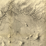
Irvona, Clearfield County, Pennsylvania.
Perspective map not drawn to scale.
Contributor: Fowler, T. M. Site: American Memory-cultural - Main Catalog Original Format: Map Date: 1895 View catalog record -

Hamburg, Berks Co., Penna. 1889.
Perspective map not drawn to scale.
Contributor: Fowler, T. M. Site: American Memory-cultural - Main Catalog Original Format: Map Date: 1889 View catalog record -

Monumental guide to the Gettysburg battlefield. A map showing the location of every monument, marker and tablet with approaching roads and avenues
Scale ca. 1:12,800.
Contributor: Hammond, Schuyler A. Site: American Memory-cultural - Main Catalog Original Format: Map Date: 1899 View catalog record
Refine your search
Original Format
- Map