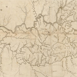
![[Map of Madison County, Va.].](https://cybercemetery.unt.edu/archive/oilspill/20121101113420im_/http://www.loc.gov/collections/static/hotchkiss-maps/images/cwh00046.jpg)


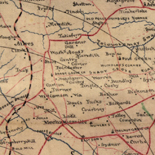


![[Rough sketch of the Rich Mountain battle area extending from Beverly, W. Va. to Clarksburg].](https://cybercemetery.unt.edu/archive/oilspill/20121101113420im_/http://www.loc.gov/collections/static/hotchkiss-maps/images/cwh00078.jpg)
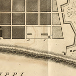
![A map of the most inhabited part of New England... Thomas Jefferys, [London] Thos. Jefferys, 1755.](https://cybercemetery.unt.edu/archive/oilspill/20121101113420im_/http://www.loc.gov/collections/static/american-revolutionary-war-maps/images/ar079700.jpg)
Results
-

[Map showing the location of the Shenandoah Iron Works at Shenandoah, Virginia].
Relief shown by hachures and form lines.
Site: American Memory-cultural - Main Catalog Original Format: Map View catalog record -

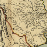
Map of a portion of the Rappahannock River and vicinity, Virginia : to illustrate the operations of the Army of Northern Virginia C.S. and the ...
Shows troop positions, settlements, roads, railroads, drainage, fords, vegetation, county names, and rural houses.
Contributor: Hotchkiss, Jedediah Site: American Memory-cultural - Main Catalog Original Format: Map Date: 1866 View catalog record -

Map of Little North Mt. land (collat to SGC 20m Ap. 1, 1879) /
Relief shown by hachures.
Contributor: Hotchkiss, Jedediah Site: American Memory-cultural - Main Catalog Original Format: Map Date: 1876 View catalog record -

Siege of Yorktown [Virginia].
Lower left corner: "Copy of map made for Maj. Genl. S.P. Heintzelman, 3d Army Corps."
Contributor: Sneden, Robert Knox Site: American Memory-cultural Original Format: Map Date: 1861 -

[Map of country between Fredericksburg and Richmond, Virginia, showing roads, railroads, and some place names].
Scale [ca. 1:290,000].
Site: American Memory-cultural - Main Catalog Original Format: Map Date: 1861 View catalog record -

Survey of Orange County, Virginia /
Relief shown by hachures.
Contributor: Izard, Walter Site: American Memory-cultural - Main Catalog Original Format: Map Date: 1863 View catalog record -

Army map of the seat of war in Virginia : showing the battle fields, fortifications etc. on & near the Potomac River /
"Entered according to act of Congress, in the year 1861, by John Disturnell, in the Clerk's Office of the District Court of the United States for the Southern District of New York."
Contributor: Bruff, Joseph Goldsborough Site: American Memory-cultural Original Format: Map Date: 1862 -

Plan of the Battle of Dranesville Va Decr 20th 1861.
Color coding indicates the location of Union and Confederate forces.
Contributor: Sneden, Robert Knox Site: American Memory-cultural Original Format: Map Date: 1861 -

Williamsburg to White House
Scale ca. 1:63,630.
Contributor: Abbot, Henry L. Site: American Memory-cultural - Main Catalog Original Format: Map Date: 1862 View catalog record -

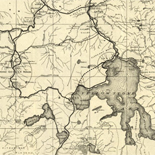
[Map of the northern part of Virginia and West Virginia, between the Blue Ridge and the Alleghany Front, south of the Potomac River and north ...
Relief shown by hachures and shading.
Site: American Memory-cultural - Main Catalog Original Format: Map View catalog record -

Geological map of Virginia & West Virginia showing their chief geological sub-divisions /
Relief shown by hachures.
Contributor: Rogers, William Barton Site: American Memory-cultural - Main Catalog Original Format: Map View catalog record -

Atlas of fifteen miles around Washington, including the counties of Fairfax and Alexandria, Virginia /
Some p. were originally folded.
Contributor: Hopkins, Griffith Morgan Site: American Memory-cultural - Main Catalog Original Format: Map Date: 1879 View catalog record -

[Map of the Fredericksburg and Chancellorsville battlefields, 1862-1863].
Relief shown by hachures.
Contributor: Hotchkiss, Jedediah Site: American Memory-cultural - Main Catalog Original Format: Map Date: 1862 View catalog record -

[Map of the Chaffin's Bluff area of Henrico County, Virginia] /
Additional annotations made in pencil.
Contributor: Smith, Normand Site: American Memory-cultural Original Format: Map -

Plan of the battle of Chancellorsville. Virginia position, 5 p.m., 2nd May 1863.
Bottom margin: "Copy from official map, Topog. Engineers."
Contributor: Sneden, Robert Knox Site: American Memory-cultural Original Format: Map Date: 1861 -

Map of n. eastern Virginia and vicinity of Washington /
Relief shown by hachures. Depths shown by soundings.
Contributor: United States. Corps of Topographical Engineers Site: American Memory-cultural - Main Catalog Original Format: Map Date: 1862 View catalog record -

Plan of the 1st Battle of Bull Run Virginia 21st July 1861. Topography from U.S. Engineers official map.
Color coding indicates location of Union and Confederate forces.
Contributor: Sneden, Robert Knox Site: American Memory-cultural Original Format: Map Date: 1861 -

[Map of the battle field of Gaines's Mill, showing approximately the positions of infantry and artillery engaged /
Relief shown by hachures.
Contributor: Wells, Jacob Site: American Memory-cultural - Main Catalog Original Format: Map Date: 1885 View catalog record -

Hughes military map of Richmond & Petersburgh [sic], Va. Showing the Rebel fortifications drawn on the ground for the War Department by Major W. C. ...
Scale ca. 1:105,000.
Contributor: Hughes, William C. Site: American Memory-cultural - Main Catalog Original Format: Map Date: 1864 View catalog record -
Position at Chancellorsville at 8 a.m. May 3rd 1863
NOTE: Researchers will be served a color photocopy of this scrapbook image.
Contributor: Sneden, Robert Knox Site: American Memory-cultural Original Format: Map Date: 1861