

![[January 15, 1945], HQ Twelfth Army Group situation map.](https://cybercemetery.unt.edu/archive/oilspill/20121101145928im_/http://www.loc.gov/collections/static/world-war-II-maps-military-situation-maps-from-1944-to-1945/images/ict21225.jpg)

![Sketch-book of positions of forces of 2nd Corps A.N.Va., campaigns of 1864 : [Virginia]](https://cybercemetery.unt.edu/archive/oilspill/20121101145928im_/http://www.loc.gov/collections/static/hotchkiss-maps/images/cwh00003.jpg)


![[Coast of Maine from Frenchmans Bay to Mosquito Harbor].](https://cybercemetery.unt.edu/archive/oilspill/20121101145928im_/http://www.loc.gov/collections/static/american-revolutionary-war-maps/images/np000011.jpg)


![Plan général du Fort Septentrional du Detour des Anglois, tel qu'il est présentement : [Louisiana]](https://cybercemetery.unt.edu/archive/oilspill/20121101145928im_/http://www.loc.gov/collections/static/louisiana-european-explorations-and-the-louisiana-purchase/images/lh000949.jpg)

Results
-

Reddition de l'Armée angloises commandée par Mylord Comte de Cornwallis aux armees combinées des Etats Unis de l'Amérique et de France aux ordres des Generaux ...
Hand colored.
Contributor: Mondhare (Firm) Site: American Memory-cultural - Main Catalog Original Format: Map Date: 1781 View catalog record -
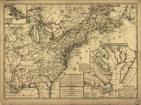
Dominia Anglorum in America Septentrionali.
Scales vary.
Contributor: Homann Erben (Firm) Site: American Memory-cultural - Main Catalog Original Format: Map Date: 1759 View catalog record -
Carte generale des colonies angloises dans l'Amerique Septentrionale pour l'intelligence de la guerre presente, d'apres des manuscrit anglais par J. B. Nolin geographe. Corrigé, augmenté ...
Scale ca. 1:5,100,000.
Contributor: Phelipeau, Ren - Phelipeau, Rene Site: American Memory-cultural - Main Catalog Original Format: Map Date: 1783 View catalog record -

Lord Cornwallis surrender, 1781.
Shows Yorktown Virginia and the York River on conical powder horn.
Contributor: Crosby, E. Site: American Memory-cultural - Main Catalog Original Format: Map Date: 1781 View catalog record -
A plan of Mr. Clifton's neck land platted by a scale of 50 poles to the inch /
Title of the pasture map from photocopy of lower right quadrant.
Contributor: Washington, George Site: American Memory-cultural - Main Catalog Original Format: Map Date: 1760 View catalog record -

A plan of my farm on Little Huntg. Creek & Potomk. R.
Scale not given.
Contributor: Washington, George Site: American Memory-cultural - Main Catalog Original Format: Map Date: 1766 View catalog record -

A map of Potomack and James rivers in North America shewing their several communications with the navigable waters of the new province on the river ...
Scale ca. 1:950,000.
Contributor: Ballendine, John Site: American Memory-cultural - Main Catalog Original Format: Map Date: 1772 View catalog record -
Carte detaillée de West Point sur la rivière d'York au confluent des Rivières de Pamunkey et Matapony.
Scale ca. 1:20,000.
Site: American Memory-cultural - Main Catalog Original Format: Map Date: 1781 View catalog record -
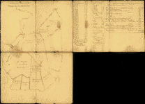
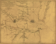
Notes sur les environs de York: Plan donné par des arpenteurs du pays.
Scale ca. 1:44,000.
Site: American Memory-cultural - Main Catalog Original Format: Map Date: 1781 View catalog record -

Notes sur les environs de York.
Scale ca. 1:44,000.
Site: American Memory-cultural - Main Catalog Original Format: Map Date: 1781 View catalog record -

Plan d'York en Virginie avec les attaques faites par les Armées françoise et américaine en 8bre. 1781.
Scale ca. 1:4,800.
Contributor: Querenet de La Combe Site: American Memory-cultural - Main Catalog Original Format: Map Date: 1781 View catalog record -
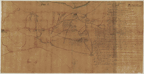
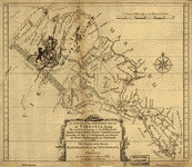
Armée de Rochambeau, 1782. Carte des environs de Williamsburg en Virginie où les armées françoise et américaine ont campés en Septembre 1781.
Scale ca. 1:15,250.
Contributor: Desandroüins, Jean Nicolas - Desandroüins, Jean Nicolas Site: American Memory-cultural - Main Catalog Original Format: Map Date: 1782 View catalog record -
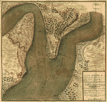
A Plan of the entrance of Chesapeak [sic] Bay, with James and York Rivers; wherein are shewn the respective positions (in the beginning of October) ...
Scale ca. 1:240,500.
Site: American Memory-cultural - Main Catalog Original Format: Map Date: 1781 View catalog record -

Siege d'York, 1781. Plan d'York en Virginie avec les attaques et les campemens de l'Armée combinée de France et d'Amérique.
Scale ca. 1:14,640.
Contributor: Querenet de La Combe Site: American Memory-cultural - Main Catalog Original Format: Map Date: 1781 View catalog record -

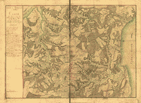
Campagne en Virginie du Major Général M'is de LaFayette : ou se trouvent les camps et marches, ainsy que ceux du Lieutenant Général Lord Cornwallis ...
Covers central Virginia from Orange County in the north to Isle of Wight County in the south, and west to Cumberland County.
Contributor: Capitaine du Chesnoy, Michel Site: American Memory-cultural - Main Catalog Original Format: Map Date: 1781 View catalog record -
A survey of the northern neck of Virginia, being the lands belonging to the Rt. Honourable Thomas Lord Fairfax Baron Cameron, bounded by & within ...
Scale ca. 1:875,000.
Contributor: Warner, John Site: American Memory-cultural - Main Catalog Original Format: Map Date: 1747 View catalog record -
Dominia Anglorum in America Septentrionali.
Scales vary.
Contributor: Homann Erben (Firm) Site: American Memory-cultural - Main Catalog Original Format: Map Date: 1759 View catalog record -

Carte de la partie de la Virginie ou l'armée combinée de France & des États-Unis de l'Amérique a fait prisonnière l'Armée anglaise commandée par Lord ...
Scale ca. 1:215,000.
Contributor: Esnauts et Rapilly Site: American Memory-cultural - Main Catalog Original Format: Map Date: 1781 View catalog record -

Part of the Province of Virginia.
Scale ca. 1:120,000.
Site: American Memory-cultural - Main Catalog Original Format: Map Date: 1791 View catalog record -

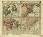
A Representation, of the sea fight, on the 5th of Sepr. 1781, between Rear Admiral Graves and the Count de Grasse.
Scale ca. 1:444,000.
Site: American Memory-cultural - Main Catalog Original Format: Map Date: 1781 View catalog record
Refine your search
Original Format
- Map
Online Format
- Image
Date
Site
- American Memory-cultural
- Main Catalog