![[Base map of Alabama].](https://cybercemetery.unt.edu/archive/oilspill/20121102000006im_/http://www.loc.gov/collections/static/hotchkiss-maps/images/cwh00201.jpg)


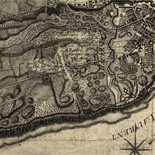
![Boston its environs and harbour, with the rebels works raised against that town in 1775... Sir Thomas Hyde Page, [1775?].](https://cybercemetery.unt.edu/archive/oilspill/20121102000006im_/http://www.loc.gov/collections/static/american-revolutionary-war-maps/images/ct000070.jpg)
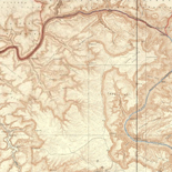
![[Base map of Pennsylvania].](https://cybercemetery.unt.edu/archive/oilspill/20121102000006im_/http://www.loc.gov/collections/static/hotchkiss-maps/images/cwh00207.jpg)
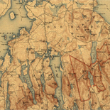
![Sketch-book of positions of forces of 2nd Corps A.N.Va., campaigns of 1864 : [Virginia]](https://cybercemetery.unt.edu/archive/oilspill/20121102000006im_/http://www.loc.gov/collections/static/hotchkiss-maps/images/cwh00003.jpg)

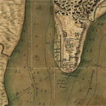
![[Topographical map of part of Washington D.C.].](https://cybercemetery.unt.edu/archive/oilspill/20121102000006im_/http://www.loc.gov/collections/static/civil-war-maps/images/cw0688500.jpg)


![[December 23, 1944], HQ Twelfth Army Group situation map.](https://cybercemetery.unt.edu/archive/oilspill/20121102000006im_/http://www.loc.gov/collections/static/world-war-II-maps-military-situation-maps-from-1944-to-1945/images/ict21202.jpg)
![[December 18, 1944], HQ Twelfth Army Group situation map.](https://cybercemetery.unt.edu/archive/oilspill/20121102000006im_/http://www.loc.gov/collections/static/world-war-II-maps-military-situation-maps-from-1944-to-1945/images/ict21197.jpg)
Results
-

A plan of the island of Burlington : and a view of the city from the River Delaware /
Cadastral map showing buildings, lot lines, orchards, and gardens.
Contributor: Birch, William Russell Site: American Memory-cultural - Main Catalog Original Format: Map Date: 1797 View catalog record -

Kemâliyle nakş olunmuş cümle cihan numûnesi /
Relief shown pictorially.
Contributor: Hâcı Ahmed - Hâcı Ahmed Site: American Memory-cultural - Main Catalog Original Format: Map Date: 1795 View catalog record -

The State of Maryland from the best authorities.
Scale ca. 1:770,000.
Contributor: Lewis, Samuel Site: American Memory-cultural - Main Catalog Original Format: Map Date: 1795 View catalog record -

Massachusetts /
Relief shown by hachures.
Contributor: Sotzmann, D. F. Site: American Memory-cultural - Main Catalog Original Format: Map Date: 1796 View catalog record -

The State of New Hampshire. Compiled chiefly from actual surveys.
Scale ca. 1:700,000.
Contributor: Lewis, Samuel Site: American Memory-cultural - Main Catalog Original Format: Map Date: 1794 View catalog record -

Carte hydrographique de la baye de la Havana. Avec le Plan de la ville et de ses forts pour joindre a la Carte de l'isle ...
Scale ca. 1:11,500.
Contributor: Bellin, Jacques Nicolas Site: American Memory-cultural - Main Catalog Original Format: Map Date: 1791 View catalog record -

Plano del Lago de Sn. Bernardo en el Seno Mexica no. /
Watermarks: J. Kool; and, Strasburg fleur-de-lis. Watermark dated as 1792.
Contributor: Vico, Antonio Site: American Memory-cultural - Main Catalog Original Format: Map Date: 1792 View catalog record -

Plano del Puerto de la Havana /
Depths shown by soundings.
Contributor: González, Pedro - González, Pedro Site: American Memory-cultural - Main Catalog Original Format: Map Date: 1791 View catalog record -

Indiana Fort Wayne : ms. map of Fort Wayne said to have been made on July 18, 1795, for General Anthony Wayne /
Pen-and-ink and watercolors.
Contributor: Neff, P. M. Site: American Memory-cultural - Main Catalog Original Format: Map Date: 1795-07-18 View catalog record -

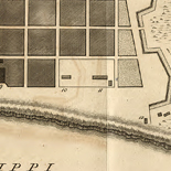
Plan of the city of Washington in the territory of Columbia : ceded by the states of Virginia and Maryland to the United States of ...
Shows block numbers and proposed government buildings.
Contributor: Ellicott, Andrew Site: American Memory-cultural - Main Catalog Original Format: Map Date: 1792 View catalog record -

Carte générale de l'Océan Atlantique ou Occidental,
Scale ca. 1:12,000,000.
Contributor: France. Dépôt des cartes et plans de la marine - France. Dépôt des cartes et plans de la marine Site: American Memory-cultural - Main Catalog Original Format: Map Date: 1792 View catalog record -

Plano de Cartagena de Yndyas /
Shows coast of Colombia in region of Cartagena.
Contributor: Mota, Juan de Site: American Memory-cultural - Main Catalog Original Format: Map Date: 1790 View catalog record -

A map of Kentucky from actual survey
Scale ca. 1:700,000.
Contributor: Barker, Elihu Site: American Memory-cultural - Main Catalog Original Format: Map Date: 1793 View catalog record -

Carta esferica de la costa comprehendida desde Acapulco a Sn. Blas trabajada abordo de las corberas de la Marina Real Descubierta y Atrevida, año de ...
Shows coast of Mexico between Acapulco and San Blas.
Site: American Memory-cultural - Main Catalog Original Format: Map Date: 1791 View catalog record -

Maps Of Arcadia National Park - National Parks Maps
Early European Maps | British Maps | Nineteenth Century Nautical Charts | Mount Desert Island | USGS Maps | National Park Service Maps of Acadia Map of the Discovery of the East ...
Site: LOC.gov web pages Original Format: Map - Web Page Date: 1999-06-02 -

Amérique septentrionale avec les routes, distances en miles, villages et etablissements françois et anglois,
Scale ca. 1:2,000,000.
Contributor: Mitchell, John Site: American Memory-cultural - Main Catalog Original Format: Map Date: 1792 View catalog record -

Ortelius Improved, or a new map of Ireland : Wherin are inserted the principal families of Irish and English extraction, who possess'd that kingdon[sic] on ...
HLAS, 24-14
Contributor: Thompson, S. Site: American Memory-cultural - Main Catalog Original Format: Map Date: 1795 View catalog record -

Plano de la Ysla de Puercos y Sn. Seuastian, costa del Brasil, en la latitutd de 23p0s 24ʹ sur.
Dated by comparison with similar map.
Site: American Memory-cultural - Main Catalog Original Format: Map Date: 1792 View catalog record -

Map of the State of Maryland laid down from an actual survey of all the principal waters, public roads, and divisions of the counties therein; ...
Scale ca. 1:300,000.
Contributor: Griffith, Dennis Site: American Memory-cultural - Main Catalog Original Format: Map Date: 1795 View catalog record -

Vermont : from the latest authorities, 1799 /
Relief shown pictorially.
Contributor: Low, John Site: American Memory-cultural - Main Catalog Original Format: Map Date: 1799 View catalog record
Refine your search
Original Format
- Map
- Web Page [5]
Online Format
- Image
- Web Page [5]