
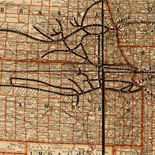
![[Sketches of portions of Madison County, Va.].](https://cybercemetery.unt.edu/archive/oilspill/20121101144952im_/http://www.loc.gov/collections/static/hotchkiss-maps/images/cwh00106.jpg)
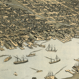
![Boston its environs and harbour, with the rebels works raised against that town in 1775... Sir Thomas Hyde Page, [1775?].](https://cybercemetery.unt.edu/archive/oilspill/20121101144952im_/http://www.loc.gov/collections/static/american-revolutionary-war-maps/images/ct000070.jpg)
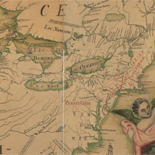
![Plano. I descripcion de la costa, desde el Cavo Cañaveral, hasta cerca de la boca de la Vir[g]inia, contando, costa de Florida, Georgia y Carolinas del S, y N, con todos sus puertos, este[ros ... ]letas, baxos, islas y rios; segun las vlti[mas not]icias, hata [sic] oy Octubre de 1756.](https://cybercemetery.unt.edu/archive/oilspill/20121101144952im_/http://www.loc.gov/collections/static/american-revolutionary-war-maps/images/ct000339.jpg)
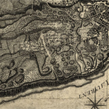
![[Map of Chancellorsville battlefield, May 3-4, 1863].](https://cybercemetery.unt.edu/archive/oilspill/20121101144952im_/http://www.loc.gov/collections/static/hotchkiss-maps/images/cwh00138.jpg)

![[December 25, 1944], HQ Twelfth Army Group situation map.](https://cybercemetery.unt.edu/archive/oilspill/20121101144952im_/http://www.loc.gov/collections/static/world-war-II-maps-military-situation-maps-from-1944-to-1945/images/ict21204.jpg)
![[Map of cavalry engagement near Bridgewater, Va. Oct. 4th and 5th, 1864]](https://cybercemetery.unt.edu/archive/oilspill/20121101144952im_/http://www.loc.gov/collections/static/hotchkiss-maps/images/cwh00193.jpg)
Results
-

A plan of the city and environs of Philadelphia,
Scale ca. 1:42,000.
Contributor: Scull, Nicholas Site: American Memory-cultural - Main Catalog Original Format: Map Date: 1777 View catalog record -

A map of Pennsylvania exhibiting not only the improved parts of that Province, but also its extensive frontiers: Laid down from actual surveys and chiefly ...
Scale ca. 1:365,000.
Contributor: Robert Sayer and John Bennett (Firm) Site: American Memory-cultural - Main Catalog Original Format: Map Date: 1775 View catalog record -

A plan of the city and environs of Philadelphia,
Scale ca. 1:42,000.
Contributor: Scull, Nicholas Site: American Memory-cultural - Main Catalog Original Format: Map Date: 1777 View catalog record -

Seat of war in the environs of Philadelphia:
Scale ca. 1:656,000.
Contributor: Kitchin, Thomas Site: American Memory-cultural - Main Catalog Original Format: Map Date: 1777 View catalog record -

Plan of the city of Philadelphia and its environs shewing its defences during the years 1777 & 1778, together with the siege of Mud Island ...
Scale ca. 1:14,400.
Contributor: Nicole, Pierre Site: American Memory-cultural - Main Catalog Original Format: Map Date: 1778 View catalog record -

A plan of the city and environs of Philadelphia : with the works and encampments of His Majesty's forces under the command of Lieutenant General ...
Scale ca. 1:21,000.
Contributor: Faden, William Site: American Memory-cultural - Main Catalog Original Format: Map Date: 1779 View catalog record -

A Draught of ten lots of ground in the northern liberties of the city of Philadelphia, surveyed the 28th August 1787, beginning at a bridge ...
Scale ca. 1:650.
Site: American Memory-cultural Original Format: Map Date: 1787 -

From Battle of Brandywine.
Scale not given.
Site: American Memory-cultural - Main Catalog Original Format: Map Date: 1777 View catalog record -

Plan de la retraite de Barren Hill en Pensilvanie : ou un détachement de deux mille deux cent hommes sous le G'al LaFayette étois entouré ...
Covers Barren Hill and vicinity (Whitemarsh Twp., Montgomery Co., Pa.) with Chestnut Hill and Germantown.
Contributor: Capitaine du Chesnoy, Michel Site: American Memory-cultural - Main Catalog Original Format: Map Date: 1778 View catalog record -

[Maps of the Maryland-Pennsylvania boundary used as trial exhibits in the 1735 court suit brought by the Penns against Lord Baltimore to determine the official ...
The maps also cover the Lower Counties (now the State of Delaware) which at the time were part of Pennsylvania.
Contributor: Senex, John Site: American Memory-cultural - Main Catalog Original Format: Map Date: 1732 View catalog record -

Plan of the lots laid out at Pittsburg and the Coal Hill.
Scale ca. 1:1,600.
Site: American Memory-cultural - Main Catalog Original Format: Map Date: 1787 View catalog record -

Captain Snow's sketch.
Scale not given.
Contributor: Snow Site: American Memory-cultural - Main Catalog Original Format: Map Date: 1754 View catalog record -


A new and accurate map of the Province of Pennsylvania, in North America : from the best authorities. Catalog Record - Electronic Resource Available
Relief shown pictorially.
Site: Main Catalog Original Format: Map Date: 1780 -

A sketch of the field of battle with the disposition of the troops in the beginning of the engagement of the 9th of July on ...
Scale 1:10,800; 300 yards to an in.
Site: American Memory-cultural - Main Catalog Original Format: Map Date: 1755 View catalog record -

A plan of the city and environs of Philadelphia,
Scale ca. 1:43,000.
Contributor: Scull, Nicholas Site: American Memory-cultural - Main Catalog Original Format: Map Date: 1777 View catalog record -

Battle of Brandywine in which the Americans were defeated : September the 11th, 1777 by General Sr. William Howe.
Scale ca. 1:15,300.
Contributor: Faden, William Site: American Memory-cultural - Main Catalog Original Format: Map Date: 1784 View catalog record -

Baye de la Delaware avec les ports, sondes, dangers, bancs, &c. depuis les caps jusqu'a Philadelphie d'après la carte de Joshua Fisher publie a Philadelfia, ...
Scale ca. 1:200,000.
Contributor: Ybarra Site: American Memory-cultural Original Format: Map Date: 1785 -

A map of the improved part of the Province of Pennsilvania in America : begun by Wil. Penn, Proprietary & Governour thereof anno 1681 /
Shows rural landholders' names, lot lines, and proprietary manors.
Contributor: Holme, Thomas Site: American Memory-cultural - Main Catalog Original Format: Map Date: 1705 View catalog record -

A map of the province of Pensilvania /
Relief shown pictorially.
Contributor: Kitchin, Thomas Site: American Memory-cultural - Main Catalog Original Format: Map Date: 1756 View catalog record -

British camp at Trudruffrin from the 18th. to the 21st. of September 1777, with the attack made by Major General Grey against the rebels near ...
Scale ca. 1:31,680.
Site: American Memory-cultural - Main Catalog Original Format: Map Date: 1778 View catalog record
Refine your search
Original Format
- Map