Shock and Awe: 3 Inspiring Wall Calendars for 2013

January 11, 2013

Shock and awe were the terms that came to mind when these three wall calendars / event planners came across my desk this week.

Shock came from the “I didn’t know that!?” response to the fascinating facts and awe as in “How did they take such awe-inspiring photos”? And the final “Awww” as in “Awww, shucks!” because there are only limited quantities available (under 100 each), so if you don’t act immediately, they’ll be gone! In fact, our supply of the National Park’s Service famous National Historic Landmarks calendar last year sold out in a few hours, and we expect this year to be more of the same.

In spite of our now digital world, wall calendars are still useful as a quick visual reference for you, your family or even your team at the office. And with these particular calendars on your wall this year, you will also be inspired to see the beauty in nature both far and near. As Anne Frank said, “Think of all the beauty still left around you and be happy.

Let’s take a peek at these three terrific calendars…


The National Historic Landmark 2013 Event Planner Calendar

Each fall, the National Park Service (NPS) holds a public photo contest to choose “fantastic photographs that illustrate the significance of any of the over 2,500 National Historic Landmarks, our nation’s most significant treasures.”  They select one image from each of the 13 National Park Service regions to be included in their annual calendar, with the winning photograph gracing the cover. (There is a separate photo contest for National Natural Landmarks as well.)

What is a U.S. National Historic Landmark, you ask? It may be “a historic building, site, structure, object, or district,” but it must be a “nationally significant historic place” that possesses “exceptional value or quality in illustrating or interpreting the heritage of the United States” as designated by the U.S. Secretary of the Interior.

The goal of their annual National Historic Landmark Photo Contest, says NPS:

“…is to encourage people to discover and explore landmark sites across the country and be inspired by our past. Based on this year’s pool of exceptional photographs, connections were made…Perhaps this year’s winning entries will spark the urge to explore the country’s vast array of more than 2,500 National Historic Landmarks, to seek out the stories that connect our rich history, and share your own views in next year’s contest.”

This 13-month wall calendar / event planner runs from January 2013 through January 2014 and features the winning photographs from the National Park Service’s Thirteenth Annual National Historic Landmarks (NHL) Photo Contest in 2012.

Different this year is the inclusion of bonus contest submission photos on each calendar page, giving even more eye candy every month for us lucky few who have the calendar.

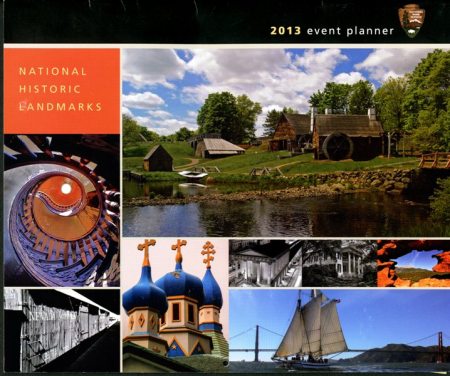
National Historic Landmarks Photo Contest 2013 Calendar front cover

Image: Front of the 2013 NHL calendar shows some of the winning public photos. Listed from top down, left to right: 

  • This year’s winning image of Saugus Iron Works National Historic Site in Saugus, Massachusetts, takes us back in time to the early industry of the 17th century, represented by scenic waterwheels and forge. Here, European iron makers brought their much-needed skills to a young Massachusetts colony (Photo by Don Woods).
  • One of the “bonus” photos is of Hay House staircase in Macon, Georgia (Photo by Andrew Wood).
  • Holy Assumption Orthodox Church, Alaska, dates from the 1890s (Photo by Dawn Wilson).
  • Charleston Market Hall and Sheds, South Carolina, is one of the last surviving 19th century American market complexes (Photo by Steven Hyatt).
  • Stanton Hall, Mississippi, represents Natchez’s wealth and opulence on the eve of the Civil War (Photo by Mike Talplacido).
  • Pike’s Peak, Colorado, a National Historic Landmark, seen from Garden of the Gods, a National Natural Landmark (Photo by Dawn Wilson).
  • Nevada Northern Railway, East Ely Yards, Nevada, is the best-preserved, least-altered, and most complete main yard complex remaining from the steam railroad era (Photo by Jen Dalley).
  • Schooner Alma (NPS), California, built in 1891, is the only survivor of a once-typical American vessel (Photo by John Conway).

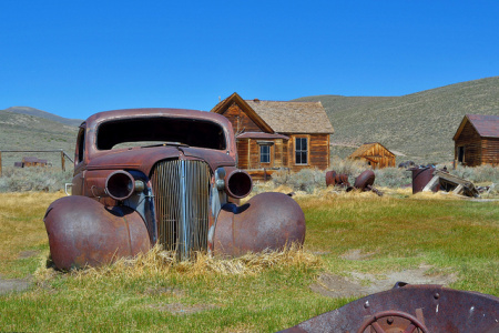
National Historic Landmark 2012 Photo Contest Bodie Historic District California

Image: One of the 2012 National Historic Landmark Photo Contest Honorable Mentions in this year’s calendar. Depicts Bodie Historic District, a genuine California gold-mining ghost town from the late 1800′s that was abandoned in the mid-1900′s. Bodie State Historic Park is located in the Bodie Hills east of the Sierra Nevada mountain range in Mono County, California, approximately 75 miles (120 km) southeast of Lake Tahoe (Photo by Joe Wenninger).


NASA Science 2013 Event Planner / Wall Calendar

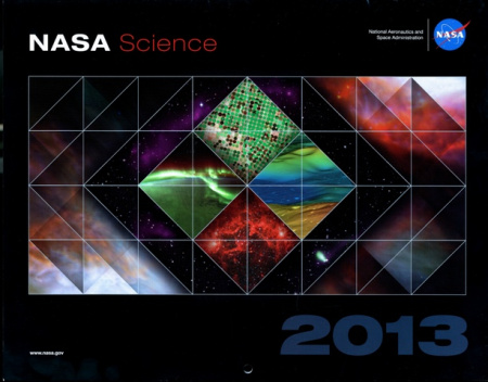
For this second wall calendar we leave the confines of earth and reach for the stars with the NASA Science 2013: Changing the Way We View the Earth, Our Sun, and the Universe wall calendar.

NASA Science 2013 Calendar front cover

It features a vast array of rare or never-before-seen phenomena as seen from NASA space photography in stunning full color.

In addition to showing U.S. national holidays, the calendar also includes all the moon phases, a nice touch!

NASA Science 2013 Wall Calendar back cover

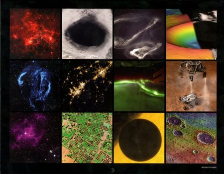
Image: Back of calendar shows insets of the monthly features, including:

  • a Deep Space Dragonfish nebula;
  • a massive cloud hole over Australia;
  • probing the edge of our atmosphere and jet streams;
  • an untouched crater on the Moon as a potential lunar settlement site;
  • a supernova stellar explosion;
  • blackouts in the East Coast from “derecho” thunderstorms;
  • Astronauts’ view of the Southern Lights that shifted unexpectedly;
  • NASA’s Curiosity rover lands safely on Mars;
  • tracking the fastest moving pulsar ever seen in space;
  • following the “greening” of the desert as Saudi Arabians tap ancient underground Ice Age water reserves;
  • rare “transit” of Venus passing in front of the sun; and
  • mapping impact craters on the planet Mercury.

Source: NASA / Jet Propulsion Laboratory-CalTech.

Space nuts (and “Big Bang Theory” fans) will be thrilled with this large calendar and its fascinating facts and stunning photos about space exploration and space-based science.


U.S. Geological Survey 2013 Event Planner/ Wall Calendar

This year’s U.S. Geological Survey’s calendar gives an eye-catching glimpse into the many facets of USGS and describes how their science is an integral part of decision-making in the U.S. and around the world. This calendar provides a dramatic glimpse at the changing world around us and how U.S. scientists are responding to these changes.

USGS 2013 Calendar front cover

For each month, descriptions of the various USGS service areas are shown along with dramatic full-color photographs or graphics giving timely examples, such as USGS work in: assessing invasive species like the high-leaping Asian carp; studying the effects of hydraulic fracturing or “fracking” on the environment; remote sensing to find precious metals in Afghanistan; tracking flooding such as happened in North Dakota; and mapping earthquakes.

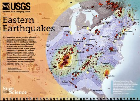
USGS 2013 Calendar Eastern Earthquakes page

Image: The East Coast portion of the USGS National Seismic Hazard map showing all earthquakes of 3.0 magnitude or greater that have been detected since 1974. Certainly those of us in the Washington area felt it keenly when the 5.8 magnitude quake based in Mineral, Virginia, hit on August 23, 2011. Coincidentally, another quake occurred yesterday in the same spot… yikes! Luckily, it was only a 2.0.

This calendar is ideal for anyone interested in natural disasters and earth science, and stumping your friends with interesting science facts!

To learn more about the USGS, you may want to read our earlier blog post, US Geological Survey and the Science of Hurricanes.


How can I buy these wall calendars?

  • Buy them at GPO’s retail bookstore at 710 North Capitol Street NW, Washington, DC 20401, open Monday–Friday, 9 a.m. to 4 p.m., except Federal holidays, (202) 512-0132.

About the Author:  Michele Bartram is Ecommerce and Promotions Manager for GPO’s Publication and Information Sales Division in Washington, DC, and is responsible for online and offline marketing of the US Government Online Bookstore (http://bookstore.gpo.gov) and promoting Federal government content to the public.
Keeping the Kids Entertained… and Educated

December 27, 2012

This week as holiday breaks from school and winter weather keep the kids indoors, parents are looking for ways to keep them entertained–and educated– at the same time.

Fortunately, many Federal agencies this year provide the perfect solution with publications that are both fun AND educational, and with which the kids might actually learn something besides how to shoot down some “Angry Birds” on their new tablet! ;-) From dinosaurs to fossils, freedom runners to astronauts, these fun facts will prove more fascinating than fiction.

Here are a few that I (and my eight and six year-old nephews) particularly enjoy:

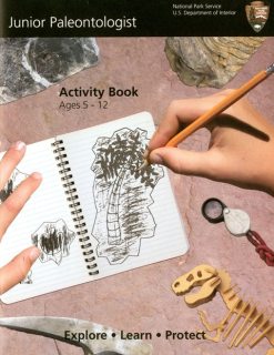
     Junior-Paleontologist Junior Paleontologist Activity Book, Ages 5-12, Explore, Learn, ProtectFor the kid who thinks dinosaurs are dynamite

In this illustrated color booklet, a child can learn about ancient life, complete fun activities, and explore some of the 230 national parks that preserve fossils and offer a look into the distant past.

And after completing the age-appropriate activities in this book, your child can then go online to request his or her free Junior Paleontologist badge from the National Park Service.

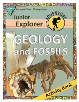
 Junior-Explorer-Geology-Fossils Junior Explorer Geology and Fossils Activity Book
For the kid who wants to be a “rock star”>/p>Fossils are the “rock stars” in this activity book as well. Includes fun facts, a crossword puzzle, and activities about rocks and fossils for explorers ages 8 to 12, along with a free Junior Explorer Certificate from the Bureau of Land Management (BLM).

Introduces basic kid-friendly concepts about geology, types of rocks and formations, and a glossary of terms. Focuses on Earth features– rock formations, canyons, caves, craters and more– that formed over long periods of time and that cannot be replaced as humans remove and make use of them, and the role of geologists to manage these non-renewable natural resources.

It also lists great public lands managed by the BLM that tourists can visit and explore these fossil-rich landscapes.

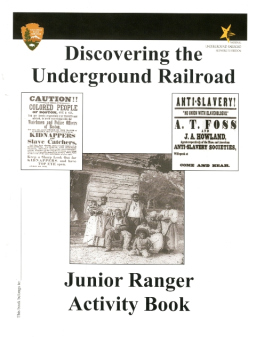
 Underground-Railroad-Activity-Book Discovering the Underground Railroad: Junior Ranger Activity BookFor the child who wants to change the world

Provides activities for children ages 5-12 to learn about the history of the underground railroad and the Emancipation Proclamation.

Children who finish the age-appropriate activities can send in to the National Underground Railroad Network to Freedom Program to receive a free Junior Ranger badge from the National Park Service.

Gently covers topics including: the meaning of freedom and slavery; the hardships and daily life of slaves; the importance and travel routes of the “Underground Railroad;” safe refuge choices; key dates and laws relating to slavery and emancipation; and key figures including Harriet Tubman, Frederick Douglas and abolitionists Levi and Catharine Coffin, among others.


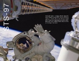
Celebrating-Space-Shuttle_30-Years
Waving-Astronaut
Celebrating 30 Years of the Space Shuttle programFor the kid or teen with stars in his or her eyes

For older kids, teens and adults with stars in their eyes (and dreams of space), this could be the book for them.

A tribute to everything accomplished during NASA’s Space Shuttle program’s 30 years of operation, this colorful book is chock-full of stunning color photography and interesting facts of every shuttle mission and its crews, from deploying the Hubble Telescope to the inspirational Sally Ride, the first American woman in space.

From its first mission on April 12, 1981, to its last, on July 21, 2011, the Space Shuttle program defined NASA and served as an inspiration to future engineers and astronauts worldwide.

Beginning with the orbiter Columbia and continuing with Challenger, Discovery, Atlantis, and Endeavour, the National Aeronautics and Space Administration’s (NASA) Space Shuttle has carried people into orbit; launched, recovered, and repaired satellites; conducted cutting-edge research; and helped build the largest human made structure in space, the International Space Station.

All of these books can also be found at the following locations:

  • Buy it at GPO’s retail bookstore at 710 North Capitol Street NW, Washington, DC 20401, open Monday–Friday, 9 a.m. to 4 p.m., except Federal holidays, (202) 512-0132.
  • Find it in a federal depository library.

Hopefully, these books will help our readers beat the winter blahs as families have to stay indoors due to the weather.

After all, as this famous (albeit anonymous) quote says: “Education is the best gift you could ever receive, because once you have it, no one can ever take it from you.

About the Author:  Michele Bartram is Promotions Manager for GPO’s Publication and Information Sales Division in Washington, DC, and is responsible for online and offline marketing of the US Government Online Bookstore (http://bookstore.gpo.gov) and promoting Federal government content to the public.

1940 Census Goes Digital

April 11, 2012

Last week, on April 2, 2012, the 1940 United States census was released to the public in digital format by the National Archives in conjunction with the U.S Census Bureau at http://1940census.archives.gov

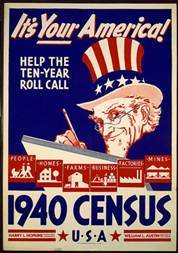
Image: 1940 Census Poster urging Americans to “Help the Ten-Year Roll Call”. Source:U.S.Census Bureau

Reports National Public Radio:

Veiled in secrecy for 72 years because of privacy protections, the 1940 U.S. census is the first historical federal decennial survey to be made available on the Internet initially rather than on microfilm.

In a great example of a private/public partnership, Archives.com’s parent company partnered with the National Archives to provide the public with free digital access to the 1940 Federal Population Census.

Miriam Kleiman, spokeswoman for the U.S. National Archives, told The Associated Press that the Archives’ 1940 census site registered more than 22 million hits in just four hours from almost 2 million users on its very first day of release. It is extremely popular already with librarians, researchers and genealogists researching their family tree.

Data from the Great Depression

Archivist Connie Potter, in an entertaining video about the Archives’ digitization project, explains that the reason this census is so amazing is because it describes “the country during the Great Depression.  It reflects all of the economic dislocation, how many people were immigrants, how many people had what level of education.

Last week’s release of digitized information covers detailed records on 132 million people living in the United States at the end of the Depression and a year before Pearl Harbor.

The census data was transferred to microfilm during World War II, and in 2009, National Archives personnel began digitizing those records, culminating in the release of the database last week.

Over 3.9 million images were digitized, providing a bonanza for researchers.

Some interesting facts about the 1940 Census

Image: An enumerator interviews a woman with her 10 children around her for the 1940 census. Source: National Archives at College Park

The Census Bureau began the 1940 census with extensive long-term planning, recruiting and training.  Back in 1940, about 120,000 census-takers, called enumerators, spread out across the U.S. and territories, going door-to-door to interview families.

Enumerators both then and now can face challenging situations when gathering the data to tabulate the census, from trudging through fields or mushing a dog sled across the snow.

Image: Rural visit by a U.S. Census taker in connection with the 16th decennial census of 1940  Source: Library of Congress image number LC-USZ62-91199

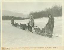
Image: The Alaska Territory saw the census enumerator arrive in his dog sled, 1940 – 1941 Source: National Archives Research Catalog

Questions from the 1940 Census

It’s interesting to note the questions that were asked on the 1940 census form.  One of the fifty questions the enumerators asked Americans in 1940 reflected the more formal societal structures of the time: “What was the Relationship of this person to the head of the household, as wife, daughter, father, mother-in-law, grandson, lodger, lodger’s wife, servant, hired hand, etc.?”  

Another question was very relevant for a Depression-era nation where children as young as 14 still worked, and millions of out-of-work Americans were given “public emergency” jobs around the country under Franklin Roosevelt’s New Deal programs. One was the Works Project Administration (originally the Works Progress Administration) or WPA, which was the “largest and most ambitious New Deal agency and employed millions of unskilled workers to carry out public works projects,including the construction of public buildings, roads and dams, as well as operating large arts, drama, media, and literacy projects.

Image: WPA Federal Arts poster. Source: Smithsonian Archives of American Art

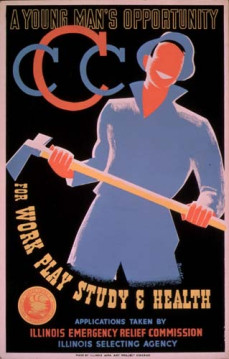
Another New Deal program mentioned in the census was the Civilian Conservation Corps or CCC . It was designed to provide employment mostly for young men in relief families who had difficulty finding jobs during the Great Depression (there were separate programs for veterans and Native Americans), while at the same time implementing a general natural resource conservation program in every state and territory for the “conservation and development of natural resources in rural lands” owned by federal, state and local governments. Many trees were planted and national and state parks built and preserved by the CCC.

Image: Illinois CCC recruiting poster. Source: Archives.gov

Another youth-focused program referenced was the National Youth Administration or NYA that focused on providing work and education for young Americans between the ages of 16 and 25.

Thus, it makes sense that this 1940 census question asked Persons 14 Years Old and Over” to classify their employment status during the time of the census-taking (March 24-30, 1940) as follows:

  • Was this person AT WORK for pay or profit in private or non-emergency Government work during week of March 24-30? (Yes or No).
  • If not, was he at work on, or assigned to, public EMERGENCY WORK (WPA, NYA, CCC, etc.) during week of March 24-30? (Yes or No).

How to Use the 1940 Census

Even for those not steeped in genealogy research will find it thrilling, like I do, to see the excitement build over the release of these images.  It might be fun to look up my ancestors because I know my grandfather worked for the W.P.A.   I’m also interested in looking at the various trends and metrics available on housing to see if there is any correlation to the current economic situations.

Visit the National Archives pages to see the various resource location aids, enumerator training videos, and question templates that have been gathered for your use.  Based on the times, there were specific instructions for enumerators to get a count of temporary housing such as huts, tents, and cabins as of a point in time.   Here’s one bit of instruction to help clarify how to count the large transient population: “Persons in hotels, tourist or trailer camps, missions, and cheap one night lodging houses (flophouses) will all be enumerated as of the evening of April 8th”.

Help Tag the Images

The Census Bureau is appealing to the public for help indexing and meta tagging the images.  This is a genealogy crowdsourcing project to ensure the 3.8 million images are indexed and freely searchable online. You, too, can register to be a 1940 Census Blog Ambassador and get a nifty badge for your page!

You can follow the 1940 Census via Twitter at: #1940Census #Genealogy #history. 

How can you get other Census Bureau publications today?

The release of the historic images will be made at 1940census.archives.gov.

For those interested in more current information, take a look at the resources in GPO’s U.S. Government Bookstore.  The subscription series help keep you updated on the Census and Population statistics as they are released.

  • Buy them at GPO’s retail bookstore at 710 North Capitol Street NW,Washington, DC 20401. Open Monday-Friday, 9am to 4pm, except Federal holidays. Call 1.(202) 512-0132 for more information.
  • Find them in a Federal Depository Library.

Guest blogger: Nancy Faget, one of our federal librarians in GPO’s Library Services & Content Management Division who writes often about NASA “rocket scientists” and digital innovations in the library field.


The Underground Railroad Leaves its Tracks in History

February 27, 2012

Last week during National Black History Month, ground was broken on the National Mall in Washington, DC, for what will become the National Museum of African American History and Culture. In his remarks at the ceremony, President Obama mentioned that he wanted his daughters to see the famous African Americans like Harriet Tubman not as larger-than-life characters, but as inspiration of “how ordinary Americans can do extraordinary things.

Image: This original photo of Harriet Tubman in the handbook lists the many roles she played in addition to being a “conductor” on the Underground Railroad, including nurse, spy and scout for the Union army during the Civil War. Her quote: “I looked at my hands to see if I was the same person now I was free. There was such a glory over everything… I felt like I was in heaven.” Source: The Underground Railroad: Official National Park Handbook.

One of the most dramatic areas of African American history is the story of the fight against slavery and the profile in courage represented by the ordinary people who did extraordinary things while participating in the Underground Railroad.

The National Park Service (NPS) has produced a number of exemplary publications about it, with three of them available today from the U.S. Government Bookstore, including the

That these items are not your typical guidebooks about a single historic site is due to the fact that the Underground Railroad itself is not a typical American national park.

Congress and the National Park Service act to preserve the legacy of the Underground Railroad

Back in 1990, Congress instructed the National Park Service to perform a special resource study of the Underground Railroad, its routes and operations in order to preserve and interpret this aspect of United States history.

Following the study, the National Park Service was mandated by Public Law 105-203 in 1998 (you can read the law on GPO’s FDSys site) to commemorate and preserve this history through a new National Underground Railroad Network to Freedom Program to “educate the public about the importance of the Underground Railroad in the eradication of slavery, its relevance in fostering the spirit of racial harmony and national reconciliation, and the evolution of our national civil rights movement.”

What was the Underground Railroad?

What was called the Underground Railroad was neither “underground” nor a “railroad,” but was instead a loose network of aid and assistance by antislavery sympathizers and freed blacks across the country that may have helped as many as one hundred thousand enslaved persons escape their bondage from before the American Revolution through the Civil War.

Image: NY State historical marker in Albany for the UGRR along the American Trails UGRR bicycle route.

Describing one of the most significant internal resistance movements ever, the National Park Service said in a 1996 press release that:

The Underground Railroad was perhaps the most dramatic protest against human bondage in United States history.  It was a clandestine operation that began during colonial times, grew as part of the organized abolitionist movement, and reached a peak between 1830 and 1865. The story is filled with excitement and triumph as well as tragedy –-individual heroism and sacrifice as well as cooperation to help enslaved people reach freedom. 

Where did the term “Underground Railroad” come from?

Historians cannot confirm the origins of the name, but one of the stories reported by the Park Service has the term coming out of Washington, DC, in 1839, when a recaptured fugitive slave allegedly claimed under torture that his escape plan instructions were to send him north, where “the railroad ran underground all the way to Boston.” However it came about, the term was widely in use by 1840, and is often shortened to “UGRR” by “those in the know.”

Image: An 1837 newspaper ad about a runaway slave from the book “The Underground Railroad from Slavery to Freedom” By Wilbur Henry Siebert, 1898. 

Underground Railroad Routes

Another byproduct of the UGRR special resource study was that the National Park Service carried out an analysis of slavery and abolitionism and identified the primary escape routes used on the UGRR.

The map below is included in the Underground Railroad: Official Map and Guide, produced by the National Park Service Cartographic staff at Harpers Ferry Center, shows the general direction of escape routes. Contrary to popular belief, Canada was not the only destination for freedom-seeking slaves–since some fled to Mexico, Florida and the Caribbean– but it was the primary destination as the efforts to catch fugitives increased.

Image: Selected Routes of the Underground Railroad from the Underground Railroad: Official Map and Guide.

Additional outputs of the resource study and the subsequent research are the following three excellent Underground Railroad publications from the National Park Service.

Underground Railroad: Official National Park Handbook

The first book in our trio of publications is the Underground Railroad: Official National Park Handbook. It is comprised of a series of fascinating articles by top Underground Railroad historians that weave together a thorough view of the amazing stories behind the legend, illustrated with many drawings, court records, letters, paintings, photos, and other pictorial representations that help make this history come alive for the reader.

The handbook is broken into 3 major sections and 5 chapters:

  • Part I: An Epic in United States History:
    • 1- Myth and Reality by Larry Gara. This introductory chapter reviews and evaluates the truths vs. the legends that grew about the Underground Railroad.
  • Part II: From Bondage to Freedom:
    • 2- Slavery in America by Brenda E. Stevenson. In this chapter, the author details the rise of the institution of slavery in America and the harsh realities of life for the people who suffered under it. An interesting segment discusses the inequities of life for enslaved women vs. men.  
    • 3- The Underground Railroad by C. Peter Ripley. This fascinating chapter tells the courageous and often harrowing stories of freedom seekers and those who aided them, including Harriet Tubman who made nearly 20 trips to lead 300 slaves to freedom and Henry “Box” Brown who shipped himself in a 2X3’ wooden crate from Richmond to Philadelphia to escape. Sprinkled throughout are cameos of famous former fugitives and abolitionists including Sojourner Truth, Frederick Douglas, and abolitionists William Lloyd Garrison and Gerritt Smith, among many others.
  • Part III: Tracking the Past:
    • 4- Tracking the Past by the National Park Service. This chapter outlines some of the work done by the National Park Service and others to discover, verify and catalog the important people, places and artifacts related to the Underground Railroad.
    • 5- Further Reading by Marie Tyler McGraw. In this final chapter, the author provides a recommended reading list for interested researchers of the authoritative works related to different aspects of the Underground Railroad story.

Underground Railroad: Official Map and Guide

This map and guide includes drawings, blurbs, maps and chronologies about different aspects of the slave trade and the Underground Railroad.

Included in this fold-out map and guide are the escape routes map shown earlier, vignettes of key figures from key “conductors” on the Railroad to abolitionists, and even a short glossary of terms related to the UGRR.

Discovering the Underground Railroad: Junior Ranger Activity Book

The final item in our trio of publications is the Discovering the Underground Railroad: Junior Ranger Activity Book.

Many National Parks offer visitors the opportunity to join the National Park Service Family as Junior Rangers. Interested students complete a series of activities during their park visit, share their answers with a park ranger, and receive an official Junior Ranger badge or patch and Junior Ranger certificate.

Since there is no one national park site for the Underground Railroad, the National Park Service came up with a different process with this activity book. Aspiring Underground Railroad Junior Rangers have to complete different numbers of activities in the book pertaining to their particular age level, then send the completed booklet in to the National Park Service’s Omaha office. There, “a ranger will go over your answers and then return your booklet along with an official Junior Ranger Badge for your efforts.

This fun booklet includes activities appropriate from ages 5 to 10 and older, from word finders and mazes to essays and historical fact matching.

How can you get these Underground Railroad publications?

About the Author:  Michele Bartram is Promotions Manager for GPO’s Publication and Information Sales Division and is responsible for online and offline marketing of the US Government Online Bookstore (Bookstore.gpo.gov) and promoting Federal government content to the public.


Beauty and the Best- Two calendars inspire New Year’s resolutions

January 18, 2012

In January of every year, people around the world find themselves making their New Year’s resolution. However, resolutions that come from the Government tend to be about serious topics like laws or declaring war. Case in point: George Washington himself famously said in a letter in 1775 justifying the American colony’s inevitable steps toward declaring independence: “We have, therefore, to resolve to conquer or die.”

Thus, you will be pleasantly surprised to know that the Federal Government can also help us with some of our personal resolutions as well. The most popular personal resolutions tend to be about getting fit, or finding more time to “stop and smell the roses” by relaxing and enjoying the beauty around us.

With their decorative and inspiring calendars for 2012, the National Park Service and the Marine Corps are ensuring that we can meet both these New Year’s resolutions with showing us both “Beauty” and “The Best”.


The National Historic Landmark 2012 Event Planner Calendar

This 12-month wall calendar / event planner from The National Park Service features the winning photographs from their Twelfth Annual National Historic Landmarks (NHL) Photo Contest.

According to the contest rules, these original photos have to be “fantastic photographs that illustrate the significance of any of the over 2,500 National Historic Landmarks, our nation’s most significant treasures”.  One beautiful image from each National Park Service region and a stunning national winner were all chosen last fall from thousands of submissions for inclusion in this 2012 calendar, with the winning photograph gracing the cover.

The winning cover photo (shown above) by photographer Eric Vondy was of National Historic Landmark Pecos Pueblo, in South of Pecos, New Mexico. Park Service judges described it:

This evocative photograph inspires the imagination, yet this site’s real history is legendary. Led by an Indian guide called “The Turk,” famous Spanish explorer Coronado and his men set out from this pueblo to search for Quivira, one of the legendary “Seven Cities of Gold.” Abandoned in 1838, today the site, east of Santa Fe, is managed by Pecos National Historical Park.


Calendar Images: (Left) 1895 lumber schooner C.A. Thayer, San Francisco, California. Photographer: John Conway.  (Right) Missouri Botanical Gardens, St. Louis, Missouri. Photographer: Judy Hitzeman.

Want to see your photo win next year? If you’re a photographer, amateur or professional, you can participate in their next annual National Park Service photo contest. Read the details on their  Annual National Historic Landmarks (NHL) Photo Contest web site.

How do I get this 2012 National Historic Landmarks Photo Contest event planner calendar?

  • UPDATE AS OF 1/19/2012:  Due to the overwhelming customer response to this blog post, unfortunately GPO has sold out of its remaining stock of this calendar! If more should become available, we will update this post.

However, feel free to enjoy the beautiful images from the calendar on the National Park Service’s FlickR page for the National Historic Landmarks 2011 Photo Contest Winners.


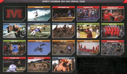
Marine Corps Special Issue Semper Fit Sports Calendar 2011-2012

The second wall calendar is even more surprising and very inspiring as well to those who are resolved to living a healthier lifestyle through fitness.

Issued by Marines Magazine, the Marine Corps’ Official Magazine, this colorful 17-month Sports Calendar (August 2011 – December 2012) recognizes some of the outstanding athlete “leathernecks” who participate in the Marine Corps’ “Semper Fit” sports, recreation and fitness program worldwide.  (“Semper Fit” is a nod to the Marine Corps motto of “Semper Fi” short for “Semper Fidelis” which is Latin for “Always Faithful” or “Always Loyal”).

One Marine base describes the Semper Fit program:

The mission at Semper Fit is to conduct, encourage and inspire the quality of life programs for that promote Healthy Lifestyles through recreation, athletics, physical fitness, the Single Marine Program and other health and wellness activities for Marine Corps active and retired members, their families and civilian workers.

The photographs on this calendar depict everything from individual sports such as the famous Marine Corps Marathon held annually in Washington, DC, and aerial motorcycle tricks…


Calendar Images: (Left) Start of the Marine Corps Marathon in Washington, DC. (Right) Motorbike aerialist and member of the “Metal Mulisha Troops” Marine stunt team.

…to intramural and varsity sports like baseball, basketball, wrestling, tug-of-war, the Dragon Boat Race, and the Warrior Games.


Calendar Images: (Left) Tug-of-war competition at Camp Leatherneck, Afghanistan. (Right) All-Marine team of active duty and veteran “wounded warriors” at opening ceremony of the all Armed Forces Warrior Games.

Many of the athletes included are recognized globally for their athletic ability, and others are Marines who stay at the top of their game no matter their age or disability, maintaining the extremely high physical fitness standards of the Corps.

The calendar also includes Federal holidays and key dates of significance to the Corps.

The Father of Semper Fit retires

Ironically, last month after nearly 36 years of service as a Marine officer and a civilian whose final role was as Quantico’s head of recreation, Chris D’Orazio, the founder of the Semper Fit program retired.

Image: Col. Dan Choike, base commander, presents Chris D’Orazio, head of recreation, a challenge coin during D’Orazio’s retirement ceremony in the Main Ballroom at the Clubs of Quantico on Dec. 5, 2011. Source: Quantico Sentry newspaper

In an interview for the Quantico Sentry, D’Orazio explained how the Semper Fit program concept came to him back in 1985, D’Orazio when he read an article about the low life expectancy of retired Marines, whether officer or enlisted:

 “Marines, especially back then, played hard, worked hard, drank hard and smoked hard,” said D’Orazio. “I looked out the window and saw a young Marine put out a cigarette, finish a can of beer, then walk back inside the building.”

“I look down and thought to myself, based on this article, this guy’s going to live less than five years after he retires,” D’Orazio said. “After a career and everything they’ve worked for, they are probably going to die that soon; that’s terrible. That was pretty much the genesis of the word ‘Semper Fit.’”

In addition to the “Semper Fit” program for USMC, D’Orazio started the “Getting Stronger, Now” fitness program for the state of Maryland, both of which were pilot fitness programs under the President’s Council on Physical Fitness and Sports.

This 2012 Semper Fit calendar is a fitting tribute to a man who dedicated his life to, well, fitness!

And the photos are pretty inspiring to hang on anyone’s wall, too!

Calendar Image: Marines compete in the 37th annual Naha Dragon Boat Race in Naha, Japan.

How do I get this Marine Corps 2012 Semper Fit Sports calendar?

  • Buy it online 24/7 at GPO’s Online Bookstore.
  • Buy it at GPO’s retail bookstore at 710 North Capitol Street NW, Washington, DC 20401, open Monday-Friday, 9am to 4pm, except Federal holidays, (202) 512-0132.

So whether you aspire to find more beauty in the world around you or to be the best you can be, the Government is here to help you out!
Resolve to have a safe and happy 2012, America!


The Civil War: 150 Years Later

May 9, 2011

Guest blogger Kim Dutch remembers the bloodiest conflict in American history.

This year is the 150th anniversary, or the Sesquicentennial (which I’m still having trouble pronouncing!), of the Civil War.  In that spirit, there are very few topics which bind us more than wars that were fought that eventually made our nation greater.  I was fortunate enough to grow up with a war history buff in the family and was particularly fascinated by the Civil War.  It amazed me how brothers fought brothers, families were divided, and that each side had such fierce loyalties.  Men and women sacrificed with no further thought or gain than “This is my duty and my honor to serve” – and sacrifices were made by all sides. 

The Civil War at a Glance” tells the story in a poignant and entertaining series of break downs.  The brochure is organized yearly using maps and chronologies.  It begins with the Eastern Theater in 1861, when Northerners called it the War of the Rebellion and the Southerners deemed it the War Between the States.  Regardless, it resulted in “pitting two vast sections of a young and vigorous nation against each other.”  For the next four years, the Union forces would struggle to get to Richmond, the Confederate capital.  Most of that fight would take place between Washington and Richmond – there’s even a breakdown by State and number of battles thought to have been fought in each.  The author lays out the path the rest of the war took in the Western Theater, too, until the end in 1865. Along the way the battles and campaigns are summarized succinctly and are easy to follow so you can get a great sense of what occurred.   It concisely explains how some battles were pivotal, the paths and strategies used to win (or fail), and the men who led them.

The author quotes Mark Twain, who said the war had “uprooted institutions that were centuries old … transformed the social life of half the country, and wrought so profoundly upon the entire national character that the influence cannot be measured short of two or three generations.”  I’d like to think that those factors since have been transformed us into a greater nation with better rights and civil liberties for all.

You can find a plain text version at http://www.pueblo.gsa.gov/cic_text/misc/civilwar/civilwar.htm.  But what REALLY stood out was a colorful and user friendly online site, http://www.nationalatlas.gov/articles/history/a_civilwar.html, which has a wealth of information.  It has an interactive feature that allows you to create maps based on State boundaries and links throughout the site for more information about people, dates, and places. 

If you want your own personal copy, you can order it here.If you would like printed copies in packages, visit the GPO Online Bookstore. The folder makes for a handy and quick reference resource for individuals and schools and other groups.  Also, it’s easy to bring along if you’re actually visiting the areas and want to have the information and timelines on hand.

There’s no shortage of information on the Civil War out there, but it’s nice to have it summarized for those of us who may have forgotten some of our history lessons…not me, of course!

 For more celebrating and commemorating: The National Park Service has an Internet page dedicated to the Civil War’s 150th anniversary, http://www.nps.gov/civilwar150, where you can find further publications, activities, and parks – it even has a site where you can search for individual soldiers.  GPO has also put together a special sale of Civil War publications in its Special Collections section, http://bookstore.gpo.gov/collections/civilwar.jsp, to honor the occasion.  I think you can never have enough recommendations and amazing stories about this war!


Planning a Vacation? How About a Place Less Frequented?

April 15, 2011

Guest blogger Tina Perantonakis likes to check out lesser-known national parks – and some of them are free!

Growing up as a native Washingtonian, my knowledge of our national parks was limited to the sites in and surrounding the National Mall, such as the Lincoln Memorial and the Jefferson Memorial. As I started traveling more throughout the United States, I had the opportunity to visit some of the most popular national parks, including Yellowstone, Redwood, and Golden Gate, but I gained the most pleasure in discovering and exploring those that are lesser known. Most recently, I visited Mesa Verde National Park in Colorado.  Mesa Verde houses arguably the most impressive cliff dwellings of the Ancestral Pueblo people. 
 
To commemorate National Park Week, which is April 16-24, 2011, I am highlighting a book published by the National Park Service: The National Parks: Index 2009-2011. This book has become indispensable in my travel planning, as it contains listings of National Park System areas by state, in addition to National Heritage Areas, National Wild and Scenic Rivers System, and the National Trails System. Although the Index is not intended to be a guidebook, nor does it contain standard guidebook information such as visiting hours, trails, and campground locations, it does provide the administrative addresses and brief descriptions of the sites – and these descriptions often include interesting facts.  Did you know that there is a national park in American Samoa devoted to protecting tropical rainforests, coral reefs, and fruit bats?  I certainly did not – until I read the entry in the National Parks Index.

This year, the National Park Service will be offering several fee-free days at more than 100 parks that usually charge an entrance fee.  I plan to take advantage of the fee-free days by visiting several Civil War historical sites, including Antietam National Battlefield  in Maryland and Appomattox Court House National Historical Park inVirginia.

For more information on National Parks Week, visit here. To take advantage of the National Park Service free entrance days, visit here.  To purchase a copy of The National Parks: Index 2009-2011, visit here.  You can also find it in a library.


A Civil War Battle of the Books and the Battle for Washington DC

March 18, 2011

For the third year in a row, GPO is doing its own version of the NCAA basketball playoffs. This year’s theme, appropriately enough, given that GPO opened for business shortly before Confederate forces fired on Fort Sumter, is the Civil War. Since I’m a minor Civil War buff myself, I’ve blogged about several of the “competitors,” including Clara Barton: Clara Barton National Historic Site, Battle of Ball’s Bluff and, just a week or so ago, Abraham Lincoln’s Journey to Greatness.

A couple of the books in this year’s tournament are National Park Service Cultural Resources Studies, which are detailed assessments of a particular park’s history, cultural landscape, and historical materials. Monocacy National Battlefield: Cultural Resources Study is meaningful to me because I’ve visited that Maryland park a number of times over the years, beginning when it first opened to the public. As a GPO employee, references to Jubal Early’s 1864 raid, which actually penetrated as far as Fort Stevens in Northwest Washington, DC, remind me that GPO employees actually were mustered into service for a day or two to help defend the city. If Early’s force had arrived a day earlier, it could have been a disaster for the Union, but the hastily assembled force at Monocacy commanded by General Lew Wallace provided just enough delay to ensure the safety of the capital. Wallace, who was criticized, not altogether fairly, for his generalship at Shiloh in 1862, was credited by General Grant for blocking Early at Monocacy. Later, Wallace had the last laugh by writing what is arguably one of the bestselling novels of his century – Ben Hur. To add to his fame, during his post-war career as governor of the New Mexico Territory, Wallace met Billy the Kid, which ensured his regular appearance in movies and TV westerns – giving him a great deal more fame than many more successful Civil War generals.

Monocacy is also a beautiful park, with a walking trail near the Monocacy River and a neat little visitor’s center. Now that spring is on the way, I’m ready to walk those trails again. You can read more about the park itself here, browse the cultural resources study here, or get your own copy via GPO. The study is also available in libraries.

Above all, don’t forget to vote for your favorites at the Civil War Super 16 Tournament. After 150 years, it’s time for a rematch!


Lincoln on the Threshold of Greatness

March 9, 2011

As I mentioned in my last post, the Government Printing Office celebrated its 150th birthday last Friday. Around here, we like to say that there were really two inaugurations on March 4, 1861 – President Lincoln’s and ours. Lincoln is also, as far as we know, the only sitting President ever to have visited GPO. Coincidentally, given these connections, a new book from the National Park Service (NPS) just hit my desk: Abraham Lincoln’s Journey to Greatness. Our 16th President is also special to the NPS. According to the introductory copy, it manages five National Park sites solely dedicated to Lincoln, four more with strong Lincoln connections, like Mount Rushmore, and a total of 47 “that include Lincoln and the Civil war stories as primary interpretive themes.” If you add in sites that deal in some way with slavery and Civil Rights stories, the total jumps to 75 – almost a quarter of all NPS sites!

I must say, though, that I wasn’t sure what to expect when I opened this handsome little volume. After all, hasn’t every Lincoln angle been covered by now? I should have paid more attention to the title. After a brief account of the Lincoln-Douglas debates and the election of 1860, the bulk of the book is an account of President-elect Lincoln’s train trip from Springfield, Illinois to Washington, DC – a literal “journey to greatness.”

In addition to brief descriptions of his welcomes to various cities along the way, the book includes quotations, such as numerous comments on his determination to preserve the Union and cogent remarks on immigration to the German Industrial Association of Cincinnati, Ohio. It also features classic vignettes from his trip, including his salute to Grace Bedell of Westfield, New York who, in a letter to candidate Lincoln, had suggested he grow a beard (“The President left the car, and the crowd making way for him, he reached her, and gave her several hearty kisses, and amid the yells of delight from the excited crowd, he bade her good-bye.”) My favorite of these, because it’s a reminder of the slyly humorous man sometimes overshadowed by the solemn national icon, is his appearance at the Leaman Place, Pennsylvania: “Loud calls being made for Mrs. Lincoln, Mr. L. brought her out, and said he had concluded to give them ‘the long and short of it!’ This remark – with the disparity between the length of himself and wife – produced a loud burst of laughter, followed by enthusiastic cheers as the train moved off.” 

Abraham Lincoln’s Journey to Greatness is a great way to look at Lincoln the man and the statesman as he began what still remains the most trying period in the history of the Republic. When I finished it, I was ready to rally round the flag! You can find a copy of this new book here or find it in a library.


Russia, America, and the Lands of the Bering Strait

January 21, 2011

Sometimes a Government publication is a window into a program that you never dreamed existed. Before opening my copy of Early Art of the Northern Far East: the Stone Age, I had never heard of the National Park Service’s Shared Beringian Heritage Program. It’s not a new program, either: according to the program’s Web site, it was “created in 1991, [and] resulted from a commitment by Presidents George H.W. Bush and Mikhail Gorbachev to expand United States and Soviet cooperation in the field of environmental protection and the study of global change.”

Now perhaps some of you are thinking, “Hold on there, Government Book Talk, what the heck is Beringia?” Thanks to that same Web site, I can state with confidence that “Beringia is defined as the land and maritime area bounded on the west by the Lena River in Russia; on the east by the Mackenzie River in Canada’s British Columbia; on the north by 72 degrees north latitude in the Chukchi Sea; and on the south by the tip of the Kamchatka Peninsula.” This joint Russo-American geographic and cultural unit possesses unique natural resources and is the home of Native peoples with much in common. The program conducts research on the prehistoric Bering land bridge as well as the natural and human history of its animal and human inhabitants, informs the public about these discoveries, and translates Russian-language publications about the region.

Early Art of the Northern Far East is one of those translated works. I must admit that it’s really for specialists only – very much in the mode of such venerable series as Smithsonian Contributions to Anthropology – but it is intriguing to see the variety of animal and celestial images that were sculpted or incised by Beringia’s earliest peoples. If you have a serious interest in cultural anthropology or prehistoric art, this is a valuable contribution to the study of  both. You can browse through it here, get your own copy here, or find it in a library.


Striking Photos from the DC Area’s National Parks

November 24, 2010

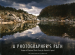
For some reason, picture books keep on popping up here at Government Book Talk. Just the other day I blogged about a Marine Corps book of photos taken in Afghanistan. Today, it’s the National Park Service (NPS), with a splendid collection of photographs taken throughout the NPS National Capital Region. A Photographer’s Path: Images of National Parks Near the Nation’s Capital is a winning collection of images highlighting nature and history in the Greater Washington DC area.

The photos, all taken by Tom Paradis of NPS, highlight the beautiful (a royal red cardinal flower with ascending blooms of scarlet, shot in DC’s own Rock Creek Park), the bizarre (a leopard/tiger-patterned stalk of the grimly named American cancer-root, taken along the George Washington Memorial Parkway), and even the glitzy (neon lights illuminating the restored amusement park arcade façade at Maryland’s Glen Echo Park). As a longtime parks visitor and Old Dominion resident, I particularly enjoyed the photos of Dyke Marsh, a wetlands paradise within shouting distance of Alexandria, Virginia. There’s a really cool shot of a verdigrised cannon at Manassas National Battlefield Park, and this park also is represented among the nature photos.

Because the photographs are really the raison d’etre of this book, text is minimal, but Megan Nortrup of NPS has done a nice job of using a minimum of words to evoke the maximum mystique of each image. A Photographer’s Path is really an extraordinarily attractive publication and a testimony both to the talents of Government employees and the marvels of America’s National Parks, even in so urbanized an area as this one. You can get a copy of this brand new book here.


Summer Travels

July 7, 2010

Government publications are more than just books. Guest blogger Kelly Seifert reminds us that maps and guides can be just as engrossing, especially at this time of year.

If you’re planning on doing some travel around the country this summer, you can start your planning with the National Parks System Map and Guide. It features a map of the United States, including Guam, Puerto Rico, and the Virgin Islands, showing the locations of parks, historic sites, and other properties operated by the National Park Service. On the reverse side, an alphabetical list of each National Park System property describes its activities, services, and facilities. If you’re planning on exploring any of the 391 destinations of the National Parks Service this summer, this is an essential take along. You can also easily access this publication by visiting your local Federal depository library. Locate a library in your area here.

To make your trip complete, check out these other great publications as well: 1) the National Trails System: Map and Guide, which includes descriptions of national historic and scenic trails, and 2) the National Wildlife Refuge System: A Visitor’s Guide, which contains a map showing national wildlife refuges that provide recreational and educational opportunities. The Visitor’s Guide also provides tips for visiting national wildlife refuges and lists refuges in all 50 States, Puerto Rico and the Virgin Islands, along with the best wildlife viewing season and the features of each refuge.

Why leave the country for a little R&R when there are so many national treasures right on your doorstep? Happy Travels!


Follow

Get every new post delivered to your Inbox.

Join 1,941 other followers