Water Resources of Arkansas

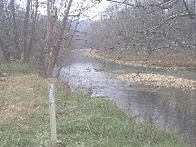
City of Hot Springs - Flood Warning Information System


Link to USGS Home Page Link to City of Hot Springs Pages Link to National Weather Service
U.S. Geological Survey City of Hot Springs National Weather Service

Normal Water Level Normal Level High Water Level High Water Level Flood Action Level Flood Action Level Rain Gage Rain Gage


NumberSiteSite Name Water Data Reports
1 343045093054901 Music Mtn nr Blacksnake Rd at Hot Springs, AR
2 343114930420001 South Slope of Sugarloaf Mtn at Hot Springs, AR
3 07358250 Whittington Cr at Whitt. Pk at Hot Springs, AR 2009
4 07358253 Whittington Cr at Tunnel Ent at Hot Springs, AR 2009
5 07358257 Hot Springs Cr US of T.E. at Glade St at Hot Sp.,AR 2009
6 07358284 Hot Springs Cr DS of Grand Ave at Hot Springs, AR 2009

View All Sites

ADDITIONAL SITES IN CITY OF HOT SPRING AREA
Streamflow
07358550
Gulpha Creek at Hot Springs National Park Service Logo
National Park Service
Precipitation
07358280
Hot Springs at Hot Springs, AR

References to non-Department of the Interior (DOI) products do not constitute an endorsement by the DOI. By viewing the Google Maps API on this web site the user agrees to these TERMS.

For questions about webpage or gaging station information contact webmaster.
For questions about facilities or recreational activities contact National Park Service

USGS Home Water Climate and Land Use Change Core Science Ecosystems Energy & Environmental Health Hazards

Accessibility FOIA Privacy Policies and Notices

Take Pride in America home page. FirstGov button U.S. Department of the Interior | U.S. Geological Survey
URL: http://ar.water.usgs.gov/hotsprings/index.html
Page Contact Information: GS-W-AR_Webmaster@usgs.gov
Page Last Modified: Wednesday, 09-Jan-2013 17:31:52 EST btj