Skip to Content
HomeAbout this siteHelpSearch this site The Library of Congress
America's Story from America's LibraryMeet Amazing AmericansJump Back in TimeExplore the StatesJoin America at PlaySee, Hear and Sing
Explore the States Maryland
 
map graphic and images of Maryland

Enlarge this image
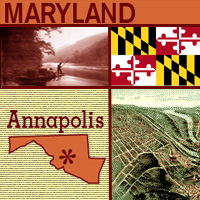
One of the original 13 states to join the Union (in 1788), Maryland is in the middle of the Eastern Seaboard. It's believed that Lord Baltimore, who received a charter for the land in 1632, named the state after Queen Henrietta Maria, wife of King Charles I. The Mason and Dixon line was drawn in the 1760s to settle a dispute between the Penn and Calvert families. In addition to marking the boundary between Pennsylvania and Maryland, it is the traditional boundary between the North and the South. Maryland is known as the "Free State"; its flower is the black-eyed susan; and its capital is Annapolis, home of the U.S. Naval Academy.
More Stories

Choose another State

More Stories About Maryland
Maryland
A Champion Shucker
"St. Mary's Oyster Festival"
A Fair to Remember!
"Montgomery County Agricultural Center / Fair"
A Life of Achievement
"Benjamin Banneker Historical Park & Museum"
Chestertown Tea Party
"Chestertown Tea Party Festival"
How About a Jimmy?
"Cracking Crabs in Maryland"
Take a Walk with a Ghost
"The Carroll County Ghost Walk"
We Don't Need a Car!
"Historic Takoma Park and Takoma Park Elementary School"


Library Of Congress | Legal Notices | Privacy | Site Map | Contact Us