Map
A map of the state of Tennessee taken from survey /

| Format |
Map |
|---|---|
| Contributors |
Rhea, Matthew |
| Dates |
1832 |
| Location |
Tennessee |
| Language |
English |
| Subjects |
Tennessee |
- Title
- A map of the state of Tennessee taken from survey /
- Description
-
Relief shown by hachures.
-
"Entered according to Act of Congress in the year 1832 by Matthew Rhea, in the Clerks Office of the District of West Tennessee."
-
"Sold by H.S Tanner, Philadelphia, Eichbaum & Norvell, Nashville, and S.D. Jacobs, Knoxville."
-
LC Trails, 180
-
Available also through the Library of Congress Web site as a raster image.
-
Includes statistical and chronological tables, "View of Nashville", and "Geological section of the State of Tennessee."
-
Distinguishing line symbols are shown for "Important Roads" and "Common Roads." The legend also includes state and county lines, Indian boundary lines, old forts, and Indian villages.
-
1 map : col., laminated, mounted on cloth backing ; 88 x 174 cm.
- Creator
- Rhea, Matthew,
- Created Published
-
Columbia, Tenn. : Matthew Rhea, 1832.
- Subject Headings
-
-
Tennessee
-
-
Tennessee.
- Notes
-
-
Relief shown by hachures.
-
-
"Entered according to Act of Congress in the year 1832 by Matthew Rhea, in the Clerks Office of the District of West Tennessee."
-
-
"Sold by H.S Tanner, Philadelphia, Eichbaum & Norvell, Nashville, and S.D. Jacobs, Knoxville."
-
-
LC Trails, 180
-
-
Available also through the Library of Congress Web site as a raster image.
-
-
Includes statistical and chronological tables, "View of Nashville", and "Geological section of the State of Tennessee."
-
-
Distinguishing line symbols are shown for "Important Roads" and "Common Roads." The legend also includes state and county lines, Indian boundary lines, old forts, and Indian villages.
- Medium
-
1 map : col., laminated, mounted on cloth backing ; 88 x 174 cm.
- Call Number
-
G3960 1832 .R4
- Repository
-
Library of Congress Geography and Map Division Washington, D.C. 20540-4650 USA dcu
- Digital Id
-
g3960 tr000180 http://hdl.loc.gov/loc.gmd/g3960.tr000180
- Library of Congress Catalog Number
- 2011588000
Rights & Access
The maps in the Map Collections materials were either published prior to 1922, produced by the United States government, or both (see catalogue records that accompany each map for information regarding date of publication and source). The Library of Congress is providing access to these materials for educational and research purposes and is not aware of any U.S. copyright protection (see Title 17 of the United States Code) or any other restrictions in the Map Collection materials.
Note that the written permission of the copyright owners and/or other rights holders (such as publicity and/or privacy rights) is required for distribution, reproduction, or other use of protected items beyond that allowed by fair use or other statutory exemptions. Responsibility for making an independent legal assessment of an item and securing any necessary permissions ultimately rests with persons desiring to use the item.
More about Copyright and other Restrictions
For guidance about compiling full citations consult Citing Primary Sources.
Part of...
-
Cultural Landscapes
[1623]
-
Geography And Maps Division
[60803]
-
American Memory
[1120991]
More maps like this
-
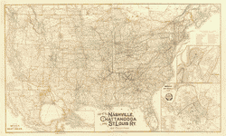 Map of the Nashville, Chattanooga and St. Louis Ry.; and connections.
Contributor:
Danley, W. L.
Site:
American Memory-cultural, Main Catalog
Original Format:
Map
Date:
1889
View catalog record
Map of the Nashville, Chattanooga and St. Louis Ry.; and connections.
Contributor:
Danley, W. L.
Site:
American Memory-cultural, Main Catalog
Original Format:
Map
Date:
1889
View catalog record
-
 A preliminary agricultural map of Tennessee based on the distribution of geological formations.
Contributor:
University of Tennessee, Knoxville. Agricultural Experiment Station
Site:
American Memory-cultural, Main Catalog
Original Format:
Map
Date:
1896
View catalog record
A preliminary agricultural map of Tennessee based on the distribution of geological formations.
Contributor:
University of Tennessee, Knoxville. Agricultural Experiment Station
Site:
American Memory-cultural, Main Catalog
Original Format:
Map
Date:
1896
View catalog record
-
 The state of Tennessee.
Site:
American Memory-cultural, Main Catalog
Original Format:
Map
View catalog record
The state of Tennessee.
Site:
American Memory-cultural, Main Catalog
Original Format:
Map
View catalog record
-
 Aboriginal map of Tennessee /
Site:
American Memory-cultural, Main Catalog
Original Format:
Map
Date:
1886
View catalog record
Aboriginal map of Tennessee /
Site:
American Memory-cultural, Main Catalog
Original Format:
Map
Date:
1886
View catalog record
-
 Tennessee.
Contributor:
Lucas, Fielding
Site:
American Memory-cultural, Main Catalog
Original Format:
Map
Date:
1826
View catalog record
Tennessee.
Contributor:
Lucas, Fielding
Site:
American Memory-cultural, Main Catalog
Original Format:
Map
Date:
1826
View catalog record
-
 Topographical sketch of the country adjacent to the turnpike between Nolensville and Chapel Hill, Tenn. /
Contributor:
Weyss, J. E.
Site:
American Memory-cultural, Main Catalog
Original Format:
Map
Date:
1863
View catalog record
Topographical sketch of the country adjacent to the turnpike between Nolensville and Chapel Hill, Tenn. /
Contributor:
Weyss, J. E.
Site:
American Memory-cultural, Main Catalog
Original Format:
Map
Date:
1863
View catalog record
-
 An outline geological map of Tennessee, including portions of Mississippi, Alabama, and Georgia.
Contributor:
Saylor, Nelson
Site:
American Memory-cultural, Main Catalog
Original Format:
Map
Date:
1866
View catalog record
An outline geological map of Tennessee, including portions of Mississippi, Alabama, and Georgia.
Contributor:
Saylor, Nelson
Site:
American Memory-cultural, Main Catalog
Original Format:
Map
Date:
1866
View catalog record
-
 Lloyd's official map of the State of Tennessee
Contributor:
Lloyd, James T.
Site:
American Memory-cultural, Main Catalog
Original Format:
Map
Date:
1862
View catalog record
Lloyd's official map of the State of Tennessee
Contributor:
Lloyd, James T.
Site:
American Memory-cultural, Main Catalog
Original Format:
Map
Date:
1862
View catalog record
-
 State of Tennessee, roadless and undeveloped area evaluation II, RARE II final environmental statement : January 1979 /
Contributor:
United States. Forest Service. Southern Region
Site:
American Memory-cultural, Main Catalog
Original Format:
Map
Date:
1979
View catalog record
State of Tennessee, roadless and undeveloped area evaluation II, RARE II final environmental statement : January 1979 /
Contributor:
United States. Forest Service. Southern Region
Site:
American Memory-cultural, Main Catalog
Original Format:
Map
Date:
1979
View catalog record
-
 Military map of middle Tennessee and parts of East Tennessee and the adjoining states, being part of the Department of the Cumberland, commanded by Maj. ...
Contributor:
Mergell, C. S.
Site:
American Memory-cultural, Main Catalog
Original Format:
Map
Date:
1874
View catalog record
Military map of middle Tennessee and parts of East Tennessee and the adjoining states, being part of the Department of the Cumberland, commanded by Maj. ...
Contributor:
Mergell, C. S.
Site:
American Memory-cultural, Main Catalog
Original Format:
Map
Date:
1874
View catalog record
-
 Battle of Missionary Ridge or Chickamauga, Tenn.
Contributor:
Sneden, Robert Knox
Site:
American Memory-cultural
Original Format:
Map
Date:
1861
Battle of Missionary Ridge or Chickamauga, Tenn.
Contributor:
Sneden, Robert Knox
Site:
American Memory-cultural
Original Format:
Map
Date:
1861
-
 New enlarged scale railroad and county map of Tennessee showing every railroad station and post office in the state, 1888.
Contributor:
Rand McNally and Company
Site:
American Memory-cultural, Main Catalog
Original Format:
Map
Date:
1888
View catalog record
New enlarged scale railroad and county map of Tennessee showing every railroad station and post office in the state, 1888.
Contributor:
Rand McNally and Company
Site:
American Memory-cultural, Main Catalog
Original Format:
Map
Date:
1888
View catalog record
-
 Lloyd's official map of the State of Tennessee
Contributor:
Lloyd, James T.
Site:
American Memory-cultural, Main Catalog
Original Format:
Map
Date:
1863
View catalog record
Lloyd's official map of the State of Tennessee
Contributor:
Lloyd, James T.
Site:
American Memory-cultural, Main Catalog
Original Format:
Map
Date:
1863
View catalog record
-
 Map of Rutherford County, Tenn. : from actual surveys /
Contributor:
D.G. Beers & Co
Site:
American Memory-cultural, Main Catalog
Original Format:
Map
Date:
1878
View catalog record
Map of Rutherford County, Tenn. : from actual surveys /
Contributor:
D.G. Beers & Co
Site:
American Memory-cultural, Main Catalog
Original Format:
Map
Date:
1878
View catalog record
-
 Mountain region of North Carolina and Tennessee.
Contributor:
Nicholson, W. L.
Site:
American Memory-cultural, Main Catalog
Original Format:
Map
Date:
1864
View catalog record
Mountain region of North Carolina and Tennessee.
Contributor:
Nicholson, W. L.
Site:
American Memory-cultural, Main Catalog
Original Format:
Map
Date:
1864
View catalog record
-
 Military map of the States of Kentucky and Tennessee, within eleven miles of the 35th parallel of latitude or southern boundary of Tennessee; compiled from ...
Contributor:
Swann, Charles E.
Site:
American Memory-cultural, Main Catalog
Original Format:
Map
Date:
1863
View catalog record
Military map of the States of Kentucky and Tennessee, within eleven miles of the 35th parallel of latitude or southern boundary of Tennessee; compiled from ...
Contributor:
Swann, Charles E.
Site:
American Memory-cultural, Main Catalog
Original Format:
Map
Date:
1863
View catalog record
You might also like
-

 The backward trail; stories of the Indians and Tennessee pioneers,
Contributor:
Hale, William Thomas
Site:
Main Catalog
Original Format:
Book
Date:
1899
The backward trail; stories of the Indians and Tennessee pioneers,
Contributor:
Hale, William Thomas
Site:
Main Catalog
Original Format:
Book
Date:
1899
-
Tennessee: its agricultural & mineral wealth, with an appendix, showing the extent, value and accessibility of its ores, with analyses of the same.
Contributor:
Tennessee. Bureau of agriculture, statistics and mines
Site:
Main Catalog
Original Format:
Book
Date:
1876
-
The government of the people of the state of Tennessee /
Contributor:
Karns, T. C.
Site:
Main Catalog
Original Format:
Book
Date:
1896
-
A history of Tennessee from 1663 to 1911, for use in schools,
Contributor:
McGee, Gentry Richard
Site:
Main Catalog
Original Format:
Book
Date:
1911
-
Speech of Hon. George S. Boutwell ... on the admission of Tennessee;
Contributor:
Boutwell, George S.
Site:
Main Catalog
Original Format:
Book
Date:
1866
-
Life of Jefferson Dillard Goodpasture;
Contributor:
Goodpasture, Albert Virgil
Site:
Main Catalog
Original Format:
Book
Date:
1897