
![Plano. I descripcion de la costa, desde el Cavo Cañaveral, hasta cerca de la boca de la Vir[g]inia, contando, costa de Florida, Georgia y Carolinas del S, y N, con todos sus puertos, este[ros ... ]letas, baxos, islas y rios; segun las vlti[mas not]icias, hata [sic] oy Octubre de 1756.](https://cybercemetery.unt.edu/archive/oilspill/20121109133413im_/http://www.loc.gov/collections/static/american-revolutionary-war-maps/images/ct000339.jpg)
![[Coast of Maine from Frenchmans Bay to Mosquito Harbor].](https://cybercemetery.unt.edu/archive/oilspill/20121109133413im_/http://www.loc.gov/collections/static/american-revolutionary-war-maps/images/np000011.jpg)
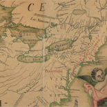
![Carte particulière d'une partie de la Louisianne ou les fleuve et rivierres [i.e. rivières] onts etés relevé a l'estime & les routtes [i.e. routes] par terre relevé & mesurées aux pas, par les Srs. Broutin, de Vergés, ingénieurs & Saucier dessinateur](https://cybercemetery.unt.edu/archive/oilspill/20121109133413im_/http://www.loc.gov/collections/static/louisiana-european-explorations-and-the-louisiana-purchase/images/ct000681.jpg)
![[Detailed map of part of Virginia from Alexandria to the Potomac River above Washington, D.C. 1886].](https://cybercemetery.unt.edu/archive/oilspill/20121109133413im_/http://www.loc.gov/collections/static/civil-war-maps/images/cw0523000.jpg)


![Plan général du Fort Septentrional du Detour des Anglois, tel qu'il est présentement : [Louisiana]](https://cybercemetery.unt.edu/archive/oilspill/20121109133413im_/http://www.loc.gov/collections/static/louisiana-european-explorations-and-the-louisiana-purchase/images/lh000949.jpg)
![[Map of cavalry engagement near Bridgewater, Va. Oct. 4th and 5th, 1864]](https://cybercemetery.unt.edu/archive/oilspill/20121109133413im_/http://www.loc.gov/collections/static/hotchkiss-maps/images/cwh00193.jpg)
![[Map of parts of Caroline, Hanover, and Henrico counties, Va. west of the Mattaponi River and the Richmond, Fredericksburg, and Potomac Railroad].](https://cybercemetery.unt.edu/archive/oilspill/20121109133413im_/http://www.loc.gov/collections/static/hotchkiss-maps/images/cwh00025.jpg)
![[Base map of Pennsylvania].](https://cybercemetery.unt.edu/archive/oilspill/20121109133413im_/http://www.loc.gov/collections/static/hotchkiss-maps/images/cwh00207.jpg)
![Boston its environs and harbour, with the rebels works raised against that town in 1775... Sir Thomas Hyde Page, [1775?].](https://cybercemetery.unt.edu/archive/oilspill/20121109133413im_/http://www.loc.gov/collections/static/american-revolutionary-war-maps/images/ct000070.jpg)
Results
-

This plan of the city of Baltimore
Scale ca. 1:7,300.
Contributor: Poppleton, Thomas H. Site: American Memory-cultural - Main Catalog Original Format: Map Date: 1822 View catalog record -

Henderson County.
Mark of ownership stamp: Established in 1873, J.S. Daugherty, owner and dealer in Texas municipal 6 to 10% bonds. Texas Pacific land grant bonds, farming, grazing and pine lands, in tracts to ...
Site: American Memory-cultural - Main Catalog Original Format: Map Date: 1870 View catalog record -

Wyld's military map of the United States, the northern states, and the southern confederate states: with the forts, harbours, arsenals, and military positions.
Scale ca. 1:4,600,000.
Contributor: Wyld, James Site: American Memory-cultural - Main Catalog Original Format: Map Date: 1861 View catalog record -

Battle of Pittsburg Landing or Shiloh April 6th and 7th 1862.
Color coding indicates the location of Union and Confederate forces.
Contributor: Sneden, Robert Knox Site: American Memory-cultural Original Format: Map Date: 1861 -

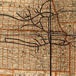
Cram's township and rail road map of New York.
Scale ca. 1:1,000,000.
Contributor: Cram, George Franklin Site: American Memory-cultural - Main Catalog Original Format: Map Date: 1888 View catalog record -

Map of Somerset County, New Jersey /
Relief shown by hachures.
Contributor: Otley, J. W. Site: American Memory-cultural - Main Catalog Original Format: Map Date: 1850 View catalog record -

Indian territory: compiled from the official records of the records of the General Land Office and other sources under supervision of Geo. U. Mayo.
From the papers of President Benjamin Harrison. DLC
Site: American Memory-cultural - Main Catalog Original Format: Map Date: 1887 View catalog record -

Battery on Turner's rocks : [Georgia].
Shows a part of the defenses of Savannah.
Site: American Memory-cultural - Main Catalog Original Format: Map Date: 1864 View catalog record -

Map of Essex Co., New York /
Relief shown by hachures.
Contributor: French, J. H. Site: American Memory-cultural - Main Catalog Original Format: Map Date: 1858 View catalog record -

Map of part of Virginia, Maryland and Delaware from the best authorities
Scale ca. 1:400,000.
Contributor: Heyne, Charles Site: American Memory-cultural - Main Catalog Original Format: Map Date: 1861 View catalog record -

View of Seymour, Conn. 1879.
Perspective map not drawn to scale.
Contributor: O.H. Bailey & Co Site: American Memory-cultural - Main Catalog Original Format: Map Date: 1879 View catalog record -

Palestine, or, the Holy Land ; Persia, Afghanistan and Beluchistan.
Relief shown in hachures.
Contributor: Rand McNally and Company Site: American Memory-cultural - Main Catalog Original Format: Map Date: 1885 View catalog record -

Map showing position of Union and Rebel armies and Jackson's flank march during 2nd Battle of Bull Run, Aug. 28th to 31st, 1862.
Color coding indicates the location of Union and Confederate forces.
Contributor: Sneden, Robert Knox Site: American Memory-cultural Original Format: Map Date: 1862 -

Sketch of the coast of North Carolina from Oregon Inlet to Ocracoke Inlet.
Scale 1:200,000.
Contributor: United States Coast Survey Site: American Memory-cultural - Main Catalog Original Format: Map Date: 1861 View catalog record -

Map of Caledonia County, Vermont /
33 inset maps, views, tables, etc.
Contributor: Walling, Henry Francis Site: American Memory-cultural - Main Catalog Original Format: Map Date: 1858 View catalog record -

Map of rail road surveys from Worcester to Baldwinville & N.H. line.
Scale ca. 1:180,000.
Contributor: Bouvé, Elisha W. - Bouvé, Elisha W. Site: American Memory-cultural - Main Catalog Original Format: Map Date: 1845 View catalog record -

Egypt, Arabia Petræa, Abyssinia, &c.
Inset: Suez Canal, scale [1:3.500,000]
Contributor: Bartholomew, J. G. Site: American Memory-cultural - Main Catalog Original Format: Map Date: 1885 View catalog record -

From the valley of the Mud Lakes to the Pacific Ocean.
Scale 1:760,320.
Contributor: Egloffstein, F. W. Site: American Memory-cultural - Main Catalog Original Format: Map Date: 1859 View catalog record -

Map of Washington County, Texas.
Shows land ownership.
Contributor: Texas. General Land Office Site: American Memory-cultural - Main Catalog Original Format: Map Date: 1879 View catalog record -

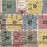
Sanborn Fire Insurance Map from Austin, Travis County, Texas.
15 Sheet(s). Jul 1889.
Site: American Memory-cultural Original Format: Map Date: 1889-01-01
Refine your search
Original Format
- Map
- Web Page [17]