
![[January 15, 1945], HQ Twelfth Army Group situation map.](https://cybercemetery.unt.edu/archive/oilspill/20121109155154im_/http://www.loc.gov/collections/static/world-war-II-maps-military-situation-maps-from-1944-to-1945/images/ict21225.jpg)
![[Base map of Pennsylvania].](https://cybercemetery.unt.edu/archive/oilspill/20121109155154im_/http://www.loc.gov/collections/static/hotchkiss-maps/images/cwh00207.jpg)


![[Detailed map of part of Virginia from Alexandria to the Potomac River above Washington, D.C. 1886].](https://cybercemetery.unt.edu/archive/oilspill/20121109155154im_/http://www.loc.gov/collections/static/civil-war-maps/images/cw0523000.jpg)

![[Base map of Alabama].](https://cybercemetery.unt.edu/archive/oilspill/20121109155154im_/http://www.loc.gov/collections/static/hotchkiss-maps/images/cwh00201.jpg)


![[December 21, 1944], HQ Twelfth Army Group situation map.](https://cybercemetery.unt.edu/archive/oilspill/20121109155154im_/http://www.loc.gov/collections/static/world-war-II-maps-military-situation-maps-from-1944-to-1945/images/ict21200.jpg)


Results
-

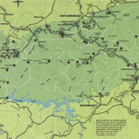
Henderson County.
Mark of ownership stamp: Established in 1873, J.S. Daugherty, owner and dealer in Texas municipal 6 to 10% bonds. Texas Pacific land grant bonds, farming, grazing and pine lands, in tracts to ...
Site: American Memory-cultural - Main Catalog Original Format: Map Date: 1870 View catalog record -

Map of Washington County, Texas.
Shows land ownership.
Contributor: Texas. General Land Office Site: American Memory-cultural - Main Catalog Original Format: Map Date: 1879 View catalog record -

Sanborn Fire Insurance Map from Austin, Travis County, Texas.
15 Sheet(s). Jul 1889.
Site: American Memory-cultural Original Format: Map Date: 1889-01-01 -

Travis Co. /
Shows land ownership.
Contributor: Pressler, Herman Site: American Memory-cultural - Main Catalog Original Format: Map Date: 1914 View catalog record -

Map of Brazos Co., Texas
Shows land ownership.
Contributor: Texas. General Land Office Site: American Memory-cultural - Main Catalog Original Format: Map Date: 1879 View catalog record -

Sanborn Fire Insurance Map from Athens, Henderson County, Texas.
1 Sheet(s). Jun 1885.
Site: American Memory-cultural Original Format: Map Date: 1885-01-01 -

Sunset, Montague Co., Texas, 1890.
Perspective map not drawn to scale.
Contributor: Fowler, T. M. Site: American Memory-cultural - Main Catalog Original Format: Map Date: 1890 View catalog record -

Sanborn Fire Insurance Map from Bartlett, Bell and Williamson Counties, Texas.
6 Sheet(s). May 1912.
Site: American Memory-cultural Original Format: Map Date: 1912-01-01 -

Map of Tyler County.
Shows land ownership.
Contributor: Texas. General Land Office Site: American Memory-cultural - Main Catalog Original Format: Map Date: 1898 View catalog record -

Marion County, Texas /
Shows landownership.
Contributor: Texas. General Land Office Site: American Memory-cultural - Main Catalog Original Format: Map Date: 1879 View catalog record -

Map of Schleicher County /
Shows land ownership.
Contributor: Rowe, S. J. Site: American Memory-cultural Original Format: Map Date: 1898 -

Blanco County
Available also through the Library of Congress Web site as a raster image.
Site: American Memory-cultural Original Format: Map -


Digital atlas of the upper Washita River Basin, southwestern Oklahoma Catalog Record - Electronic Resource Available
System requirements: PC with DVD reader, and Windows 2000 or XP, or Macintosh OS9.0.4, 9.1, 9.2, or OS X with 128 MB RAM, or most Unix/Linux systems, all with software to handle ...
Contributor: Becker, Carol J. Site: Main Catalog Original Format: Map Date: 2008 -

Sketch of Texas with the boundaries of Mexican States as shown on General Austin's map of Texas published by R. S. Tanner, 1839.
Manuscript.
Contributor: Gilman, E. Site: American Memory-cultural - Main Catalog Original Format: Map Date: 1839 View catalog record -

Palo Pinto County
Available also through the Library of Congress Web site as a raster image.
Site: American Memory-cultural - Main Catalog Original Format: Map View catalog record -

Fannin Co. /
Blueprint
Contributor: Pressler, Chas. W. Site: American Memory-cultural - Main Catalog Original Format: Map Date: 1901 View catalog record -

Motley Co. /
Shows landownership.
Contributor: Texas. General Land Office Site: American Memory-cultural - Main Catalog Original Format: Map Date: 1893 View catalog record -

Guadalupe Co., Texas.
Shows land ownership.
Contributor: Texas. General Land Office Site: American Memory-cultural - Main Catalog Original Format: Map Date: 1880 View catalog record -

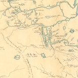
From the Red River to the Rio Grande
Scale 1:950,400.
Contributor: Pope, John Site: American Memory-cultural - Main Catalog Original Format: Map Date: 1859 View catalog record -

Angelina County, Texas.
Shows land ownership.
Contributor: Texas. General Land Office Site: American Memory-cultural - Main Catalog Original Format: Map Date: 1879 View catalog record