North American Atlas Data Download
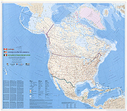 A map of North America was made at 1:10,000,000-scale using a set of basic map information provided by national atlas programs in Canada, Mexico, and the United States. This set of data is available from nationalatlas.gov. This North American Atlas Data and map are also available from the Commission for Environmental Cooperation in Montreal, Quebec.
Follow this link for information about downloading North American Atlas data.
