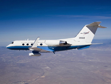
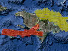
NASA radar imaging flights over Central America, Haiti and the Dominican Republic are in the second week of a three-week campaign.
Latest from NASA on Haiti
Radar Studies Continue in Hispaniola
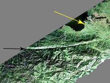
NASA Radar Captures its First Haiti Image
NASA has released imagery from its first airborne radar flights over Hispaniola. 3-D images created from such data after future flights will aid in quake studies.
NASA Airborne Radar Studies Haiti Earthquake Faults
NASA has added a series of overflights of quake faults in Haiti and the Dominican Republic to a previously scheduled three-week airborne radar campaign to Central America.
More from NASA on Haiti
-

Space Station Views of Haiti
Views of Haiti seen from the International Space Station
-

Ships Arriving in Port-au-Prince, Haiti
Ships carrying relief supplies and aid stream into Port-au-Prince, Haiti, in this image taken by the Advanced Spaceborne Thermal Emission and Reflection Radiometer (ASTER) on NASA’s Terra satellite on January 21, 2010.
-

New Haiti Quake Reported
A magnitude 6.1 aftershock struck Haiti today, Jan. 20, west of last week’s magnitude 7.0 earthquake. The extent of the damage is not yet known.
How to Help
Administrator Bolden
-

Message From the Administrator on the Tragedy in Haiti and How Employees Can Help
NASA joins the President, the nation, and the entire world in mourning those who have perished.


