Map
Sketch of sea coast of South Carolina and Georgia from Bull's Bay to Ossabaw Sound /

| Format |
Map |
|---|---|
| Contributors |
Lindenkohl, A. |
| Dates |
1863 |
| Location |
Georgia South Carolina United States |
| Language |
English |
| Subjects |
Civil War Coasts Georgia History South Carolina United States |
- Title
- Sketch of sea coast of South Carolina and Georgia from Bull's Bay to Ossabaw Sound /
- Description
-
Scale 1:200,000.
-
Sectioned and mounted on cloth backing.
-
Hand colored.
-
Oriented with north toward the upper right.
-
LC Civil War maps (2nd ed.) 363
-
From the papers of Joseph Roswell Hawley.
-
LC copy annotated in ink in cover.
-
Available also through the Library of Congress Web site as a raster image.
-
Includes list of "References" to Civil War engagements.
-
1 map : col. ; 41 x 96 cm. fold. in cover 22 x 13 cm.
- Creator
- Lindenkohl, A.
- Created Published
-
[Washington] : U.S. Coast Survey, 1863.
- Subject Headings
-
-
Coasts--South Carolina
-
-
Coasts--Georgia
-
-
South Carolina--History--Civil War, 1861-1865
-
-
Georgia--History--Civil War, 1861-1865
-
-
United States--South Carolina.
-
-
United States--Georgia.
- Notes
-
-
Scale 1:200,000.
-
-
Sectioned and mounted on cloth backing.
-
-
Hand colored.
-
-
Oriented with north toward the upper right.
-
-
LC Civil War maps (2nd ed.) 363
-
-
From the papers of Joseph Roswell Hawley.
-
-
LC copy annotated in ink in cover.
-
-
Available also through the Library of Congress Web site as a raster image.
-
-
Includes list of "References" to Civil War engagements.
- Medium
-
1 map : col. ; 41 x 96 cm. fold. in cover 22 x 13 cm.
- Call Number
-
G3912.C6S5 1863 .L5
- Repository
-
Library of Congress Geography and Map Division Washington, D.C. 20540-4650 USA dcu
- Digital Id
-
g3912c cw0363000 http://hdl.loc.gov/loc.gmd/g3912c.cw0363000
- Library of Congress Catalog Number
- 79695239
Rights & Access
The maps in the Map Collections materials were either published prior to 1922, produced by the United States government, or both (see catalogue records that accompany each map for information regarding date of publication and source). The Library of Congress is providing access to these materials for educational and research purposes and is not aware of any U.S. copyright protection (see Title 17 of the United States Code) or any other restrictions in the Map Collection materials.
Note that the written permission of the copyright owners and/or other rights holders (such as publicity and/or privacy rights) is required for distribution, reproduction, or other use of protected items beyond that allowed by fair use or other statutory exemptions. Responsibility for making an independent legal assessment of an item and securing any necessary permissions ultimately rests with persons desiring to use the item.
More about Copyright and other Restrictions
For guidance about compiling full citations consult Citing Primary Sources.
Part of...
-
Civil War Maps
[2281]
-
Military Battles And Campaigns Cartographic Items
[3867]
-
Geography And Maps Division
[60803]
-
American Memory
[1121009]
More maps like this
-
 Sketch of sea coast of South Carolina and Georgia from Bull's Bay to Ossabaw Sound /
Contributor:
Lindenkohl, A.
Site:
American Memory-cultural, Main Catalog
Original Format:
Map
Date:
1863
View catalog record
Sketch of sea coast of South Carolina and Georgia from Bull's Bay to Ossabaw Sound /
Contributor:
Lindenkohl, A.
Site:
American Memory-cultural, Main Catalog
Original Format:
Map
Date:
1863
View catalog record
-
 [Sketch of portions of seacoast of South Carolina & Georgia
Contributor:
Lindenkohl, A.
Site:
American Memory-cultural, Main Catalog
Original Format:
Map
Date:
1863
View catalog record
[Sketch of portions of seacoast of South Carolina & Georgia
Contributor:
Lindenkohl, A.
Site:
American Memory-cultural, Main Catalog
Original Format:
Map
Date:
1863
View catalog record
-
 [Map of the environs of Savannah, Georgia. 186-]
Contributor:
Lindenkohl, A.
Site:
American Memory-cultural, Main Catalog
Original Format:
Map
Date:
1861
View catalog record
[Map of the environs of Savannah, Georgia. 186-]
Contributor:
Lindenkohl, A.
Site:
American Memory-cultural, Main Catalog
Original Format:
Map
Date:
1861
View catalog record
-
 Sketch of portions of seacoast of South Carolina & Georgia
Contributor:
Lindenkohl, A.
Site:
American Memory-cultural, Main Catalog
Original Format:
Map
Date:
1862
View catalog record
Sketch of portions of seacoast of South Carolina & Georgia
Contributor:
Lindenkohl, A.
Site:
American Memory-cultural, Main Catalog
Original Format:
Map
Date:
1862
View catalog record
-
 Sketch of sea coast of South Carolina and Georgia from Bull's Bay to Ossabaw Sound /
Contributor:
Lindenkohl, A.
Site:
American Memory-cultural, Main Catalog
Original Format:
Map
Date:
1863
View catalog record
Sketch of sea coast of South Carolina and Georgia from Bull's Bay to Ossabaw Sound /
Contributor:
Lindenkohl, A.
Site:
American Memory-cultural, Main Catalog
Original Format:
Map
Date:
1863
View catalog record
-
 Sketch of portions of seacoast of South Carolina & Georgia /
Contributor:
Lindenkohl, A.
Site:
American Memory-cultural, Main Catalog
Original Format:
Map
Date:
1862
View catalog record
Sketch of portions of seacoast of South Carolina & Georgia /
Contributor:
Lindenkohl, A.
Site:
American Memory-cultural, Main Catalog
Original Format:
Map
Date:
1862
View catalog record
-
 North Carolina & South Carolina
Contributor:
Lindenkohl, A.
Site:
American Memory-cultural, Main Catalog
Original Format:
Map
Date:
1865
View catalog record
North Carolina & South Carolina
Contributor:
Lindenkohl, A.
Site:
American Memory-cultural, Main Catalog
Original Format:
Map
Date:
1865
View catalog record
-
 Sketch of the Atlantic coast of the United States from Savannah River to St. Mary's River, embracing the coast of the State of Georgia
Contributor:
Lindenkohl, A.
Site:
American Memory-cultural, Main Catalog
Original Format:
Map
Date:
1861
View catalog record
Sketch of the Atlantic coast of the United States from Savannah River to St. Mary's River, embracing the coast of the State of Georgia
Contributor:
Lindenkohl, A.
Site:
American Memory-cultural, Main Catalog
Original Format:
Map
Date:
1861
View catalog record
-
 [Northern Georgia and western and central South Carolina].
Contributor:
Lindenkohl, A.
Site:
American Memory-cultural, Main Catalog
Original Format:
Map
Date:
1865
View catalog record
[Northern Georgia and western and central South Carolina].
Contributor:
Lindenkohl, A.
Site:
American Memory-cultural, Main Catalog
Original Format:
Map
Date:
1865
View catalog record
-
 [Northern Georgia and western and central South Carolina]
Contributor:
Lindenkohl, A.
Site:
American Memory-cultural, Main Catalog
Original Format:
Map
Date:
1865
View catalog record
[Northern Georgia and western and central South Carolina]
Contributor:
Lindenkohl, A.
Site:
American Memory-cultural, Main Catalog
Original Format:
Map
Date:
1865
View catalog record
-
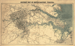 Military map of south-eastern Virginia,
Contributor:
Lindenkohl, A.
Site:
American Memory-cultural, Main Catalog
Original Format:
Map
Date:
1864
View catalog record
Military map of south-eastern Virginia,
Contributor:
Lindenkohl, A.
Site:
American Memory-cultural, Main Catalog
Original Format:
Map
Date:
1864
View catalog record
-
 Military map of south-eastern Virginia
Contributor:
Lindenkohl, A.
Site:
American Memory-cultural, Main Catalog
Original Format:
Map
Date:
1864
View catalog record
Military map of south-eastern Virginia
Contributor:
Lindenkohl, A.
Site:
American Memory-cultural, Main Catalog
Original Format:
Map
Date:
1864
View catalog record
-
 Military map of south-eastern Virginia,
Contributor:
Lindenkohl, A.
Site:
American Memory-cultural, Main Catalog
Original Format:
Map
Date:
1864
View catalog record
Military map of south-eastern Virginia,
Contributor:
Lindenkohl, A.
Site:
American Memory-cultural, Main Catalog
Original Format:
Map
Date:
1864
View catalog record
-
 Coast of North Carolina & Virginia
Contributor:
Lindenkohl, A.
Site:
American Memory-cultural, Main Catalog
Original Format:
Map
Date:
1863
View catalog record
Coast of North Carolina & Virginia
Contributor:
Lindenkohl, A.
Site:
American Memory-cultural, Main Catalog
Original Format:
Map
Date:
1863
View catalog record
You might also like
-
 The Siege of Savannah in December, 1864, and the Confederate operations in Georgia and the third military district of South Carolina during General Sherman's march ...
Contributor:
Jones, Charles Colcock
Site:
American Memory-cultural
Original Format:
Book
Date:
1875
The Siege of Savannah in December, 1864, and the Confederate operations in Georgia and the third military district of South Carolina during General Sherman's march ...
Contributor:
Jones, Charles Colcock
Site:
American Memory-cultural
Original Format:
Book
Date:
1875
-
 Battery schottisch
Contributor:
Bechter, Hermann, Composer
Site:
Performing Arts Encyclopedia
Original Format:
Music Score
Date:
1863
Battery schottisch
Contributor:
Bechter, Hermann, Composer
Site:
Performing Arts Encyclopedia
Original Format:
Music Score
Date:
1863
-
 Old plantation days; being recollections of southern life before the civil war,
Contributor:
De Saussure, N. B.
Site:
Main Catalog
Original Format:
Book
Date:
1909
Old plantation days; being recollections of southern life before the civil war,
Contributor:
De Saussure, N. B.
Site:
Main Catalog
Original Format:
Book
Date:
1909
-
 My southern home
Contributor:
Huff, Mayme C. H., Composer
Site:
Performing Arts Encyclopedia
Original Format:
Music Score
Date:
1904
My southern home
Contributor:
Huff, Mayme C. H., Composer
Site:
Performing Arts Encyclopedia
Original Format:
Music Score
Date:
1904
-
 Henry Jackson Hunt papers, 1841-1978
Contributor:
Hunt, Henry Jackson
Site:
Finding Aids, Main Catalog
Original Format:
Manuscript
View catalog record
Henry Jackson Hunt papers, 1841-1978
Contributor:
Hunt, Henry Jackson
Site:
Finding Aids, Main Catalog
Original Format:
Manuscript
View catalog record
-
The mountain campaigns in Georgia.
Contributor:
[Brown, Joseph M.]
Site:
Main Catalog
Original Format:
Book
Date:
1886