

![Plan général du Fort Septentrional du Detour des Anglois, tel qu'il est présentement : [Louisiana]](https://cybercemetery.unt.edu/archive/oilspill/20121205163956im_/http://www.loc.gov/collections/static/louisiana-european-explorations-and-the-louisiana-purchase/images/lh000949.jpg)


![[January 1, 1945], HQ Twelfth Army Group situation map.](https://cybercemetery.unt.edu/archive/oilspill/20121205163956im_/http://www.loc.gov/collections/static/world-war-II-maps-military-situation-maps-from-1944-to-1945/images/ict21211.jpg)


![[December 25, 1944], HQ Twelfth Army Group situation map.](https://cybercemetery.unt.edu/archive/oilspill/20121205163956im_/http://www.loc.gov/collections/static/world-war-II-maps-military-situation-maps-from-1944-to-1945/images/ict21204.jpg)

![[January 3, 1945], HQ Twelfth Army Group situation map.](https://cybercemetery.unt.edu/archive/oilspill/20121205163956im_/http://www.loc.gov/collections/static/world-war-II-maps-military-situation-maps-from-1944-to-1945/images/ict21213.jpg)
![Boston its environs and harbour, with the rebels works raised against that town in 1775... Sir Thomas Hyde Page, [1775?].](https://cybercemetery.unt.edu/archive/oilspill/20121205163956im_/http://www.loc.gov/collections/static/american-revolutionary-war-maps/images/ct000070.jpg)
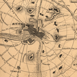
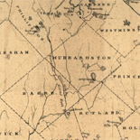
![[Map of parts of Caroline, Hanover, and Henrico counties, Va. west of the Mattaponi River and the Richmond, Fredericksburg, and Potomac Railroad].](https://cybercemetery.unt.edu/archive/oilspill/20121205163956im_/http://www.loc.gov/collections/static/hotchkiss-maps/images/cwh00025.jpg)
Results
Refined by:
Original Format: Map-

Maps showing the Boston Hoosac Tunnel and Western Railway with its eastern and western connections.
Scale 1:1,267,200.
Contributor: G.W. & C.B. Colton & Co Site: American Memory-cultural - Main Catalog Original Format: Map Date: 1881 View catalog record -

Congressional districts of the 110th Congress of the United States of America /
Includes coverage map and 19 ancillary maps detailing congressional districts in select urban areas.
Contributor: Mason, Virginia W. Site: American Memory-cultural - Main Catalog Original Format: Map Date: 2006 View catalog record -

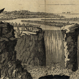
Dordracvm ; Briela.
Perspective map not drawn to scale.
Contributor: Merian, Matthaeus Site: American Memory-cultural - Main Catalog Original Format: Map Date: 1646 View catalog record -

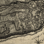
Notes sur les environs de York: Plan donné par des arpenteurs du pays.
Scale ca. 1:44,000.
Site: American Memory-cultural - Main Catalog Original Format: Map Date: 1781 View catalog record -

[Marshall Islands stick chart, Mattang type].
Title and date supplied by cataloger.
Site: American Memory-cultural - Main Catalog Original Format: Map View catalog record -

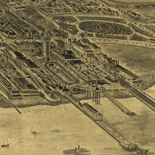
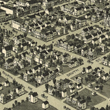
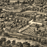
Fonda, N.Y. /
Bird's-eye view.
Contributor: Burleigh, L. R. Site: American Memory-cultural - Main Catalog Original Format: Map Date: 1889 View catalog record -

Sanborn Fire Insurance Map from Chickasha, Grady County, Oklahoma.
2 Sheet(s). Apr 1894.
Site: American Memory-cultural Original Format: Map Date: 1894-01-01 -


Geologic map of the Yucca Mountain region, Nye County, Nevada / Catalog Record - Electronic Resource Available
Relief shown by contours.
Contributor: Geological Survey (U.S.) Site: Main Catalog Original Format: Map Date: 2002 -

Map showing the new transcontinental route of the Atlantic & Pacific Railroad and its connections.
Scale ca. 1:3,800,000.
Contributor: G.W. & C.B. Colton & Co Site: American Memory-cultural - Main Catalog Original Format: Map Date: 1883 View catalog record -

Physical map of the world, April 2007.
"803307AI (R00349) 4-07."
Contributor: United States. Central Intelligence Agency Site: American Memory-cultural - Main Catalog Original Format: Map Date: 2007 View catalog record -
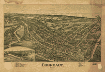
Conneaut, Ohio 1896 /
Perspective map not drawn to scale.
Contributor: Fowler, T. M. Site: American Memory-cultural - Main Catalog Original Format: Map Date: 1896 View catalog record -

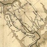
Proposed line of rail roads and hotels.
Available also through the Library of Congress Web site as a raster image.
Site: American Memory-cultural - Main Catalog Original Format: Map View catalog record -

Scott's map of the city of Baltimore. From latest records and actual surveys by
Scale ca. 1:7,200.
Contributor: Martenet, Simon J. Site: American Memory-cultural - Main Catalog Original Format: Map Date: 1856 View catalog record -

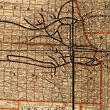
Standard atlas of Audubon County, Iowa : including a plat book of the villages, cities and townships of the county, map of the state, United ...
Available also through the Library of Congress Web site as a raster image.
Contributor: Geo. A. Ogle & Co Site: American Memory-cultural - Main Catalog Original Format: Map Date: 1900 View catalog record -

Bahrain.
"Base 802944 (B01254) 12-02."
Contributor: United States. Central Intelligence Agency Site: American Memory-cultural - Main Catalog Original Format: Map Date: 2002 View catalog record -

Plan of a fort opposite Paducah, Ky.
Shows the environs of the proposed fort in Massac County, Illinois.
Site: American Memory-cultural - Main Catalog Original Format: Map Date: 1864 View catalog record -

Poland--LOT air routes to non-communist countries : March 1977.
Shows LOT airways originating in Warsaw and terminating mostly in Europe; does not show airways to communist-bloc countries.
Contributor: United States. Central Intelligence Agency Site: American Memory-cultural - Main Catalog Original Format: Map Date: 1977 View catalog record -

Sketch of the states of Massachusetts, Connecticut, and Rhode Island, and parts of New Hampshire & New York exhibiting the several rail road routes completed, ...
Scale [ca. 1:700,000].
Contributor: Kennedy, Archibald Site: American Memory-cultural - Main Catalog Original Format: Map Date: 1846 View catalog record -

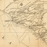
Macon, Geo. 1864.
Shows defenses at Macon, Georgia.
Site: American Memory-cultural - Main Catalog Original Format: Map Date: 1864 View catalog record -

Second battle of Bull Run. Position of troops at sunset, Aug. 29, 1862.
Scale ca. 1:62,000.
Contributor: Wells, Jacob Site: American Memory-cultural - Main Catalog Original Format: Map Date: 1886 View catalog record