![[December 18, 1944], HQ Twelfth Army Group situation map.](https://cybercemetery.unt.edu/archive/oilspill/20121207202629im_/http://www.loc.gov/collections/static/world-war-II-maps-military-situation-maps-from-1944-to-1945/images/ict21197.jpg)
![[December 23, 1944], HQ Twelfth Army Group situation map.](https://cybercemetery.unt.edu/archive/oilspill/20121207202629im_/http://www.loc.gov/collections/static/world-war-II-maps-military-situation-maps-from-1944-to-1945/images/ict21202.jpg)
![Map of the Rappahannock River from [sic] Port Royal to Richards Ferry](https://cybercemetery.unt.edu/archive/oilspill/20121207202629im_/http://www.loc.gov/collections/static/civil-war-maps/images/cw0619600.jpg)
![[Sketch of the battles of Chancellorsville, Salem Church, and Fredericksburg], May 2, 3, and 4, 1863](https://cybercemetery.unt.edu/archive/oilspill/20121207202629im_/http://www.loc.gov/collections/static/civil-war-maps/images/cwh00129.jpg)


![Plano. I descripcion de la costa, desde el Cavo Cañaveral, hasta cerca de la boca de la Vir[g]inia, contando, costa de Florida, Georgia y Carolinas del S, y N, con todos sus puertos, este[ros ... ]letas, baxos, islas y rios; segun las vlti[mas not]icias, hata [sic] oy Octubre de 1756.](https://cybercemetery.unt.edu/archive/oilspill/20121207202629im_/http://www.loc.gov/collections/static/american-revolutionary-war-maps/images/ct000339.jpg)
![[Coast of Maine from Frenchmans Bay to Mosquito Harbor].](https://cybercemetery.unt.edu/archive/oilspill/20121207202629im_/http://www.loc.gov/collections/static/american-revolutionary-war-maps/images/np000011.jpg)
![[Rough sketch of the Rich Mountain battle area extending from Beverly, W. Va. to Clarksburg].](https://cybercemetery.unt.edu/archive/oilspill/20121207202629im_/http://www.loc.gov/collections/static/hotchkiss-maps/images/cwh00078.jpg)
![[Base map of Pennsylvania].](https://cybercemetery.unt.edu/archive/oilspill/20121207202629im_/http://www.loc.gov/collections/static/hotchkiss-maps/images/cwh00207.jpg)
![[December 16, 1944], HQ Twelfth Army Group situation map.](https://cybercemetery.unt.edu/archive/oilspill/20121207202629im_/http://www.loc.gov/collections/static/world-war-II-maps-military-situation-maps-from-1944-to-1945/images/ict21195.jpg)
![[Detailed map of part of Virginia from Alexandria to the Potomac River above Washington, D.C. 1886].](https://cybercemetery.unt.edu/archive/oilspill/20121207202629im_/http://www.loc.gov/collections/static/civil-war-maps/images/cw0523000.jpg)
![[January 1, 1945], HQ Twelfth Army Group situation map.](https://cybercemetery.unt.edu/archive/oilspill/20121207202629im_/http://www.loc.gov/collections/static/world-war-II-maps-military-situation-maps-from-1944-to-1945/images/ict21211.jpg)
Results
-

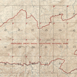
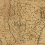
Map of Liberty Co., Texas.
Shows land ownership.
Contributor: Texas. General Land Office Site: American Memory-cultural - Main Catalog Original Format: Map Date: 1879 View catalog record -

Sterling Co.
Shows land ownership.
Contributor: Texas. General Land Office Site: American Memory-cultural Original Format: Map Date: 1892 -

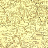
Map of Callahan Co. /
LC Land ownership maps, 917
Contributor: Texas. General Land Office Site: American Memory-cultural - Main Catalog Original Format: Map Date: 1879 View catalog record -

Sanborn Fire Insurance Map from Bastrop, Bastrop County, Texas.
2 Sheet(s). Apr 1896.
Site: American Memory-cultural Original Format: Map Date: 1896-01-01 -

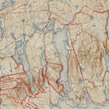
Map of Grimes Co., Texas.
Shows land ownership.
Contributor: Texas. General Land Office Site: American Memory-cultural - Main Catalog Original Format: Map Date: 1880 View catalog record -

Cottle Co.
Shows land ownership.
Contributor: Texas. General Land Office Site: American Memory-cultural - Main Catalog Original Format: Map Date: 1891 View catalog record -

Map of Bexar County /
"Compiled and drawn, from the Records of Surveys in Bexar County, sketches from General Land Office and sketches and memoranda of the present County Surveyor."
Contributor: Rullmann, John D. Site: American Memory-cultural - Main Catalog Original Format: Map Date: 1887 View catalog record -

Palo Pinto County, Texas /
In upper right margin: Our unsold lands of the Texas & Pacific Railway Company are colored yellow.
Contributor: Texas & Pacific Railway. Land Dept Site: American Memory-cultural - Main Catalog Original Format: Map View catalog record -

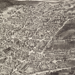
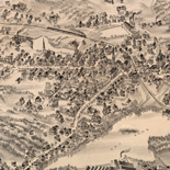
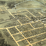
Aeroplane view of business district Amarillo, Texas.
Perspective map not drawn to scale.
Contributor: Motter, E. E. Site: American Memory-cultural - Main Catalog Original Format: Map Date: 1912 View catalog record -

Gillespie County /
Shows landownership.
Contributor: Texas. General Land Office Site: American Memory-cultural - Main Catalog Original Format: Map Date: 1918 View catalog record -

Sanborn Fire Insurance Map from Anson, Jones County, Texas.
5 Sheet(s). Jun 1922.
Site: American Memory-cultural Original Format: Map Date: 1922-01-01 -

Sanborn Fire Insurance Map from Amarillo, Potter County, Texas.
5 Sheet(s). Feb 1902.
Site: American Memory-cultural Original Format: Map Date: 1902-01-01 -

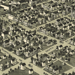
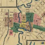
Waco, Texas 1892.
Perspective map not drawn to scale.
Contributor: Westyard, A. L. Site: American Memory-cultural - Main Catalog Original Format: Map Date: 1892 View catalog record -

Glasscock County, state of Texas.
Shows land ownership.
Contributor: Texas. General Land Office Site: American Memory-cultural - Main Catalog Original Format: Map Date: 1889 View catalog record -

Sanborn Fire Insurance Map from Big Spring, Howard County, Texas.
2 Sheet(s). Aug 1900.
Site: American Memory-cultural Original Format: Map Date: 1900-01-01 -

Map of Tom Green County.
LC Land ownership maps, 1145
Site: American Memory-cultural - Main Catalog Original Format: Map View catalog record -

Smith County.
Shows land ownership.
Contributor: Texas. General Land Office Site: American Memory-cultural Original Format: Map Date: 1880 -

Map of portions of Eastland, Brown and Comanche Counties : showing the lands of the Texas and Pacific R'y Co. in yellow color /
Shows landownership.
Contributor: Stakemann, M. Site: American Memory-cultural - Main Catalog Original Format: Map View catalog record -

Map of San Patricio County /
Shows land ownership.
Contributor: Texas. General Land Office Site: American Memory-cultural - Main Catalog Original Format: Map Date: 1896 View catalog record -

Map of Jack County, Texas /
LC Land ownership maps, 1020
Contributor: Texas. General Land Office Site: American Memory-cultural - Main Catalog Original Format: Map Date: 1879 View catalog record