![[Detailed map of part of Virginia from Alexandria to the Potomac River above Washington, D.C. 1886].](https://cybercemetery.unt.edu/archive/oilspill/20121207201537im_/http://www.loc.gov/collections/static/civil-war-maps/images/cw0523000.jpg)
![[Plan of Fort Henry and its outworks.]](https://cybercemetery.unt.edu/archive/oilspill/20121207201537im_/http://www.loc.gov/collections/static/civil-war-maps/images/cw0414000.jpg)
![[December 23, 1944], HQ Twelfth Army Group situation map.](https://cybercemetery.unt.edu/archive/oilspill/20121207201537im_/http://www.loc.gov/collections/static/world-war-II-maps-military-situation-maps-from-1944-to-1945/images/ict21202.jpg)
![[Map of Chancellorsville battlefield, May 3-4, 1863].](https://cybercemetery.unt.edu/archive/oilspill/20121207201537im_/http://www.loc.gov/collections/static/hotchkiss-maps/images/cwh00138.jpg)

![[Rough sketch of the Rich Mountain battle area extending from Beverly, W. Va. to Clarksburg].](https://cybercemetery.unt.edu/archive/oilspill/20121207201537im_/http://www.loc.gov/collections/static/hotchkiss-maps/images/cwh00078.jpg)
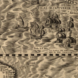
![Carte particulière d'une partie de la Louisianne ou les fleuve et rivierres [i.e. rivières] onts etés relevé a l'estime & les routtes [i.e. routes] par terre relevé & mesurées aux pas, par les Srs. Broutin, de Vergés, ingénieurs & Saucier dessinateur](https://cybercemetery.unt.edu/archive/oilspill/20121207201537im_/http://www.loc.gov/collections/static/louisiana-european-explorations-and-the-louisiana-purchase/images/ct000681.jpg)

![[January 15, 1945], HQ Twelfth Army Group situation map.](https://cybercemetery.unt.edu/archive/oilspill/20121207201537im_/http://www.loc.gov/collections/static/world-war-II-maps-military-situation-maps-from-1944-to-1945/images/ict21225.jpg)

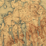
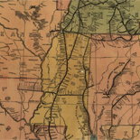
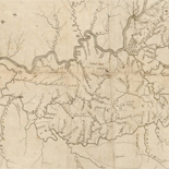
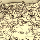
Results
-

Map of Harrisburg City, Dauphin Co. Pa. /
City street map showing ward boundaries, ward names, and principal buildings.
Contributor: Boyd, G. M. Site: American Memory-cultural - Main Catalog Original Format: Map Date: 1900 View catalog record -

Minersville, Pennsylvania, 1889.
Perspective map not drawn to scale.
Contributor: Fowler, T. M. Site: American Memory-cultural - Main Catalog Original Format: Map Date: 1889 View catalog record -

A map of Schuylkill County, Penna. /
General-content map showing townships, railroads, buildings in rural areas, and householders' names in rural areas.
Contributor: Sheafer, P. W. Site: American Memory-cultural Original Format: Map Date: 1855 -

Chambersburg, Pennsylvania, burned by rebel cavalry July 30th 1864.
Perspective map not drawn to scale.
Contributor: Fowler, T. M. Site: American Memory-cultural - Main Catalog Original Format: Map Date: 1894 View catalog record -

Souderton, Montgomery County, Pennsylvania 1894.
Perspective map not drawn to scale.
Contributor: Fowler, T. M. Site: American Memory-cultural - Main Catalog Original Format: Map Date: 1894 View catalog record -

Edinboro, Pa. 1898.
Perspective map not drawn to scale.
Contributor: O'Brien, John J. Site: American Memory-cultural - Main Catalog Original Format: Map Date: 1898 View catalog record -

Map of Schuylkill County, Pennsylvania.
LC Land ownership maps, 793
Site: American Memory-cultural Original Format: Map -

Map of a route through south west Pennsylvania from Fort Loundoun, Franklin Co. to Fort Pitt, Pittsburgh.
Scale 1:380,160; 6 miles to an in.
Site: American Memory-cultural - Main Catalog Original Format: Map Date: 1763 View catalog record -

Strasburg, Lancaster Co., Pa. 1903 /
Perspective map not drawn to scale.
Contributor: Fowler, T. M. Site: American Memory-cultural - Main Catalog Original Format: Map Date: 1903 View catalog record -

Gettysburg and vicinity, showing the lines of battle July, 1863, and the land purchased and dedicated to the public by General S. Wylie Crawford and ...
Scale 1:15,840.
Contributor: Gettysburg Battlefield Memorial Association Site: American Memory-cultural - Main Catalog Original Format: Map Date: 1863 View catalog record -

Bird's eye view of the city of Corry, Erie County, Pennsylvania 1870.
Perspective map not drawn to scale.
Contributor: Ruger, A. Site: American Memory-cultural - Main Catalog Original Format: Map Date: 1870 View catalog record -

British camp at Trudruffrin from the 18th. to the 21st. of September 1777, with the attack made by Major General Grey against the rebels near ...
Scale ca. 1:31,680.
Site: American Memory-cultural - Main Catalog Original Format: Map Date: 1778 View catalog record -

South Fork, Cambria County, Pennsylvania 1900.
Perspective map not drawn to scale.
Contributor: Fowler, T. M. Site: American Memory-cultural - Main Catalog Original Format: Map Date: 1900 View catalog record -

Dunmore, Pennsylvania /
Bird's-eye-view.
Contributor: Fowler, T. M. Site: American Memory-cultural - Main Catalog Original Format: Map Date: 1892 View catalog record -

Topographical map of Sullivan Co., Pennsylvania.
LC Land ownership maps, 798
Site: American Memory-cultural Original Format: Map -

Map of a part of the east cavalry field showing positions of division and brigade markers and batteries
Scale 1:7200.
Contributor: Gettysburg National Military Park Commission Site: American Memory-cultural - Main Catalog Original Format: Map Date: 1910 View catalog record -

Great Bend, Penn. 1887.
Perspective map not drawn to scale.
Contributor: Burleigh, L. R. Site: American Memory-cultural - Main Catalog Original Format: Map Date: 1887 View catalog record -

Dedicated to the city of Philadelphia through the directors of the Pennsylvania Railroad Company; plan no. 2. exhibits the streets with the present railroads removed; ...
Scale ca. 1:40,000.
Contributor: Hoxsie, S. K. Site: American Memory-cultural - Main Catalog Original Format: Map Date: 1858 View catalog record -

Map of the battle field of Gettysburg, July 1st, 2nd, 3rd 1863 /
"The map is reduced from one on a scale of 200 feet to the inch, deposited in the Archives of the office of the Chief of Engineers. The survey was ordered by ...
Contributor: Bachelder, John B. Site: American Memory-cultural Original Format: Map Date: 1959 -

[The course of Delaware River from Philadelphia to Chester, exhibiting the several works erected by the rebels to defend its passage, with the attacks made ...
Scale ca. 1:32,400.
Contributor: Faden, William Site: American Memory-cultural Original Format: Map Date: 1777
Refine your search
Original Format
- Map