
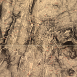
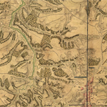
![[Map of cavalry engagement near Bridgewater, Va. Oct. 4th and 5th, 1864]](https://cybercemetery.unt.edu/archive/oilspill/20120921145122im_/http://www.loc.gov/collections/static/hotchkiss-maps/images/cwh00193.jpg)
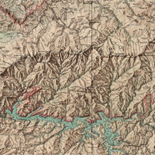

![[Sketch of the Manassas battlefield].](https://cybercemetery.unt.edu/archive/oilspill/20120921145122im_/http://www.loc.gov/collections/static/hotchkiss-maps/images/cwh00108.jpg)
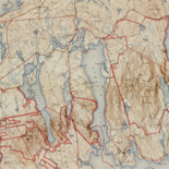
![[Base map of Pennsylvania].](https://cybercemetery.unt.edu/archive/oilspill/20120921145122im_/http://www.loc.gov/collections/static/hotchkiss-maps/images/cwh00207.jpg)

Results
-


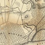
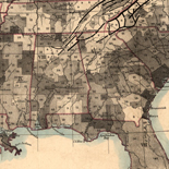
Map of Sonoma County, California : showing new boundary lines of county and townships, private claims and ranches, government townships and section lines, rail roads ... Catalog Record - Electronic Resource Available
Relief shown by hachures and spot heights.
Contributor: Thompson, R. A. Site: Main Catalog Original Format: Map Date: 1884 -

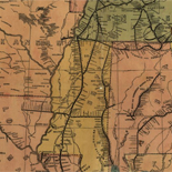
Map of Campbell Co.
LC Land ownership maps, 1229
Site: American Memory-cultural - Main Catalog Original Format: Map View catalog record -

Bird's-eye view of Washington, D.C.--the nation's capital /
Low-angle view.
Contributor: Green, H. H. Site: American Memory-cultural - Main Catalog Original Format: Map Date: 1916 View catalog record -

Bell County /
Shows land ownership.
Contributor: Rosenberg, E. von Site: American Memory-cultural - Main Catalog Original Format: Map Date: 1919 View catalog record -

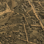
Panoramic view of the city of Ravenna, county seat of Portage Co., Ohio 1882.
Perspective map not drawn to scale.
Contributor: Ruger, A. Site: American Memory-cultural - Main Catalog Original Format: Map Date: 1882 View catalog record -

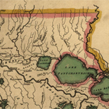
[Survey of a tract of 9,138 acres of coal lands on the New River in Raleigh County, West Virginia, west of Quinnimont].
Pen-and-ink on tracing linen, mounted on cloth.
Site: American Memory-cultural - Main Catalog Original Format: Map View catalog record -

Salem, West Virginia 1899.
Perspective map not drawn to scale.
Contributor: Fowler, T. M. Site: American Memory-cultural - Main Catalog Original Format: Map Date: 1899 View catalog record -

Vicksburg and vicinity.
Scale ca. 1:58,000.
Contributor: United States. Navy Site: American Memory-cultural - Main Catalog Original Format: Map Date: 1863 View catalog record -

Map showing the line of the Plymouth, Kankakee, & Pacific Railroad and its connections.
Scale 1:1,267,200.
Contributor: G.W. & C.B. Colton & Co Site: American Memory-cultural - Main Catalog Original Format: Map Date: 1871 View catalog record -

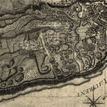
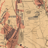
Map of the seat of war showing the battles of July 18th & 21st 1861
[Scale ca. 1:115,000].
Contributor: Corbett, V. P. Site: American Memory-cultural - Main Catalog Original Format: Map Date: 1861 View catalog record -

Speciel Land Charte von Pensilvanien, Neu Jersey, Neu York, und von denen drey Land-schafften an dem Delaware Fl. In America in Englischer Spr. gedruckt A. ...
Scale ca. 1:1,000,000.
Contributor: Evans, Lewis Site: American Memory-cultural - Main Catalog Original Format: Map Date: 1750 View catalog record -

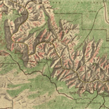
[Yellowstone National Park, Wyoming]
Available also through the Library of Congress Web site as a raster image.
Site: American Memory-cultural - Main Catalog Original Format: Map Date: 1880 View catalog record -

Map of Little North Mountain or Preston & Wilson iron lands /
General map, does not give mining information.
Contributor: Hotchkiss, Jedediah Site: American Memory-cultural - Main Catalog Original Format: Map Date: 1883 View catalog record -

Grand Canyon.
Scale ca. 1:95,000.
Contributor: United States. National Park Service Site: American Memory-cultural - Main Catalog Original Format: Map Date: 1977 View catalog record -

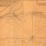
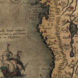
A plan of New York Island, with part of Long Island, Staten Island & east New Jersey, with a particular description of the engagement on ...
Scale ca. 1:85,000.
Contributor: Faden, William Site: American Memory-cultural - Main Catalog Original Format: Map Date: 1776 View catalog record -

Greensburg, Pennsylvania 1901.
Perspective map not drawn to scale.
Contributor: Fowler, T. M. Site: American Memory-cultural - Main Catalog Original Format: Map Date: 1901 View catalog record -

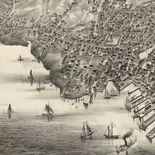
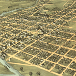
The city of Chicago.
Perspective map not drawn to scale.
Contributor: Currier & Ives Site: American Memory-cultural - Main Catalog Original Format: Map Date: 1892 View catalog record -

Bacon's military map of the United States shewing the forts & fortifications.
Scale ca. 1:8,000,000.
Contributor: Bacon and Company Site: American Memory-cultural - Main Catalog Original Format: Map Date: 1862 View catalog record -

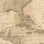
États-Unis de l'Amérique septentrionale avec les Isles Royale, de Terre Nueve, de St. Jean, l'Acadie &c.
Scale ca. 1:1,500,000.
Contributor: Robert de Vaugondy, Didier Site: American Memory-cultural - Main Catalog Original Format: Map Date: 1785 View catalog record -

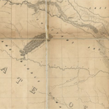
From the Rio Grande to the Pacific Ocean : from explorations and surveys /
Scale 1:950,400.
Contributor: Hoffman, J. D. Site: American Memory-cultural - Main Catalog Original Format: Map Date: 1859 View catalog record
Refine your search
Original Format
- Map