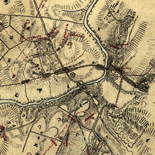
![[Sketch of the Manassas battlefield].](https://cybercemetery.unt.edu/archive/oilspill/20121207193201im_/http://www.loc.gov/collections/static/hotchkiss-maps/images/cwh00108.jpg)
![Sketch-book of positions of forces of 2nd Corps A.N.Va., campaigns of 1864 : [Virginia]](https://cybercemetery.unt.edu/archive/oilspill/20121207193201im_/http://www.loc.gov/collections/static/hotchkiss-maps/images/cwh00003.jpg)

![Plano. I descripcion de la costa, desde el Cavo Cañaveral, hasta cerca de la boca de la Vir[g]inia, contando, costa de Florida, Georgia y Carolinas del S, y N, con todos sus puertos, este[ros ... ]letas, baxos, islas y rios; segun las vlti[mas not]icias, hata [sic] oy Octubre de 1756.](https://cybercemetery.unt.edu/archive/oilspill/20121207193201im_/http://www.loc.gov/collections/static/american-revolutionary-war-maps/images/ct000339.jpg)
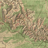
![[Base map of Alabama].](https://cybercemetery.unt.edu/archive/oilspill/20121207193201im_/http://www.loc.gov/collections/static/hotchkiss-maps/images/cwh00201.jpg)
![[December 21, 1944], HQ Twelfth Army Group situation map.](https://cybercemetery.unt.edu/archive/oilspill/20121207193201im_/http://www.loc.gov/collections/static/world-war-II-maps-military-situation-maps-from-1944-to-1945/images/ict21200.jpg)
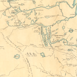
![Carte particulière d'une partie de la Louisianne ou les fleuve et rivierres [i.e. rivières] onts etés relevé a l'estime & les routtes [i.e. routes] par terre relevé & mesurées aux pas, par les Srs. Broutin, de Vergés, ingénieurs & Saucier dessinateur](https://cybercemetery.unt.edu/archive/oilspill/20121207193201im_/http://www.loc.gov/collections/static/louisiana-european-explorations-and-the-louisiana-purchase/images/ct000681.jpg)
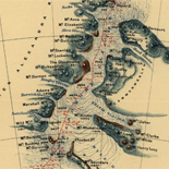
![[Sketch of the battles of Chancellorsville, Salem Church, and Fredericksburg], May 2, 3, and 4, 1863](https://cybercemetery.unt.edu/archive/oilspill/20121207193201im_/http://www.loc.gov/collections/static/civil-war-maps/images/cwh00129.jpg)
Results
-

Panoramic Mapping - Panoramic Maps
The tradition of perspective mapping flowered in Europe in the late sixteenth and early seventeenth centuries. Mathias Merian, George Braun, Franz Hogenberg, and others produced perspective maps of European cities. These early ...
Site: LOC.gov web pages Original Format: Map - Web Page Date: 2007-05-17 -

Overview - World War Ii Maps Military Situation Maps From 1944 To 1945
The World War II Military Situation Maps contains maps showing troop positions beginning on June 6, 1944 to July 26, 1945. Starting with the D-Day Invasion, the maps give daily details on ...
Site: LOC.gov web pages Original Format: Map - Web Page -

Overview - Discovery And Exploration
This category documents the discovery and exploration with both manuscripts and published maps. Many of these maps reflect the European Age of Discoveries, dating from the late 15th century to the 17th ...
Contributor: Library of Congress Geography and Map Division Site: LOC.gov web pages Original Format: Map - Web Page -

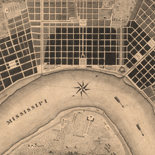
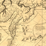
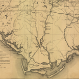
Overview - Louisiana European Explorations And The Louisiana Purchase
This presentation focuses on the various documents—from maps to newspapers to cultural artifact—that help to describe the region of North America that stretched from as far east as Alabama into what is ...
Site: LOC.gov web pages Original Format: Web Page - Map Date: 2007-08-13 -

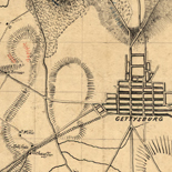
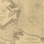
History Of Mapping The Civil War - Civil War Maps
War, like necessity, has been called the mother of invention. The same might be said of cartography, for with every war there is a great rush to produce maps to aid in ...
Site: LOC.gov web pages Original Format: Map - Web Page Date: 2008-08-04 -

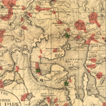
Yellowstone The First National Park - National Parks Maps
Among those who played key roles in establishing Yellowstone as the Nation's first national park was Ferdinand Vandiveer Hayden. His accomplishments in 1871-72 were the high point of a long and distinguished ...
Site: LOC.gov web pages Original Format: Map - Web Page Date: 1999-06-02 -

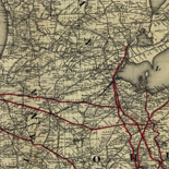
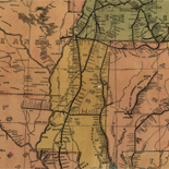
History Of Railroads And Maps - Railroad Maps 1828 To 1900
Railways were introduced in England in the seventeenth century as a way to reduce friction in moving heavily loaded wheeled vehicles. The first North American "gravity road," as it was called, was ...
Site: LOC.gov web pages Original Format: Map - Web Page Date: 1998-10-19 -
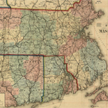
Overview - Panoramic Maps
The panoramic map was a popular cartographic form used to depict U.S. and Canadian cities and towns during the late nineteenth and early twentieth centuries. Known also as bird's-eye views, perspective maps, ...
Contributor: Library of Congress. Geography and Map Division Site: LOC.gov web pages - Main Catalog Original Format: Map - Web Page Date: 2007-05-17 View catalog record -
Maps Of Great Smoky Mountains National Park - National Parks Maps
Early European Maps | American Maps and Map Makers | Exploration and Geological Mapping | Environmental Maps | Early USGS Maps | USGS and the TVA -- Topographic Quadrangle Maps | National ...
Site: LOC.gov web pages Original Format: Web Page - Map Date: 1999-06-02 -

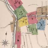
Sanborn Time Series - Sanborn Maps
Fire insurance maps are valuable to much historic research because they often provide evidence of change over time. Specific changes in an individual site such as when a building was expanded or ...
Site: LOC.gov web pages Original Format: Web Page - Map -
Louisiana As A Spanish Colony - Louisiana European Explorations And The Louisiana Purchase
Diplomacy of the French Cession The impetus to cede the French colony of Louisiana to the Spanish was the long, expensive conflict of the French and Indian War, also known as the ...
Site: LOC.gov web pages Original Format: Map - Web Page Date: 2007-08-13 -
Overview - Sanborn Maps
The Sanborn Fire Insurance Maps Online Checklist provides a searchable database of the fire insurance maps published by the Sanborn Map Company housed in the collections of the Geography and Map Division.
Contributor: Sanborn (Firm) Site: LOC.gov web pages - Main Catalog Original Format: Web Page - Map Date: 1867-01-01 View catalog record -

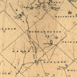
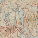
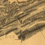
Overview - Hotchkiss Maps
The Hotchkiss Map Collection contains cartographic items made by Major Jedediah Hotchkiss (1828-1899), a topographic engineer in the Confederate Army. Hotchkiss made detailed battle maps primarily of the Shenandoah Valley, some of ...
Site: LOC.gov web pages - Main Catalog Original Format: Map - Web Page Date: 1828-01-01 View catalog record -

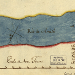
Overview - Rochambeau Maps
The Rochambeau Map Collection contains cartographic items used by Jean Baptiste Donatien de Vimeur, comte de Rochambeau (1725-1807), when he was commander in chief of the French expeditionary army (1780-82) during the ...
Site: LOC.gov web pages - Main Catalog Original Format: Map - Web Page Date: 1725-01-01 View catalog record -
The Exploration And Legacy Of The Louisiana Territory - Louisiana European Explorations And The Louisiana Purchase
American Exploration of Louisiana Acquisition and exploration of American lands throughout the first decade of the 19th century began and ended with President Thomas Jefferson. Whether involved in purchasing the Louisiana Territory; ...
Site: LOC.gov web pages Original Format: Map - Web Page Date: 2007-08-13 -
The Hotchkiss Collection Of Confederate Maps - Hotchkiss Maps
by Clara LeGear Jedediah Hotchkiss was born at Windsor, Broome County, N. Y., November 30, 1828. He was graduated from the Windsor Academy and early showed great interest in botany and in ...
Site: LOC.gov web pages Original Format: Map - Web Page Date: 1948-11-01 -

Explorations and Encounters, Exploring the Early Americas
This section presents materials from the voyages of exploration of Christopher Columbus, Hernán Cortés, and Francisco Pizarro, and material about the natives of the Americas they encountered.
Contributor: Christopher Columbus - Hernán Cortés - Francisco Pizarro - Taíno - Charles V - Holy Roman Emperor Site: LOC.gov web pages Original Format: Book - Three Dimensional Object - Map - Photo, Print, Drawing - Web Page -

Creating the Bill of Rights, Creating the United States Exhibit
The Bill of Rights, the first ten amendments to the Constitution, passed by Congress in 1789, became the bedrock of individual rights and liberties.
Contributor: James Madison - Thomas Jefferson - George Washington - John Adams - Abigail Adams Site: LOC.gov web pages Original Format: Book - Manuscript - Map - Photo, Print, Drawing - Web Page -
Overview - Civil War Maps
Civil War Maps brings together materials from three premier collections: the Library of Congress Geography and Map Division, the Virginia Historical Society, and the Library of Virginia. Among the reconnaissance, sketch, and ...
Site: LOC.gov web pages - Main Catalog Original Format: Web Page - Map Date: 2008-08-04 View catalog record -
Introduction To The Collection - Sanborn Maps
(This article was published within the Library's publication, Fire Insurance Maps: in the Library of Congress) Key for interpreting Sanborn fire insurance maps The Sanborn map collection consists of a uniform series ...
Site: LOC.gov web pages Original Format: Web Page - Map
Refine your search
Original Format
Online Format
- Web Page
- Image [42]
- PDF [1]