
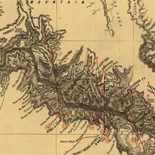
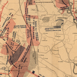
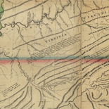
![[Map of parts of Caroline, Hanover, and Henrico counties, Va. west of the Mattaponi River and the Richmond, Fredericksburg, and Potomac Railroad].](https://cybercemetery.unt.edu/archive/oilspill/20121207164248im_/http://www.loc.gov/collections/static/hotchkiss-maps/images/cwh00025.jpg)

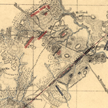

![[Sketch of the battles of Chancellorsville, Salem Church, and Fredericksburg], May 2, 3, and 4, 1863](https://cybercemetery.unt.edu/archive/oilspill/20121207164248im_/http://www.loc.gov/collections/static/civil-war-maps/images/cwh00129.jpg)
![[Base map of Alabama].](https://cybercemetery.unt.edu/archive/oilspill/20121207164248im_/http://www.loc.gov/collections/static/hotchkiss-maps/images/cwh00201.jpg)
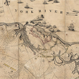
![Map of the Rappahannock River from [sic] Port Royal to Richards Ferry](https://cybercemetery.unt.edu/archive/oilspill/20121207164248im_/http://www.loc.gov/collections/static/civil-war-maps/images/cw0619600.jpg)

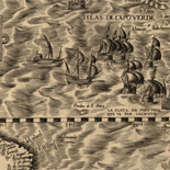
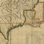
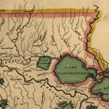
![Carte particulière d'une partie de la Louisianne ou les fleuve et rivierres [i.e. rivières] onts etés relevé a l'estime & les routtes [i.e. routes] par terre relevé & mesurées aux pas, par les Srs. Broutin, de Vergés, ingénieurs & Saucier dessinateur](https://cybercemetery.unt.edu/archive/oilspill/20121207164248im_/http://www.loc.gov/collections/static/louisiana-european-explorations-and-the-louisiana-purchase/images/ct000681.jpg)
Results
Refined by:
Original Format: Map-

Map of the battlefield of Antietam with the locations of monuments erected by the Commonwealth of Pennsylvania
Scale 1:18,000.
Contributor: Antietam Battlefield Memorial Commission Site: American Memory-cultural - Main Catalog Original Format: Map Date: 1908 View catalog record -

Campaigns of the American Civil War--atlas /
Title from cover.
Contributor: Fiebeger, G. J. Site: American Memory-cultural - Main Catalog Original Format: Map Date: 1914 View catalog record -

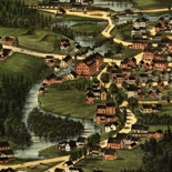
Minersville, Pennsylvania, 1889.
Perspective map not drawn to scale.
Contributor: Fowler, T. M. Site: American Memory-cultural - Main Catalog Original Format: Map Date: 1889 View catalog record -

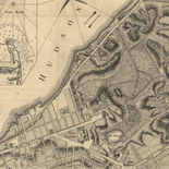
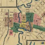
Map of the city of Rochester : from Cornells' Maps : to accompany Boyd's Rochester and six county directory /
City street map showing wards, ward numbers, and schools.
Contributor: Stuart, Oliver J. Site: American Memory-cultural - Main Catalog Original Format: Map Date: 1870 View catalog record -

Kuwait administrative divisions.
"Base 803214AI (G00423) 4-06."
Contributor: United States. Central Intelligence Agency Site: American Memory-cultural - Main Catalog Original Format: Map Date: 2006 View catalog record -

Italy.
Available also through the Library of Congress web site as a raster image.
Contributor: Charles Scribner's Sons Site: American Memory-cultural - Main Catalog Original Format: Map Date: 1890 View catalog record -

Plan de Pnom-Penh.
Available also through the Library of Congress Web site as a raster image.
Contributor: Portail, A. Site: American Memory-cultural - Main Catalog Original Format: Map Date: 1920 View catalog record -

[February 6, 1945], HQ Twelfth Army Group situation map.
Available also through the Library of Congress web site as a raster image.
Contributor: Allied Forces. Army Group, 12th. Engineer Section Site: American Memory-cultural - Main Catalog Original Format: Map Date: 1945-02-06 View catalog record -

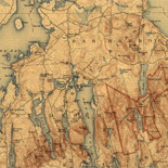
Great Smoky Mountains National Park /
Relief shown by spot heights.
Contributor: United States. National Park Service Site: American Memory-cultural - Main Catalog Original Format: Map Date: 1981 View catalog record -
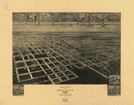
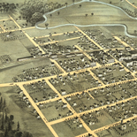
Birds eye view of Ocilla, Georgia 1908.
Perspective map not drawn to scale.
Contributor: Fowler, T. M. Site: American Memory-cultural - Main Catalog Original Format: Map Date: 1908 View catalog record -

[April 28, 1945], HQ Twelfth Army Group situation map.
Available also through the Library of Congress web site as a raster image.
Contributor: Allied Forces. Army Group, 12th. Engineer Section Site: American Memory-cultural - Main Catalog Original Format: Map Date: 1945-04-28 View catalog record -

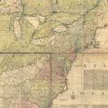
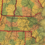
An accurate map of North America. Describing and distinguishing the British, Spanish and French dominions on this great continent; exhibiting the present seat of war, ...
Scale ca. 1:5,500,000.
Contributor: Bowen, Emanuel Site: American Memory-cultural - Main Catalog Original Format: Map Date: 1755 View catalog record -

Plats of the Wilson Cary Nicholas surveys (from the originals) made in Wythe and Russell Counties, Virginia, now Mercer, Raleigh, Wyoming, McDowell, and Logan counties, ...
Pen-and-ink on tracing linen, mounted on cloth.
Contributor: Hotchkiss, Jedediah Site: American Memory-cultural - Main Catalog Original Format: Map Date: 1884 View catalog record -

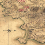
Official map of San Francisco.
Scale 1:6,600; 550 English ft. to the in.
Contributor: Eddy, William M. Site: American Memory-cultural - Main Catalog Original Format: Map Date: 1849 View catalog record -
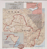
China-USSR border, eastern sector.
Scale 1:7,200,000.
Contributor: United States. Central Intelligence Agency Site: American Memory-cultural - Main Catalog Original Format: Map Date: 1977 View catalog record -

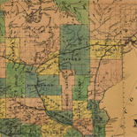
Map of Liberty Co., Texas.
Shows land ownership.
Contributor: Texas. General Land Office Site: American Memory-cultural - Main Catalog Original Format: Map Date: 1879 View catalog record -
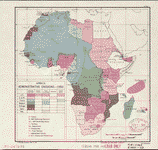
Africa, administrative divisions, 1950.
Shows political status of countries.
Contributor: United States. Central Intelligence Agency. Map Division Site: American Memory-cultural - Main Catalog Original Format: Map Date: 1950 View catalog record -

Holbrook's map of the city of Newark, New Jersey.
Street map hand col. to show wards and ward numbers.
Contributor: A.S. Holbrook's Printing Office Site: American Memory-cultural - Main Catalog Original Format: Map Date: 1878 View catalog record -

New Haven Harbor
[Scale 1:30,000].
Contributor: United States Coast Survey Site: American Memory-cultural - Main Catalog Original Format: Map View catalog record -

Plan of the siege of St. Sebastian in the year 1813.
Relief shown by hachures.
Site: American Memory-cultural - Main Catalog Original Format: Map Date: 1813 View catalog record