Sanborn Fire Insurance MapsSearch by:
Please note: There are over 50,000 hits for United States in this database.
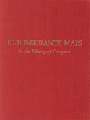
The Sanborn Fire Insurance Maps Online Checklist provides a searchable database of the fire insurance maps published by the Sanborn Map Company housed in the collections of the Geography and Map Division. The online checklist is based upon the Library's 1981 publication Fire Insurance Maps in the Library of Congress and will be continually updated to reflect new acquisitions. The online checklist also contains links to existing digital images from our collection and will be updated as new images are added. If you have any questions, comments, or are interested in obtaining reproductions from the collection, please Ask A Librarian. To date, over 6000 sheets are online in the following states: AK, AL, AZ, CA, CT, DC, GA, IL, IN, KY, LA, MA, MD, ME, MI, MO, MS, NC, NE, NH, NJ, NV, OH, PA, TX, VA, VT, WY and Canada, Mexico, Cuba sugar warehouses, and U.S. whiskey warehouses.
Ask
a Librarian |
||||||||||||||||||||||||||||||||
| The Library of Congress >> Researchers February 2, 2012 |
Legal | External Link Disclaimer |
Contact
Us: Ask a Librarian |
