Searching Tips
Home
Subject Map
Select a subject
---------------
Arts & Music
Health & Phys Ed
History & Soc Studies
- U.S. History Topics
- U.S. Time Periods
- World Studies
Language Arts
Math
Science
---------------
Subject map
Arts & Music
Health & Phys Ed
History & Soc Studies
U.S. History Topics
U.S. Time Periods
World Studies
Language Arts
Math
Science
What's New
Calendar
Maps
30 Resources
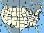
Nationalatlas.gov
is a primary source of U.S. maps and geographic information. Zoom in on your state and...
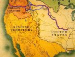
Rivers, Edens, Empires: Lewis & Clark and the Revealing of America
looks at historical maps, relations with Indians, and expedition artifacts -- the...
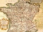
Geography: U.S. Geological Survey
provides online maps and map tools. Find maps that are popular with teachers, tools for...
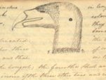
Lewis and Clark: Mapping the West
features maps of the famous expedition. The Corps of Discovery collected 30 maps from...
Interior Dept
Library of Congress
U.S. Geological Survey
Smithsonian Institution
See All 30 maps Resources
About FREE
Privacy
Security
Disclaimer
WhiteHouse.gov
USA.gov