![[December 16, 1944], HQ Twelfth Army Group situation map.](https://cybercemetery.unt.edu/archive/oilspill/20121227132254im_/http://www.loc.gov/collections/static/world-war-ii-maps-military-situation-maps-from-1944-to-1945/images/ict21195.jpg)


![[Topographical map of part of Washington D.C.].](https://cybercemetery.unt.edu/archive/oilspill/20121227132254im_/http://www.loc.gov/collections/static/civil-war-maps/images/cw0688500.jpg)

![[December 18, 1944], HQ Twelfth Army Group situation map.](https://cybercemetery.unt.edu/archive/oilspill/20121227132254im_/http://www.loc.gov/collections/static/world-war-ii-maps-military-situation-maps-from-1944-to-1945/images/ict21197.jpg)


![[Detailed map of part of Virginia from Alexandria to the Potomac River above Washington, D.C. 1886].](https://cybercemetery.unt.edu/archive/oilspill/20121227132254im_/http://www.loc.gov/collections/static/civil-war-maps/images/cw0523000.jpg)
![[Base map of Alabama].](https://cybercemetery.unt.edu/archive/oilspill/20121227132254im_/http://www.loc.gov/collections/static/hotchkiss-maps/images/cwh00201.jpg)
Results
-


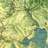
Lander, Wyoming. Catalog Record Only
Scale not given.
Contributor: J & R Map Company Site: Main Catalog Original Format: Map Date: 1973 -
Korea's tourist map / Catalog Record Only
Relief shown by form lines.
Contributor: Korea International Travel Company Site: Main Catalog Original Format: Map Date: 1995 -
TOPO! Interactive maps on CD-ROM New Hampshire and the White Mountains Catalog Record Only
System requirements: IBM PC or equivalent; 4MB RAM minimum; Windows 3.1, 95 or NT; 8 bit color monitor; 2X CD-ROM drive.
Site: Main Catalog Original Format: Map Date: 1998 -
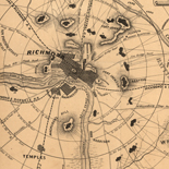
Plan of the city of Washington. Catalog Record Only
Relief shown by hachures. Depths shown by soundings.
Contributor: Weld, Isaac Site: Main Catalog Original Format: Map Date: 1798 -

Fort Wagner. Morris Island
NOTE: Researchers will be served a color photocopy of this scrapbook image.
Contributor: Sneden, Robert Knox Site: American Memory-cultural Original Format: Map Date: 1863 -
Hammond atlas of the Middle East. Catalog Record Only
Also covers north Africa.
Contributor: Hammond Incorporated Site: Main Catalog Original Format: Map Date: 1997 -
Lake Charles and vicinity, Louisiana / Catalog Record Only
Panel title: Street & road map of Lake Charles, Sulphur and Calcasieu Parish, Louisiana.
Contributor: Hagstrom Company Site: Main Catalog Original Format: Map Date: 1980 -
Village of Birch Run. Catalog Record Only
1 map : photocopy ; 20 x 24 cm., on sheet 28 x 44 cm.
Site: Main Catalog Original Format: Map Date: 1994 -
Regional map of the Philippines, 1983 / Catalog Record Only
Includes descriptive index to "Regional offices" and inset of "National Capital Region, metropolitan Manila."
Contributor: Philippines. National Census and Statistics Office Site: Main Catalog Original Format: Map Date: 1983 -
Arlington County, eighteenth century / Catalog Record Only
Shows locations of houses and mills and names of residences.
Contributor: Bell, W. Site: Main Catalog Original Format: Map Date: 1960 -
Hammond pocket road atlas : United States, Canada, Mexico. Catalog Record Only
Produced by Hammond for United Parcel Service. Company logo imprinted on cover.
Contributor: Hammond Incorporated Site: Main Catalog Original Format: Map Date: 1990 -
Sanborn Fire Insurance Map from Peru, Miami County, Indiana.
517. 32 Sheet(s). Aug 1930 - Sep 1948.
Site: American Memory-cultural Original Format: Map Date: 1948-01-01 -
County of Haldimand, Ontario. Catalog Record Only
Scale 1:158,400; 2 1/2 miles per in.
Contributor: Miles and Company, Toronto Site: Main Catalog Original Format: Map Date: 1979 -
Brooks County, Texas; Catalog Record Only
2 maps 106 x 190 cm. and 107 x 173 cm.
Contributor: Tobin (Edgar), Aerial Surveys, San Antonio Site: Main Catalog Original Format: Map Date: 1952 -
Southern California / Catalog Record Only
"11-80."
Contributor: California State Automobile Association. Cartographic Dept Site: Main Catalog Original Format: Map Date: 1980 -
Sanborn Fire Insurance Map from Portsmouth, Rockingham County, New Hampshire.
Map of congested district. 2 skeleton maps. Bound. 56 Sheet(s). 1920.
Site: American Memory-cultural Original Format: Map Date: 1920 -
Hearne Brothers official polyconic projection map of greater Columbus with all of Franklin County. Catalog Record Only
Panel title: Map of Columbus and Franklin County.
Contributor: Hearne Brothers Site: Main Catalog Original Format: Map Date: 1980 -
Street map of Pinetop, Lakeside, Wagonwheel / Catalog Record Only
Panel title.
Contributor: Commercial Graphics (Firm) Site: Main Catalog Original Format: Map Date: 1980 -
Wildwoods, New Jersey, an island beach resort : love those Wildwood days : calendar of events / Catalog Record Only
Covers boroughs of Wildwood, Wildwood Crest, and North Wildwood.
Contributor: Granigan Design (Firm) Site: Main Catalog Original Format: Map Date: 2006 -
Southeastern states / Catalog Record Only
"97-10."
Contributor: American Automobile Association Site: Main Catalog Original Format: Map Date: 1998
Refine your search
Original Format
Online Format
Date
Contributor
- Merchant Maps (Firm) [9427]
- Rand Mcnally And Company [6354]
- United States. National Park Service [3629]
- Champion Map Corporation [3207]
- Rockford Map Publishers [3168]
- United States. Soil Conservation Service [2914]
- United States. Central Intelligence Agency [2795]
- Geological Survey (U.S.) [2330]
- Thomas Bros. Maps [1387]
- Universal Map (Firm) [1347]
-
More Contributors