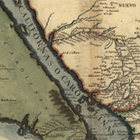
![Amérique septentrion.lle [i.e. septentrionale] : composée, corigée, et augmētée, sur les iournaux, mémoires, et observations les plus justes qui en ón'́etes.tes en l'année 1685 & 1686, par plusieurs particuliés](https://cybercemetery.unt.edu/archive/oilspill/20121227132003im_/http://www.loc.gov/collections/static/discovery-and-exploration/images/ct000667.jpg)
![[January 3, 1945], HQ Twelfth Army Group situation map.](https://cybercemetery.unt.edu/archive/oilspill/20121227132003im_/http://www.loc.gov/collections/static/world-war-ii-maps-military-situation-maps-from-1944-to-1945/images/ict21213.jpg)
Results
-


Maps of DuPage County with Lombard, Villa Park, and Elmhurst, Illinois : happy to help you find your way around! / Catalog Record Only
Panel title.
Contributor: Merchant Maps (Firm) Site: Main Catalog Original Format: Map Date: 1983 -
Sanborn Fire Insurance Map from Sibley, Ford County, Illinois.
2 Sheet(s). May 1923.
Site: American Memory-cultural Original Format: Map Date: 1923-01-01 -
Amended zoning map of Flossmoor, Illinois. Catalog Record Only
Scale ca. 1:9,800.
Contributor: Crane, Jacob L. Site: Main Catalog Original Format: Map Date: 1957 -
Marriott's Great America, Illinois. Catalog Record Only
Pictorial map.
Site: Main Catalog Original Format: Map Date: 1982 -
Chicago and suburban street map /c Chicago Motor Club, AAA. Catalog Record Only
Segments of map separately titled: Chicago street map : (northern section) -- Chicago street map : (southern section).
Contributor: Rand McNally and Company Site: Main Catalog Original Format: Map Date: 1974 -
City of Edwardsville, Illinois, official map. Catalog Record Only
Cadastral map.
Contributor: Edwardsville (Ill.) Site: Main Catalog Original Format: Map Date: 1989 -
Plat book of Champaign County, Illinois. Catalog Record Only
Title from cover.
Site: Main Catalog Original Format: Map Date: 1930 -
Village of Western Springs, Illinois / Catalog Record Only
Cadastral map.
Contributor: Lindley & Sons Site: Main Catalog Original Format: Map Date: 1983 -
General highway map, village of South Jacksonville, Morgan County, Illinois / Catalog Record Only
Blue line print.
Contributor: Illinois. Dept. of Transportation. Office of Planning and Programming Site: Main Catalog Original Format: Map Date: 1986 -
Mt. Vernon, Illinois / Catalog Record Only
Panel title: Map of Mt. Vernon, Illinois.
Contributor: Coggeshall Map Service Site: Main Catalog Original Format: Map Date: 1977 -
Plat book of Ogle County, Illinois. Catalog Record Only
LeGear. Atlases of the United States, 4324
Contributor: W.W. Hixson & Co Site: Main Catalog Original Format: Map Date: 1930 -
Village of Schiller Park, zoning map : Cook County, Illinois / Catalog Record Only
"Prepared 4-21-78."
Contributor: Edwin Hancock Engineering Co Site: Main Catalog Original Format: Map Date: 1984 -
City of Rock Falls, Illinois. Catalog Record Only
Scale ca. 1:7,200.
Contributor: Evert Kincaid & Associates Site: Main Catalog Original Format: Map Date: 1967 -
Map of Decatur, IL / Catalog Record Only
Panel title.
Contributor: Mass Marketing Inc Site: Main Catalog Original Format: Map Date: 1989 -
Sanborn Fire Insurance Map from Pekin, Tazewell County, Illinois.
10 Sheet(s). May 1885.
Site: American Memory-cultural Original Format: Map Date: 1885-01-01 -
Street map of the Edgewater area in Chicago. Catalog Record Only
"6/80."
Contributor: All American Publishing Co Site: Main Catalog Original Format: Map Date: 1980 -
Viaduct clearances for Chicago streets and neighboring suburbs / Catalog Record Only
Alternate title: Viaduct clearances.
Contributor: M & E Enterprise Site: Main Catalog Original Format: Map Date: 1980 -
Kendall County, Illinois, land atlas & plat book : 2005. Catalog Record Only
Shows landowners' names and state lands.
Contributor: Rockford Map Publishers Site: Main Catalog Original Format: Map Date: 2005 -
Gallatin County, Illinois, land atlas & plat book : 1987. Catalog Record Only
Cover title.
Contributor: Rockford Map Publishers Site: Main Catalog Original Format: Map Date: 1987 -
Mendota, Illinois, 61342; "World's greatest little city." Catalog Record Only
Scale not given.
Contributor: All American Publishing Co Site: Main Catalog Original Format: Map Date: 1973
Refine your search
Original Format
- Map
- Web Page [1]
Online Format
Contributor
- Rockford Map Publishers [901]
- Merchant Maps (Firm) [401]
- Rand Mcnally And Company [234]
- Villageprofile.Com Inc [158]
- Geological Survey (U.S.) [105]
- United States. Soil Conservation Service [97]
- Champion Map Corporation [95]
- Geo. A. Ogle & Co [84]
- W.W. Hixson & Co [81]
- Sidwell Company [67]
-
More Contributors