![A map of the most inhabited part of New England... Thomas Jefferys, [London] Thos. Jefferys, 1755.](https://cybercemetery.unt.edu/archive/oilspill/20121227124738im_/http://www.loc.gov/collections/static/american-revolutionary-war-maps/images/ar079700.jpg)


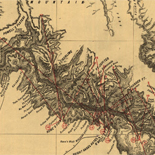
![[Rough sketch of the Rich Mountain battle area extending from Beverly, W. Va. to Clarksburg].](https://cybercemetery.unt.edu/archive/oilspill/20121227124738im_/http://www.loc.gov/collections/static/hotchkiss-maps/images/cwh00078.jpg)


![A correct map of a section of the United States showing the allignment [sic] of the Pittsburgh, Marion, and Chicago Railway between Chewton, Penna. and Marion, Ohio and connections.](https://cybercemetery.unt.edu/archive/oilspill/20121227124738im_/http://www.loc.gov/collections/static/railroad-maps-1828-to-1900/images/rr005350.jpg)


![[Base map of Pennsylvania].](https://cybercemetery.unt.edu/archive/oilspill/20121227124738im_/http://www.loc.gov/collections/static/hotchkiss-maps/images/cwh00207.jpg)


![[Sketch of the Manassas battlefield].](https://cybercemetery.unt.edu/archive/oilspill/20121227124738im_/http://www.loc.gov/collections/static/hotchkiss-maps/images/cwh00108.jpg)


![[December 18, 1944], HQ Twelfth Army Group situation map.](https://cybercemetery.unt.edu/archive/oilspill/20121227124738im_/http://www.loc.gov/collections/static/world-war-ii-maps-military-situation-maps-from-1944-to-1945/images/ict21197.jpg)


Results
-

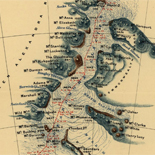
Fort Wagner. Morris Island
NOTE: Researchers will be served a color photocopy of this scrapbook image.
Contributor: Sneden, Robert Knox Site: American Memory-cultural Original Format: Map Date: 1863 -
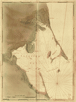
[Chart of Plymouth Bay.
Scale ca. 1:24,000.
Contributor: Des Barres, Joseph F. W. Site: American Memory-cultural - Main Catalog Original Format: Map Date: 1770 View catalog record -

Bird's eye view of the city of Lyons, Clinton Co., Iowa 1868.
Perspective map not drawn to scale.
Contributor: Ruger, A. Site: American Memory-cultural - Main Catalog Original Format: Map Date: 1868 View catalog record -

Map of the state of New-York showing its water and rail road lines. Jan 1855, by direction of John T. Clark State Engineer & Surveyor.
Scale ca. 1:1,000,000.
Contributor: Vaughan, David Site: American Memory-cultural - Main Catalog Original Format: Map Date: 1855 View catalog record -
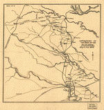
Operations of the Army of the Potomac, May & June 1864.
Scale not given.
Site: American Memory-cultural - Main Catalog Original Format: Map Date: 1864 View catalog record -

Accuratissima Brasiliæ tabula.
Relief shown pictorially.
Contributor: Hondius, Hendrik Site: American Memory-cultural - Main Catalog Original Format: Map Date: 1630 View catalog record -
Les Deserts D'Egypte, De Thabaide D'Arabie, De Sirie, &c
Les Deserts D'Egypte, De Thabaide D'Arabie, De Sirie, &c / [map] :Image Description (Performing Arts Encyclopedia, Library of Congress )
Contributor: Michallet, Estienne Site: Performing Arts Encyclopedia Original Format: Map Date: 1693 -

Ghana administrative divisions.
"Base 803238AI (G00183) 5-07."
Contributor: United States. Central Intelligence Agency Site: American Memory-cultural - Main Catalog Original Format: Map Date: 2007 View catalog record -

Map of the state of Virginia : containing the counties, principal towns, railroads, rivers, canals & all other internal improvements.
Relief shown by hachures.
Contributor: West & Johnston Site: American Memory-cultural - Main Catalog Original Format: Map Date: 1862 View catalog record -

Portions of Virginia and North Carolina, embracing Richmond & Lynchburg, Va. and Goldsboro & Salisbury, N.C.
Relief shown by hachures.
Contributor: United States. War Dept. Engineer Bureau Site: American Memory-cultural - Main Catalog Original Format: Map Date: 1864 View catalog record -

[March 18, 1945], HQ Twelfth Army Group situation map.
Available also through the Library of Congress web site as a raster image.
Contributor: Allied Forces. Army Group, 12th. Engineer Section Site: American Memory-cultural - Main Catalog Original Format: Map Date: 1945-03-18 View catalog record -

Greene, N.Y. /
Perspective map not drawn to scale.
Contributor: Burleigh, L. R. Site: American Memory-cultural - Main Catalog Original Format: Map Date: 1890 View catalog record -

Plano de la bahia de Pansacola.
Scale ca. 1:60,000.
Contributor: Paredes, Antonio Donato Site: American Memory-cultural - Main Catalog Original Format: Map Date: 1782 View catalog record -

Beijing Shi zui xin xiang xi quan tu.
Includes lists of schools, hotels, apartments, companies, and government organizations.
Contributor: Beijing wen ya she Site: American Memory-cultural - Main Catalog Original Format: Map Date: 1938 View catalog record -

Adrian, Michigan 1866.
Perspective map not drawn to scale.
Contributor: Ruger, A. Site: American Memory-cultural - Main Catalog Original Format: Map Date: 1866 View catalog record -

Bird's eye view of the city of Santa Fé, N.M. 1882.
Perspective map not drawn to scale.
Contributor: Wellge, H. Site: American Memory-cultural - Main Catalog Original Format: Map Date: 1882 View catalog record -

Plano de la Bahía Balentín situado en la Tierra del Fuego, Estrecho de Mayre.
Relief shown pictorially. Depths shown by soundings.
Site: American Memory-cultural - Main Catalog Original Format: Map Date: 1700 View catalog record -
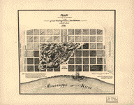
Plan showing the boundaries of the great conflagration of New Orleans on the 21st of March 1788.
Shows settled parts of the town with the darker shading of the squares.
Site: American Memory-cultural - Main Catalog Original Format: Map View catalog record -

Plat book of Kalamazoo County, Michigan : compiled from surveys and the public records of Kalamazoo County, Michigan.
Available also through the Library of Congress Web site as a raster image.
Contributor: Thrift Press (Rockford, Ill.) Site: American Memory-cultural - Main Catalog Original Format: Map Date: 1928 View catalog record -

Kōgen enkai ōfukuzu : Meiji jūhachinen : jikkei jūmanbun no ichi /
Relief shown by contours, hachures, and spot heights.
Contributor: Kaizu, Mitsuo Site: American Memory-cultural - Main Catalog Original Format: Map Date: 1886 View catalog record
Refine your search
Original Format
Online Format
Date
Site
Contributor
- United States. Central Intelligence Agency [1294]
- Allied Forces. Army Group, 12Th. Engineer Section [419]
- Sneden, Robert Knox [316]
- Fowler, T. M. [236]
- Ruger, A. [194]
- Texas. General Land Office [174]
- Burleigh, L. R. [134]
- G.W. & C.B. Colton & Co [130]
- Hotchkiss, Jedediah [128]
- United States Coast Survey [108]
-
More Contributors