Map
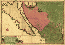
La Californie ou Nouvelle Caroline : teatro de los trabajos, Apostolicos de la Compa. e Jesus en la America Septe. /

| Format |
Map |
|---|---|
| Contributors |
Fer, Nicolas De |
| Dates |
1720 |
| Location |
California Mexico United States |
| Language |
French |
| Subjects |
California Mexico United States |
- Title
- La Californie ou Nouvelle Caroline : teatro de los trabajos, Apostolicos de la Compa. e Jesus en la America Septe. /
- Description
-
Relief shown pictorially.
-
Available also through the Library of Congress Web site as a raster image.
-
1 map : hand col. ; 45 x 66 cm.
- Creator
- Fer, Nicolas de,
- Created Published
-
Paris : [N. de Fer, 1720?]
- Subject Headings
-
-
Mexico
-
-
California
-
-
Mexico.
-
-
United States--California.
- Notes
-
-
Relief shown pictorially.
-
-
Available also through the Library of Congress Web site as a raster image.
- Medium
-
1 map : hand col. ; 45 x 66 cm.
- Call Number
-
G4410 1720 .F4
- Repository
-
Library of Congress Geography and Map Division Washington, D.C. 20540-4650 USA dcu
- Digital Id
-
g4410 ct001000 http://hdl.loc.gov/loc.gmd/g4410.ct001000
- Library of Congress Catalog Number
- 96686640
Rights & Access
The maps in the Map Collections materials were either published prior to 1922, produced by the United States government, or both (see catalogue records that accompany each map for information regarding date of publication and source). The Library of Congress is providing access to these materials for educational and research purposes and is not aware of any U.S. copyright protection (see Title 17 of the United States Code) or any other restrictions in the Map Collection materials.
Note that the written permission of the copyright owners and/or other rights holders (such as publicity and/or privacy rights) is required for distribution, reproduction, or other use of protected items beyond that allowed by fair use or other statutory exemptions. Responsibility for making an independent legal assessment of an item and securing any necessary permissions ultimately rests with persons desiring to use the item.
More about Copyright and other Restrictions
For guidance about compiling full citations consult Citing Primary Sources.
Part of...
-
Discovery And Exploration
[150]
-
Geography And Maps Division
[60803]
-
American Memory
[1121009]
More maps like this
-
 La Californie ou Nouvelle Caroline : teatro de los trabajos, Apostolicos de la Compa. e Jesus en la America Septe. /
Contributor:
Fer, Nicolas de
Site:
American Memory-cultural, Main Catalog
Original Format:
Map
Date:
1720
View catalog record
La Californie ou Nouvelle Caroline : teatro de los trabajos, Apostolicos de la Compa. e Jesus en la America Septe. /
Contributor:
Fer, Nicolas de
Site:
American Memory-cultural, Main Catalog
Original Format:
Map
Date:
1720
View catalog record
-
 Les costes aux environs de la rivière de Misisipi : découvertes par Mr. de la Salle en 1683 et reconnues par Mr. le Chevallier d'Iberville ...
Contributor:
Fer, Nicolas de
Site:
American Memory-cultural, Main Catalog
Original Format:
Map
Date:
1701
View catalog record
Les costes aux environs de la rivière de Misisipi : découvertes par Mr. de la Salle en 1683 et reconnues par Mr. le Chevallier d'Iberville ...
Contributor:
Fer, Nicolas de
Site:
American Memory-cultural, Main Catalog
Original Format:
Map
Date:
1701
View catalog record
-
 L'Ancienne Thebaide, ou, la Carta generale des lieux habitez par les Ss. peres des deserts : dressez sur celle des Religieux de la Trappe /
Contributor:
Fer, Nicolas de
Site:
American Memory-cultural, Main Catalog
Original Format:
Map
Date:
1738
View catalog record
L'Ancienne Thebaide, ou, la Carta generale des lieux habitez par les Ss. peres des deserts : dressez sur celle des Religieux de la Trappe /
Contributor:
Fer, Nicolas de
Site:
American Memory-cultural, Main Catalog
Original Format:
Map
Date:
1738
View catalog record
-
 Le Bresil.
Contributor:
Fer, Nicolas de
Site:
American Memory-cultural, Main Catalog
Original Format:
Map
Date:
1719
View catalog record
Le Bresil.
Contributor:
Fer, Nicolas de
Site:
American Memory-cultural, Main Catalog
Original Format:
Map
Date:
1719
View catalog record
-
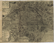 Huitieme plan de Paris.
Contributor:
Fer, Nicolas de
Site:
American Memory-cultural, Main Catalog
Original Format:
Map
Date:
1705
View catalog record
Huitieme plan de Paris.
Contributor:
Fer, Nicolas de
Site:
American Memory-cultural, Main Catalog
Original Format:
Map
Date:
1705
View catalog record
-
L'Ancienne Thebaide, ou, la Carta generale des lieux habitez par les Ss. peres des deserts Contributor: Fer, Nicolas de, creator Site: Performing Arts Encyclopedia Original Format: Map Date: 1738
-
 Map of the United States of North America with parts of the adjacent countries /
Contributor:
Burr, David H.
Site:
American Memory-cultural, Main Catalog
Original Format:
Map
Date:
1839
View catalog record
Map of the United States of North America with parts of the adjacent countries /
Contributor:
Burr, David H.
Site:
American Memory-cultural, Main Catalog
Original Format:
Map
Date:
1839
View catalog record
-
 Mapa, que comprende la Frontera, de los Dominios del Rey, en la America Septentrional.
Contributor:
Urrutia, José de, Urrutia, José de
Site:
American Memory-cultural, Main Catalog
Original Format:
Map
Date:
1769
View catalog record
Mapa, que comprende la Frontera, de los Dominios del Rey, en la America Septentrional.
Contributor:
Urrutia, José de, Urrutia, José de
Site:
American Memory-cultural, Main Catalog
Original Format:
Map
Date:
1769
View catalog record
-
 Mapa de los Estados Unidos de Méjico : segun lo organizado y definido por las varias actas del congreso de dicha républica y construido por ...
Contributor:
Disturnell, John
Site:
American Memory-cultural, Main Catalog
Original Format:
Map
Date:
1847
View catalog record
Mapa de los Estados Unidos de Méjico : segun lo organizado y definido por las varias actas del congreso de dicha républica y construido por ...
Contributor:
Disturnell, John
Site:
American Memory-cultural, Main Catalog
Original Format:
Map
Date:
1847
View catalog record
-
 The Santa Fé Route and connections, 1888.
Contributor:
Rand McNally and Company
Site:
American Memory-cultural, Main Catalog
Original Format:
Map
Date:
1888
View catalog record
The Santa Fé Route and connections, 1888.
Contributor:
Rand McNally and Company
Site:
American Memory-cultural, Main Catalog
Original Format:
Map
Date:
1888
View catalog record
-
 Boundary between the United States and Mexico.
Contributor:
Emory, William H.
Site:
American Memory-cultural, Main Catalog
Original Format:
Map
Date:
1855
View catalog record
Boundary between the United States and Mexico.
Contributor:
Emory, William H.
Site:
American Memory-cultural, Main Catalog
Original Format:
Map
Date:
1855
View catalog record
-
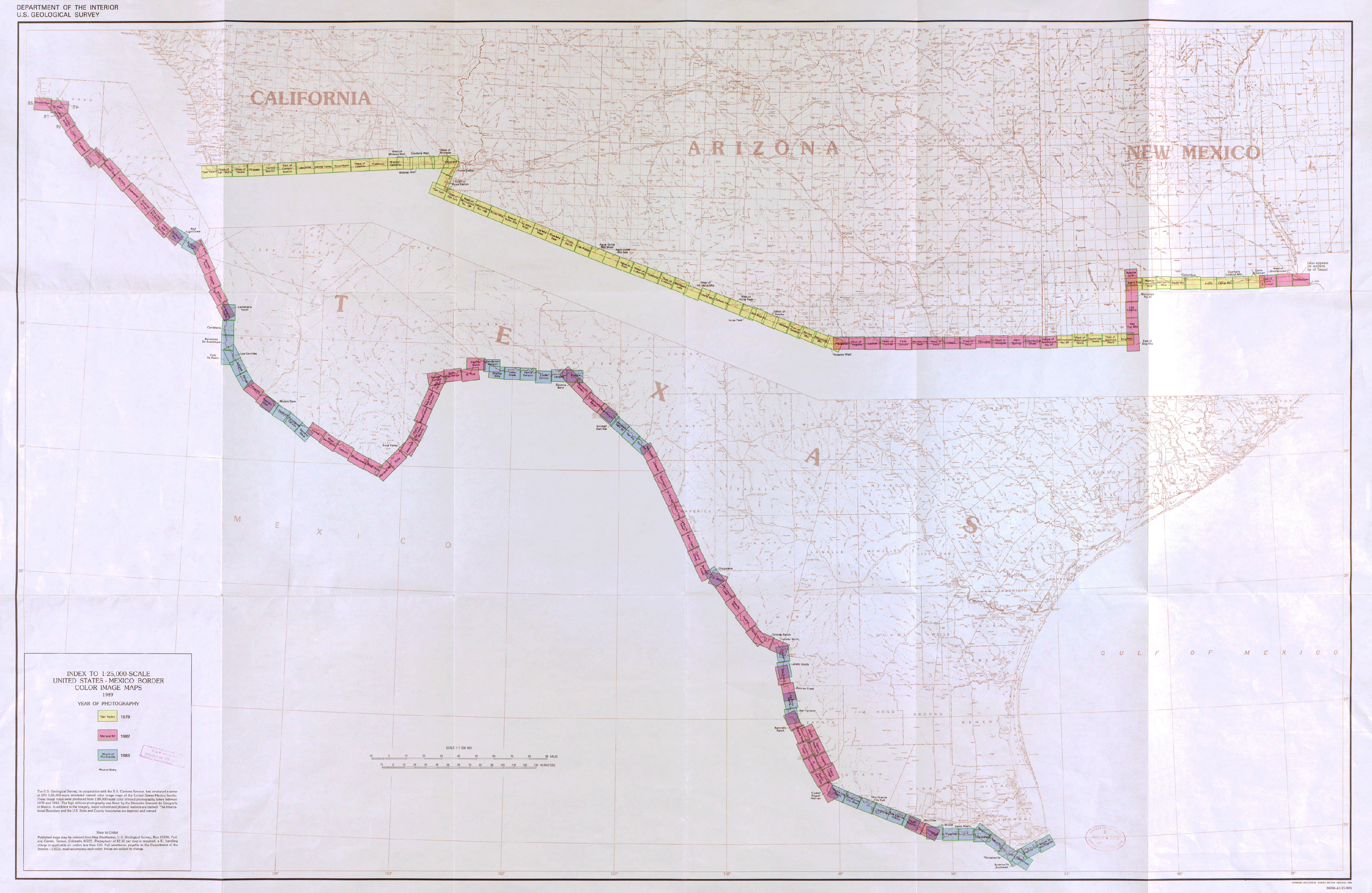 Color image map : [ports of entry, United States-Mexican border] /
Contributor:
Geological Survey (U.S.)
Site:
American Memory-cultural, Main Catalog
Original Format:
Map
Date:
1979
View catalog record
Color image map : [ports of entry, United States-Mexican border] /
Contributor:
Geological Survey (U.S.)
Site:
American Memory-cultural, Main Catalog
Original Format:
Map
Date:
1979
View catalog record
-
 Carta esferica de los territorios de la alta y baja Californias y estado de Sonora.
Contributor:
Narvaes, Jose M.
Site:
American Memory-cultural, Main Catalog
Original Format:
Map
Date:
1823
View catalog record
Carta esferica de los territorios de la alta y baja Californias y estado de Sonora.
Contributor:
Narvaes, Jose M.
Site:
American Memory-cultural, Main Catalog
Original Format:
Map
Date:
1823
View catalog record
-
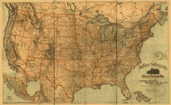 Matthews, Northrup & Co's official railroad map of the United States, Dominion of Canada and Mexico perfected to date from latest authentic sources.
Contributor:
Matthews-Northrup Company
Site:
American Memory-cultural, Main Catalog
Original Format:
Map
Date:
1890
View catalog record
Matthews, Northrup & Co's official railroad map of the United States, Dominion of Canada and Mexico perfected to date from latest authentic sources.
Contributor:
Matthews-Northrup Company
Site:
American Memory-cultural, Main Catalog
Original Format:
Map
Date:
1890
View catalog record
-
 Mexico, reference map.
Contributor:
United States. Central Intelligence Agency
Site:
American Memory-cultural, Main Catalog
Original Format:
Map
Date:
1993
View catalog record
Mexico, reference map.
Contributor:
United States. Central Intelligence Agency
Site:
American Memory-cultural, Main Catalog
Original Format:
Map
Date:
1993
View catalog record
-
Carta esferica de los territorios de la alta y baja Californias y estado de Sonora.
Contributor:
Narvaes, Jose M.
Site:
American Memory-cultural, Main Catalog
Original Format:
Map
Date:
1823
View catalog record
You might also like
-

 United Air Lines, Inc., airplanes and personnel
Site:
Main Catalog
Original Format:
Photo, Print, Drawing
Date:
1945
United Air Lines, Inc., airplanes and personnel
Site:
Main Catalog
Original Format:
Photo, Print, Drawing
Date:
1945
-
 Keel and saddle: a retrospect of forty years of military and naval service.
Contributor:
Revere, Joseph Warren
Site:
Main Catalog
Original Format:
Book
Date:
1872
Keel and saddle: a retrospect of forty years of military and naval service.
Contributor:
Revere, Joseph Warren
Site:
Main Catalog
Original Format:
Book
Date:
1872
-
 Santa Fe R.R. crosses the Colorado River into California between Topock, Arizona and Beal, California
Contributor:
Delano, Jack
Site:
Prints & Photographs
Original Format:
Photo, Print, Drawing
Date:
1939
Santa Fe R.R. crosses the Colorado River into California between Topock, Arizona and Beal, California
Contributor:
Delano, Jack
Site:
Prints & Photographs
Original Format:
Photo, Print, Drawing
Date:
1939
-
 Imperial Valley press and the Imperial press.
Site:
Main Catalog
Original Format:
Newspaper
Date:
1906
Imperial Valley press and the Imperial press.
Site:
Main Catalog
Original Format:
Newspaper
Date:
1906
-
Eldorado, or, Adventures in the path of empire: comprising a voyage to California, via Panama; life in San Francisco and Monterey; pictures of the gold ...
Contributor:
Taylor, Bayard
Site:
American Memory-cultural, Main Catalog
Original Format:
Book
Date:
1850
View catalog record
-
 Things as they are
Contributor:
Elton, Robert N., Perkins, S. Lee, Serrell, Henry
Site:
Prints & Photographs, Main Catalog
Original Format:
Photo, Print, Drawing
Date:
1849
View catalog record
Things as they are
Contributor:
Elton, Robert N., Perkins, S. Lee, Serrell, Henry
Site:
Prints & Photographs, Main Catalog
Original Format:
Photo, Print, Drawing
Date:
1849
View catalog record