


![[Plan of Fort Henry and its outworks.]](https://cybercemetery.unt.edu/archive/oilspill/20121228004649im_/http://www.loc.gov/collections/static/civil-war-maps/images/cw0414000.jpg)


![Plano. I descripcion de la costa, desde el Cavo Cañaveral, hasta cerca de la boca de la Vir[g]inia, contando, costa de Florida, Georgia y Carolinas del S, y N, con todos sus puertos, este[ros ... ]letas, baxos, islas y rios; segun las vlti[mas not]icias, hata [sic] oy Octubre de 1756.](https://cybercemetery.unt.edu/archive/oilspill/20121228004649im_/http://www.loc.gov/collections/static/american-revolutionary-war-maps/images/ct000339.jpg)


![[December 21, 1944], HQ Twelfth Army Group situation map.](https://cybercemetery.unt.edu/archive/oilspill/20121228004649im_/http://www.loc.gov/collections/static/world-war-ii-maps-military-situation-maps-from-1944-to-1945/images/ict21200.jpg)
![Plan général du Fort Septentrional du Detour des Anglois, tel qu'il est présentement : [Louisiana]](https://cybercemetery.unt.edu/archive/oilspill/20121228004649im_/http://www.loc.gov/collections/static/louisiana-european-explorations-and-the-louisiana-purchase/images/lh000949.jpg)


Results
-

Operations of the Army of the Potomac, May & June 1864.
Scale not given.
Site: American Memory-cultural - Main Catalog Original Format: Map Date: 1864 View catalog record -

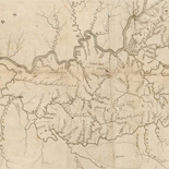
Map of the state of Virginia : containing the counties, principal towns, railroads, rivers, canals & all other internal improvements.
Relief shown by hachures.
Contributor: West & Johnston Site: American Memory-cultural - Main Catalog Original Format: Map Date: 1862 View catalog record -

Portions of Virginia and North Carolina, embracing Richmond & Lynchburg, Va. and Goldsboro & Salisbury, N.C.
Relief shown by hachures.
Contributor: United States. War Dept. Engineer Bureau Site: American Memory-cultural - Main Catalog Original Format: Map Date: 1864 View catalog record -

Map of the Confederate lines from Fort Gregg to Mrs. Price's : [Virginia] /
Relief shown by hachures.
Contributor: Hoffmann, J. Paul Site: American Memory-cultural - Main Catalog Original Format: Map View catalog record -

The heart of the rebellion: scene of the late Seven Days battles near Richmond; new base of operations of the Army of the [P]otomac.
Scale ca. 1:138,000.
Site: American Memory-cultural - Main Catalog Original Format: Map Date: 1862 View catalog record -

Sketch of McClelland's [sic] position, July 7th, 1862 /
Shows McClellan's army at Harrison's Landing in Charles City County and shows names of some residents.
Contributor: Blackford, W. W. Site: American Memory-cultural - Main Catalog Original Format: Map Date: 1862 View catalog record -

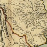
From Cold Mt. in Amherst across Rockbridge & Bath cos., Va. & part of Pocahontas Co., W. Va. /
Date and scale from Stephenson's Civil War maps, 1989.
Contributor: Ruffner, W. H. Site: American Memory-cultural - Main Catalog Original Format: Map Date: 1861 View catalog record -

Map of the State of Virginia
Scale ca. 1:887,040.
Contributor: Nicholson, W. L. Site: American Memory-cultural - Main Catalog Original Format: Map Date: 1865 View catalog record -

Col. William Allen's map of the vicinity of Hanover Junction.
Shows names of some residents in Hanover County.
Contributor: Allen, William Wirt Site: American Memory-cultural - Main Catalog Original Format: Map Date: 1864 View catalog record -

Map of Lunenburg County, Virginia.
LC Land ownership maps, 1294
Site: American Memory-cultural - Main Catalog Original Format: Map View catalog record -

Map of Bedford Co.
LC Land ownership maps, 1215
Site: American Memory-cultural - Main Catalog Original Format: Map View catalog record -

Richmond & vicinity.
Relief shown by hachures.
Site: American Memory-cultural - Main Catalog Original Format: Map View catalog record -

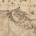
The siege of Yorktown, April 1862
Scale not given.
Contributor: Worret, Ch Site: American Memory-cultural - Main Catalog Original Format: Map Date: 1862 View catalog record -

Topographical map of the Bull Run battle-field. [1861].
Scale ca. 1:27,000.
Contributor: Harris, D. B. Site: American Memory-cultural - Main Catalog Original Format: Map Date: 1861 View catalog record -

Jetersville and Sailors Creek. [1865]
Scale 1:21,120.
Contributor: Michler, N. Site: American Memory-cultural - Main Catalog Original Format: Map Date: 1867 View catalog record -

[Map of portions of Orange, Louisa, Spotsylvania, and Culpeper counties, Virginia].
Title, date, and scale from Stephenson's Civil War maps, 1989.
Site: American Memory-cultural - Main Catalog Original Format: Map Date: 1864 View catalog record -

Hanover County, Virginia /
Pencil and pen-and-ink over pencil grid on paper mounted on cloth.
Contributor: Hotchkiss, Jedediah Site: American Memory-cultural - Main Catalog Original Format: Map Date: 1867 View catalog record -

Map of the seat of war /
Covers Virginia and Maryland and portions of Delaware, Pennsylvania, New Jersey and North Carolina.
Contributor: Evans & Cogswell Site: American Memory-cultural - Main Catalog Original Format: Map Date: 1861 View catalog record -

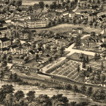
Encampment of U.St. troops at Newport News, Va., 1861 & 1862 /
Bird's eye view.
Contributor: E. Sachse & Co Site: American Memory-cultural - Main Catalog Original Format: Map Date: 1862 View catalog record -

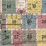
Map of the Springfield & Deep Run estates on the Coal Lands of the N. York & Richmond Coal Co, in Henrico Co. Virginia, their ...
Scale ca. 1:320,000.
Contributor: DeBow, S. Herries Site: American Memory-cultural - Main Catalog Original Format: Map Date: 1856 View catalog record
Refine your search
Original Format
- Map