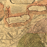
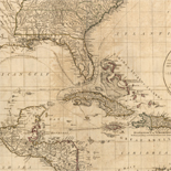
![Plano. I descripcion de la costa, desde el Cavo Cañaveral, hasta cerca de la boca de la Vir[g]inia, contando, costa de Florida, Georgia y Carolinas del S, y N, con todos sus puertos, este[ros ... ]letas, baxos, islas y rios; segun las vlti[mas not]icias, hata [sic] oy Octubre de 1756.](https://cybercemetery.unt.edu/archive/oilspill/20121228214950im_/http://www.loc.gov/collections/static/american-revolutionary-war-maps/images/ct000339.jpg)

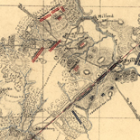
![[Sketch of the battles of Chancellorsville, Salem Church, and Fredericksburg], May 2, 3, and 4, 1863](https://cybercemetery.unt.edu/archive/oilspill/20121228214950im_/http://www.loc.gov/collections/static/civil-war-maps/images/cwh00129.jpg)
Results
-

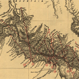
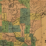
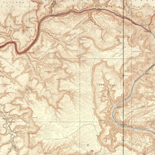
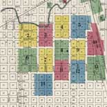
[Map of northeastern Alabama and northwestern Georgia showing movement of Union troops under the command of Gen. Edward M. McCook].
Relief shown by hachures.
Site: American Memory-cultural - Main Catalog Original Format: Map Date: 1864 View catalog record -

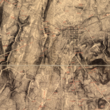
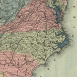
Map of middle and east Tennessee and parts of Alabama and Georgia /
Railroads are colored red, drainage is blue, and some roads are brown. A few corrections in ink are indicated in the vicinity of Chattanooga.
Contributor: Michler, N. Site: American Memory-cultural - Main Catalog Original Format: Map Date: 1862 View catalog record -

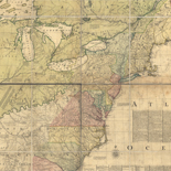
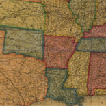
Map of Georgia & Alabama exhibiting the post offices, post roads, canals, rail roads & c.; by David H. Burr (Late topographer to the Post ...
Scale ca. 1:650,000.
Contributor: Burr, David H. Site: American Memory-cultural - Main Catalog Original Format: Map Date: 1839 View catalog record -

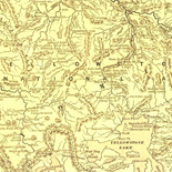
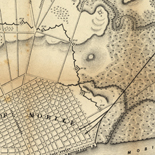
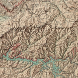
Part of northern Georgia : no. 2 /
Covers a portion of northwestern Georgia and adjacent Alabama to the west of Atlanta.
Contributor: Merrill, W. E. Site: American Memory-cultural - Main Catalog Original Format: Map Date: 1864 View catalog record -

Northern Alabama and Georgia /
Relief shown by hachures.
Contributor: Lindenkohl, A. Site: American Memory-cultural - Main Catalog Original Format: Map Date: 1864 View catalog record -

Northern Alabama and Georgia /
Relief shown by hachures.
Contributor: Lindenkohl, A. Site: American Memory-cultural - Main Catalog Original Format: Map Date: 1864 View catalog record -
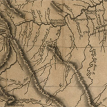
Map by which the Creek Indians gave their statement at Fort Strother on the 22nd Jany, 1816 : [Alabama and Georgia].
Shows Alabama and Georgia from the Tombigbee River in the west to the southern Great Smoky Mountains and the Savannah River in the east and indicating U.S. Army forts in that region.
Site: American Memory-cultural - Main Catalog Original Format: Map Date: 1816 View catalog record -

Northern Alabama and Georgia /
Relief shown by hachures.
Contributor: Lindenkohl, A. Site: American Memory-cultural - Main Catalog Original Format: Map Date: 1864 View catalog record -

[Map of South Carolina, Georgia, Alabama, and Tennessee.]
NOTE: Researchers will be served a color photocopy of this diary page.
Contributor: Sneden, Robert Knox Site: American Memory-cultural Original Format: Map Date: 1861 -

Northern Alabama and Georgia /
Relief shown by hachures.
Contributor: Lindenkohl, A. Site: American Memory-cultural - Main Catalog Original Format: Map Date: 1864 View catalog record -

Map of northern Georgia /
Also shows eastern Alabama.
Contributor: Merrill, W. E. Site: American Memory-cultural - Main Catalog Original Format: Map Date: 1864 View catalog record
Refine your search
Original Format
- Map
Online Format
- Image
Date
Site
- American Memory-cultural
- Main Catalog [10]
Contributor
Subject
- Georgia
- United States
- Alabama
- History [3]
- Civil War [2]
- Tennessee [2]
- Confederate States of America [1]
- Creek Indians [1]
- East [1]
- 19Th Century [1]
-
More Subjects