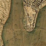


![Boston its environs and harbour, with the rebels works raised against that town in 1775... Sir Thomas Hyde Page, [1775?].](https://cybercemetery.unt.edu/archive/oilspill/20121228214749im_/http://www.loc.gov/collections/static/american-revolutionary-war-maps/images/ct000070.jpg)
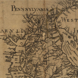
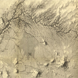
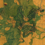
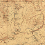
![[Base map of Alabama].](https://cybercemetery.unt.edu/archive/oilspill/20121228214749im_/http://www.loc.gov/collections/static/hotchkiss-maps/images/cwh00201.jpg)
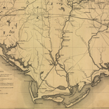
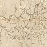
![[Topographical map of part of Washington D.C.].](https://cybercemetery.unt.edu/archive/oilspill/20121228214749im_/http://www.loc.gov/collections/static/civil-war-maps/images/cw0688500.jpg)

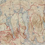
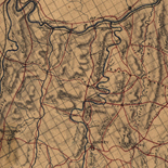
![[Sketch of the battles of Chancellorsville, Salem Church, and Fredericksburg], May 2, 3, and 4, 1863](https://cybercemetery.unt.edu/archive/oilspill/20121228214749im_/http://www.loc.gov/collections/static/civil-war-maps/images/cwh00129.jpg)


Results
-

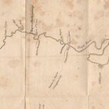
[Union troop positions at Peach Tree Creek, Georgia, July 20, 1864].
Shows Union camps and troop positions in north Atlanta.
Site: American Memory-cultural - Main Catalog Original Format: Map Date: 1864-07-20 View catalog record -
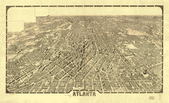
Atlanta.
Perspective map not drawn to scale.
Contributor: Foote and Davies Company (Atlanta, Ga.) Site: American Memory-cultural - Main Catalog Original Format: Map Date: 1919 View catalog record -

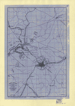
Map illustrating the military operations in front of Atlanta, Ga. From the passage of Peach Tree Creek, July 19th 1864, to the commencement of the ...
Scale ca. 1:32,000.
Contributor: United States. Army. Corps of Engineers Site: American Memory-cultural - Main Catalog Original Format: Map Date: 1875 View catalog record -

Map illustrating the siege of Atlanta, Ga. by the U.S. forces under command of Maj. Gen. W. T. Sherman, from the passage of Peach Tree ...
Scale ca. 1:47,520.
Contributor: Poe, O. M. Site: American Memory-cultural - Main Catalog Original Format: Map Date: 1866-01-01 View catalog record -

Map illustrating the siege of Atlanta, Ga., by the U.S. forces under command of Maj. Gen. W.T. Sherman, from the passage of Peach Tree Creek, ...
Partial cadastral map showing selected buildings and householders' names beyond city limits.
Contributor: Poe, O. M. Site: American Memory-cultural - Main Catalog Original Format: Map Date: 1865-01-01 View catalog record -

Map of Atlanta and vicinity. [July 1864].
Scale ca. 1:165,000.
Contributor: Western and Atlantic Railroad Company Site: American Memory-cultural - Main Catalog Original Format: Map Date: 1887 View catalog record -

Birds eye view of the city of Atlanta, the capitol of Georgia 1871.
Perspective map not drawn to scale.
Contributor: Ruger, A. Site: American Memory-cultural - Main Catalog Original Format: Map Date: 1871 View catalog record -

Civil War Centennial, city of Atlanta : showing the area of the three major engagements and deployment of Union and Confederate forces during the summer ...
Scale ca. 1:24,000.
Contributor: Georgia. State Highway Dept Site: American Memory-cultural - Main Catalog Original Format: Map Date: 1964 View catalog record -

Atlanta, Georgia and its rebel defences [sic]
Color coding indicates the location of Union and Confederate forces.
Contributor: Sneden, Robert Knox Site: American Memory-cultural Original Format: Map Date: 1861 -

Map showing Genl. Sherman's march from Chattanooga to Atlanta.
Color coding indicates the location of Union and Confederate forces.
Contributor: Sneden, Robert Knox Site: American Memory-cultural Original Format: Map Date: 1861 -

Sherman's march from Atlanta to the sea. Drawn from official map of Brig. Genl. O. M. Poe, Chief Engineer.
NOTE: Researchers will be served a color photocopy of this diary page.
Contributor: Sneden, Robert Knox Site: American Memory-cultural Original Format: Map Date: 1861 -

Atlanta : from Vincent's subdivision map, published by the City Council /
From Vincent's subdivision map of the city of Atlanta, Dekalb County, state of Georgia. Savannah : Edward A. Vincent, 185-.
Contributor: United States. Army of the Cumberland. Topographical Engineers Office Site: American Memory-cultural - Main Catalog Original Format: Map Date: 1864 View catalog record -

Vincent's subdivision map of the city of Atlanta, Dekalb County, state of Georgia : showing all the lots, blocks, sections, &c.
Cadastral map.
Contributor: Vincent, Edward A. Site: American Memory-cultural - Main Catalog Original Format: Map View catalog record -

Bird's eye view of Atlanta, Fulton Co., State capital, Georgia.
Perspective map not drawn to scale.
Contributor: Koch, Augustus Site: American Memory-cultural - Main Catalog Original Format: Map Date: 1892 View catalog record -

Map of Atlanta and vicinity /
Shows fortifications, roads, railroads, rivers, and towns. The battles of peach Tree Creek (July 20), Atlanta (July 22), and Ezra Church (July 28) are indicated.
Contributor: Western and Atlantic Railroad Company Site: American Memory-cultural - Main Catalog Original Format: Map Date: 1864 View catalog record -

Map showing the operations of the national forces under the command of Maj. Gen. W.T. Sherman during the campaign resulting in the capture of Atlanta, ...
Relief shown by hachures.
Contributor: Hergesheimer, E. Site: American Memory-cultural - Main Catalog Original Format: Map Date: 1864 View catalog record -

Atlanta.
Appears to be an unfinished tracing of the map Atlanta, from Vincent's subdivision map / Army of the Cumberland, Topographical Engineers Office, 1864 (Sherman 44).
Site: American Memory-cultural - Main Catalog Original Format: Map Date: 1864 View catalog record -

Georgia.
NOTE: Researchers will be served a color photocopy of this diary page.
Contributor: Sneden, Robert Knox Site: American Memory-cultural Original Format: Map Date: 1861 -

Map illustrating the siege of Atlanta, Ga. by the U.S. forces, under command of Maj. Gen. W.T. Sherman : from the passage of Peach Tree ...
Relief shown by hachures and spot heights.
Contributor: Poe, O. M. Site: American Memory-cultural - Main Catalog Original Format: Map Date: 1864-08-26 View catalog record -
Atlanta & vicinity : compiled from state map and information /
Shows fortifications around Atlanta.
Contributor: Finegan, N. Site: American Memory-cultural - Main Catalog Original Format: Map Date: 1864 View catalog record
Refine your search
Original Format
- Map
Online Format
- Image
Site
- American Memory-cultural
- Main Catalog [16]
Contributor
- Sneden, Robert Knox [4]
- Poe, O. M. [3]
- Western And Atlantic Railroad Company [2]
- Finegan, N. [1]
- Hergesheimer, E. [1]
- United States. Army of The Cumberland. Topographical Engineers Office [1]
- Ruger, A. [1]
- Georgia. State Highway Dept [1]
- Koch, Augustus [1]
- Foote And Davies Company (Atlanta, Ga.) [1]
-
More Contributors