![[Base map of Alabama].](https://cybercemetery.unt.edu/archive/oilspill/20121228213424im_/http://www.loc.gov/collections/static/hotchkiss-maps/images/cwh00201.jpg)
![[December 23, 1944], HQ Twelfth Army Group situation map.](https://cybercemetery.unt.edu/archive/oilspill/20121228213424im_/http://www.loc.gov/collections/static/world-war-ii-maps-military-situation-maps-from-1944-to-1945/images/ict21202.jpg)
![Map of the Rappahannock River from [sic] Port Royal to Richards Ferry](https://cybercemetery.unt.edu/archive/oilspill/20121228213424im_/http://www.loc.gov/collections/static/civil-war-maps/images/cw0619600.jpg)


![[Topographical map of part of Washington D.C.].](https://cybercemetery.unt.edu/archive/oilspill/20121228213424im_/http://www.loc.gov/collections/static/civil-war-maps/images/cw0688500.jpg)
Results
-

Middle Georgia & South Carolina /
Scale ca. 1:633,600; 1 in. = 10 miles.
Contributor: United States Coast Survey Site: American Memory-cultural - Main Catalog Original Format: Map Date: 1865 View catalog record -

[Union troop positions at Peach Tree Creek, Georgia, July 20, 1864].
Shows Union camps and troop positions in north Atlanta.
Site: American Memory-cultural - Main Catalog Original Format: Map Date: 1864-07-20 View catalog record -

Map of Marietta and vicinity. [June 1864]
Scale ca. 1:185,000.
Contributor: Western and Atlantic Railroad Company Site: American Memory-cultural - Main Catalog Original Format: Map Date: 1864 View catalog record -

Georgia, Chickamauga and Chattanooga National Military Park (Chickamauga Battlefield) /
Scale 1:9,600 or 1 in. = 800 ft.
Contributor: Geological Survey (U.S.) Site: American Memory-cultural - Main Catalog Original Format: Map Date: 1975 View catalog record -

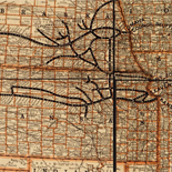
Map of part of Fulton, Fayette, and Campbell counties, from surveys, state map, and information, extra copies to be filled up and returned for second ...
Relief shown by hachures.
Contributor: United States. Army of the Cumberland. Topographical Engineers Office Site: American Memory-cultural - Main Catalog Original Format: Map Date: 1864 View catalog record -

Camp McDonald; a school of Instruction for the 4th Brigade Georgia Volunteers
Scale 1:2400.
Contributor: McClellan, I. B. Site: American Memory-cultural - Main Catalog Original Format: Map Date: 1917 View catalog record -

[Fortifications west of Dalton, Georgia].
Relief shown by hachures.
Site: American Memory-cultural - Main Catalog Original Format: Map Date: 1864 View catalog record -

Beaufort Harbor and coast line between Charleston, S.C. and Savanna [sic] Ga., with 5 mile distance lines in circles round Beaufort, and R.R. connections, roads, ...
Scale not given.
Contributor: L. Prang & Co Site: American Memory-cultural - Main Catalog Original Format: Map Date: 1861 View catalog record -

[Union troop positions northwest of Marietta, Georgia, June? 1864].
Relief shown by hachures.
Site: American Memory-cultural - Main Catalog Original Format: Map Date: 1864 View catalog record -
Atlanta.
Perspective map not drawn to scale.
Contributor: Foote and Davies Company (Atlanta, Ga.) Site: American Memory-cultural - Main Catalog Original Format: Map Date: 1919 View catalog record -

Chickamauga and Chattanooga National Military Park.
Scale ca. 1:95,000.
Contributor: United States. National Park Service Site: American Memory-cultural - Main Catalog Original Format: Map Date: 1968 View catalog record -
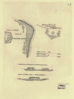
Works at eastern point of Whitmarsh Island [and] bastion on the line of defences [sic] across Whitmarsh Island.
Shows fortification of Savannah, Georgia.
Site: American Memory-cultural - Main Catalog Original Format: Map Date: 1864 View catalog record -

[Map of the Union troop positions southwest of Marietta, Georgia, June 10-July 3, 1864].
Title and date from Stephenson's Civil War maps, 1989.
Site: American Memory-cultural - Main Catalog Original Format: Map Date: 1864-07-03 View catalog record -

Andersonville Prison, Georgia in July 1864.
Lower margin of the map: "Whole Content of Stockade 25 1/2 acres, including swamp. Number of Prisoners July 1st."
Contributor: Sneden, Robert Knox Site: American Memory-cultural Original Format: Map Date: 1861 -

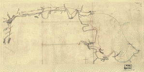
Map[s] illustrating the military operations of the Atlanta campaign ... 1864 /
Shows Union Army lines of march, dates, troop positions, and campsites in northwestern Georgia between Chattanooga and Atlanta.
Site: American Memory-cultural - Main Catalog Original Format: Map Date: 1874 View catalog record -

Map illustrating the military operations in front of Atlanta, Ga. From the passage of Peach Tree Creek, July 19th 1864, to the commencement of the ...
Scale ca. 1:32,000.
Contributor: United States. Army. Corps of Engineers Site: American Memory-cultural - Main Catalog Original Format: Map Date: 1875 View catalog record -

Map[s] illustrating the military operations of the Atlanta campaign ... 1864 /
Relief shown by hachures.
Site: American Memory-cultural - Main Catalog Original Format: Map Date: 1875 View catalog record -

[Map of Catoosa County and parts of Whitfield, Murray, and Walker counties, Georgia] Chattanooga, Sept. 12 [1863?] /
Relief shown by hachures.
Contributor: U.S. Army Topographic Engineering Center Site: American Memory-cultural - Main Catalog Original Format: Map Date: 1863 View catalog record -

Battle-field of Chickamauga. [Sept 18-20, 1863].
Scale ca. 1:84,000.
Contributor: Wells, Jacob Site: American Memory-cultural - Main Catalog Original Format: Map Date: 1887 View catalog record -
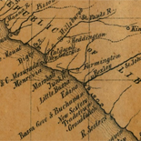
[Map of the Etowah River from Rome to Cartersville, Georgia].
Shows fords, bridges, and ferries across the Etowah River spanning southeastern Floyd County and southwestern Bartow County, Georgia. Fortifications shown at Caldwell Ford, Bartow County.
Site: American Memory-cultural - Main Catalog Original Format: Map Date: 1864 View catalog record
Refine your search
Original Format
- Map
Online Format
Contributor
- Sneden, Robert Knox [30]
- Lindenkohl, A. [15]
- Western And Atlantic Railroad Company [11]
- United States Coast Survey [8]
- United States. Army. Dept. of The Cumberland. Topographical Engineers [8]
- United States. Army of The Cumberland. Topographical Engineers Office [5]
- Geological Survey (U.S.) [5]
- United States. National Park Service [5]
- Poe, O. M. [5]
- Blakeslee, G. H. [4]
-
More Contributors