The National Map

|
Boundaries
Governmental Units Model -- March 1, 2006 (Plot size 36"x24"; 2.1MB PDF)
|

![]() U.S. Department of the Interior |
U.S. Geological Survey
U.S. Department of the Interior |
U.S. Geological Survey
URL: http://nationalmap.gov/boundaries.html
Page Contact Information: The National Map
Page Last Modified: Monday, 14-Jan-2013 17:56:42 EST

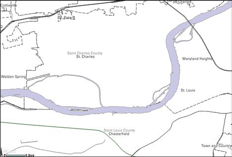 Boundaries data or governmental units represent major civil areas including states, counties, Federal, and Native American lands, and incorporated places such as cities and towns. These data are useful for understanding the extent of jurisdictional or administrative areas for a wide range of applications, including managing resources, responding to natural disasters, or recreational activities such as hiking and backpacking. Governmental unit data downloads can be accessed at: