![[December 18, 1944], HQ Twelfth Army Group situation map.](https://cybercemetery.unt.edu/archive/oilspill/20130114071357im_/http://www.loc.gov/collections/static/world-war-ii-maps-military-situation-maps-from-1944-to-1945/images/ict21197.jpg)
![[Sketch of the Manassas battlefield].](https://cybercemetery.unt.edu/archive/oilspill/20130114071357im_/http://www.loc.gov/collections/static/hotchkiss-maps/images/cwh00108.jpg)
![[Detailed map of part of Virginia from Alexandria to the Potomac River above Washington, D.C. 1886].](https://cybercemetery.unt.edu/archive/oilspill/20130114071357im_/http://www.loc.gov/collections/static/civil-war-maps/images/cw0523000.jpg)
![[Coast of Maine from Frenchmans Bay to Mosquito Harbor].](https://cybercemetery.unt.edu/archive/oilspill/20130114071357im_/http://www.loc.gov/collections/static/american-revolutionary-war-maps/images/np000011.jpg)
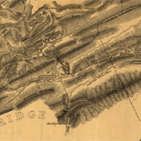
![[Map of cavalry engagement near Bridgewater, Va. Oct. 4th and 5th, 1864]](https://cybercemetery.unt.edu/archive/oilspill/20130114071357im_/http://www.loc.gov/collections/static/hotchkiss-maps/images/cwh00193.jpg)
![[January 3, 1945], HQ Twelfth Army Group situation map.](https://cybercemetery.unt.edu/archive/oilspill/20130114071357im_/http://www.loc.gov/collections/static/world-war-ii-maps-military-situation-maps-from-1944-to-1945/images/ict21213.jpg)
![A correct map of a section of the United States showing the allignment [sic] of the Pittsburgh, Marion, and Chicago Railway between Chewton, Penna. and Marion, Ohio and connections.](https://cybercemetery.unt.edu/archive/oilspill/20130114071357im_/http://www.loc.gov/collections/static/railroad-maps-1828-to-1900/images/rr005350.jpg)
Results
-


Gun Lake : Allegan & Barry counties. Catalog Record Only
Depths shown by contours and spot heights.
Site: Main Catalog Original Format: Map Date: 1988 -
Map of Barry County, Michigan / Catalog Record Only
"Basic map from Michigan State Highway Department."
Contributor: W.S. McAlpine Map Co Site: Main Catalog Original Format: Map Date: 1951 -
Sanborn Fire Insurance Map from Mancelona, Antrim County, Michigan.
3 Sheet(s). Feb 1896.
Site: American Memory-cultural Original Format: Map Date: 1896-01-01 -
Triennial atlas & plat book, Oceana County, Michigan with index to owners. Catalog Record Only
Title from cover.
Contributor: Rockford Map Publishers Site: Main Catalog Original Format: Map Date: 1968 -
Plymouth downtown walking map. Catalog Record Only
Panel title.
Site: Main Catalog Original Format: Map Date: 1996 -
Newaygo County, Michigan, land atlas, plat book, sportsman's guide : 1996. Catalog Record Only
Shows federal, state and county lands located within forests, parks & game areas.
Contributor: Rockford Map Publishers Site: Main Catalog Original Format: Map Date: 1996 -
Monroe Charter Township, tourist map, Monroe Charter Township, Monroe County, Michigan / Catalog Record Only
"March 1985."
Contributor: Maurice Parkins Associates Site: Main Catalog Original Format: Map Date: 1985 -
Fish Ottawa County, Holland & Grand Haven, Michigan. Catalog Record Only
Title from panel.
Site: Main Catalog Original Format: Map Date: 2003 -
City of Niles, Michigan. Catalog Record Only
Scale ca. 1:12,200.
Contributor: Niles, Mich. City Engineer Site: Main Catalog Original Format: Map Date: 1975 -
Sanborn Fire Insurance Map from Harbor Springs, Emmet County, Michigan.
4 Sheet(s). Sep 1900.
Site: American Memory-cultural Original Format: Map Date: 1900-01-01 -
Roscommon County, Michigan, land atlas & plat book : 1990. Catalog Record Only
Cover title.
Contributor: Rockford Map Publishers Site: Main Catalog Original Format: Map Date: 1990 -
Sanborn Fire Insurance Map from Detroit, Wayne County, Michigan.
Key map to edition. Bound. 104 Sheet(s). Vol. 11, 1929.
Site: American Memory-cultural Original Format: Map Date: 1929 -
Sanborn Fire Insurance Map from Petoskey, Emmet County, Michigan.
518. Includes Alanson, Bay Shore, Clarion, Bay View, Kegomic, Oden, Walloon Lake. 32 Sheet(s). Aug 1929 - Mar 1950.
Site: American Memory-cultural Original Format: Map Date: 1950-01-01 -
Sanborn Fire Insurance Map from Farmington, Oakland County, Michigan.
3 Sheet(s). Jun 1933.
Site: American Memory-cultural Original Format: Map Date: 1933-01-01 -
Sanborn Fire Insurance Map from Pinckney, Livingston County, Michigan.
519. 2 Sheet(s). Sep 1930.
Site: American Memory-cultural Original Format: Map Date: 1930-01-01 -
Manistee County, Michigan, four season vacationland. Catalog Record Only
Panel title.
Contributor: Manistee Area Chamber of Commerce Site: Main Catalog Original Format: Map Date: 1996 -
Michigan snowmobile trails. Catalog Record Only
Title from panel.
Contributor: Universal Map (Firm) Site: Main Catalog Original Format: Map Date: 1990 -
Visitors map of metropolitan Detroit : map of downtown Detroit with index to important buildings / Catalog Record Only
Panel title.
Contributor: Automobile Club of Michigan Site: Main Catalog Original Format: Map Date: 1965 -
Map of Gratiot County, Michigan / Catalog Record Only
Scale 1:126,720; 1/2 in. = 1 mile.
Contributor: W.S. McAlpine Co Site: Main Catalog Original Format: Map Date: 1935 -
Sanborn Fire Insurance Map from Athens, Calhoun County, Michigan.
2 Sheet(s). Sep 1916.
Site: American Memory-cultural Original Format: Map Date: 1916-01-01
Refine your search
Original Format
- Map
- Web Page [1]
Online Format
Contributor
- Rockford Map Publishers [761]
- Merchant Maps (Firm) [379]
- Automobile Club of Michigan [351]
- Metro Graphic Arts [269]
- Novoprint Usa, Inc [208]
- Universal Map (Firm) [163]
- Rand Mcnally And Company [160]
- United States. Soil Conservation Service [91]
- Dmb Graphic Arts [74]
- Hixson (W.W.) And Company [63]
-
More Contributors