Map
Missouri territory formerly Louisiana.

| Format |
Map |
|---|---|
| Contributors |
Carey, Mathew |
| Dates |
1814 |
| Location |
Canada Prairie Provinces United States |
| Language |
English |
| Subjects |
Canada Prairie Provinces United States West West (U.S.) |
- Title
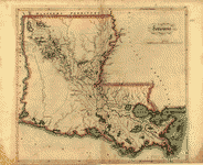
- Missouri territory formerly Louisiana.
- Description
-
Shows boundaries of Missouri Territory.
-
Available also through the Library of Congress web site as a raster image.
-
1 map : col. ; 31 x 34 cm.
- Creator
- Carey, Mathew,
- Created Published
-
[S.l., 1814]
- Subject Headings
-
-
West (U.S.)
-
-
Prairie Provinces
-
-
United States--West.
-
-
Canada--Prairie Provinces.
- Notes
-
-
Shows boundaries of Missouri Territory.
-
-
Available also through the Library of Congress web site as a raster image.
- Medium
-
1 map : col. ; 31 x 34 cm.
- Call Number
-
G4050 1814 .C3 TIL
- Repository
-
Library of Congress Geography and Map Division Washington, D.C. 20540-4650 dcu
- Digital Id
-
g4050 ct000653 http://hdl.loc.gov/loc.gmd/g4050.ct000653
- Library of Congress Catalog Number
- 2001620467
Rights & Access
The maps in the Map Collections materials were either published prior to 1922, produced by the United States government, or both (see catalogue records that accompany each map for information regarding date of publication and source). The Library of Congress is providing access to these materials for educational and research purposes and is not aware of any U.S. copyright protection (see Title 17 of the United States Code) or any other restrictions in the Map Collection materials.
Note that the written permission of the copyright owners and/or other rights holders (such as publicity and/or privacy rights) is required for distribution, reproduction, or other use of protected items beyond that allowed by fair use or other statutory exemptions. Responsibility for making an independent legal assessment of an item and securing any necessary permissions ultimately rests with persons desiring to use the item.
More about Copyright and other Restrictions
For guidance about compiling full citations consult Citing Primary Sources.
Part of...
-
Louisiana: European Explorations And The Louisiana Purchase
[77]
-
Discovery And Exploration
[150]
-
Geography And Maps Division
[60803]
-
American Memory
[1121009]
More maps like this
-
 Missouri territory formerly Louisiana.
Contributor:
Carey, Mathew
Site:
American Memory-cultural, Main Catalog
Original Format:
Map
Date:
1814
View catalog record
Missouri territory formerly Louisiana.
Contributor:
Carey, Mathew
Site:
American Memory-cultural, Main Catalog
Original Format:
Map
Date:
1814
View catalog record
-
 Louisiana.
Contributor:
Carey, Mathew
Site:
American Memory-cultural, Main Catalog
Original Format:
Map
Date:
1814
View catalog record
Louisiana.
Contributor:
Carey, Mathew
Site:
American Memory-cultural, Main Catalog
Original Format:
Map
Date:
1814
View catalog record
-
 Vermont, from actual survey.
Contributor:
Carey, Mathew
Site:
American Memory-cultural, Main Catalog
Original Format:
Map
Date:
1814
View catalog record
Vermont, from actual survey.
Contributor:
Carey, Mathew
Site:
American Memory-cultural, Main Catalog
Original Format:
Map
Date:
1814
View catalog record
-
 Connecticut, from the best authorities.
Contributor:
Carey, Mathew
Site:
American Memory-cultural, Main Catalog
Original Format:
Map
Date:
1795
View catalog record
Connecticut, from the best authorities.
Contributor:
Carey, Mathew
Site:
American Memory-cultural, Main Catalog
Original Format:
Map
Date:
1795
View catalog record
-
 North Carolina.
Contributor:
Carey, Mathew
Site:
American Memory-cultural, Main Catalog
Original Format:
Map
Date:
1814
View catalog record
North Carolina.
Contributor:
Carey, Mathew
Site:
American Memory-cultural, Main Catalog
Original Format:
Map
Date:
1814
View catalog record
-
 A map of the north west parts of America, with the utmost respect, inscrib'd to His Excellency, Sir Guy Carleton, Knight of the Bath: Captain ...
Contributor:
Henry, Alexander
Site:
American Memory-cultural, Main Catalog
Original Format:
Map
Date:
1776
View catalog record
A map of the north west parts of America, with the utmost respect, inscrib'd to His Excellency, Sir Guy Carleton, Knight of the Bath: Captain ...
Contributor:
Henry, Alexander
Site:
American Memory-cultural, Main Catalog
Original Format:
Map
Date:
1776
View catalog record
-
 Louisiana.
Contributor:
Lewis, Samuel
Site:
American Memory-cultural, Main Catalog
Original Format:
Map
Date:
1805
View catalog record
Louisiana.
Contributor:
Lewis, Samuel
Site:
American Memory-cultural, Main Catalog
Original Format:
Map
Date:
1805
View catalog record
-
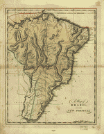 A map of Brazil, now called New Portugal.
Contributor:
Carey, Mathew
Site:
American Memory-cultural, Main Catalog
Original Format:
Map
Date:
1814
View catalog record
A map of Brazil, now called New Portugal.
Contributor:
Carey, Mathew
Site:
American Memory-cultural, Main Catalog
Original Format:
Map
Date:
1814
View catalog record
-
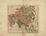
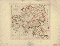 Asia according to the best authorities.
Contributor:
Carey, Mathew
Site:
American Memory-cultural, Main Catalog
Original Format:
Map
Date:
1814
View catalog record
Asia according to the best authorities.
Contributor:
Carey, Mathew
Site:
American Memory-cultural, Main Catalog
Original Format:
Map
Date:
1814
View catalog record
-
 Map of the World from the best authorities.
Contributor:
Carey, Mathew
Site:
American Memory-cultural, Main Catalog
Original Format:
Map
Date:
1795
View catalog record
Map of the World from the best authorities.
Contributor:
Carey, Mathew
Site:
American Memory-cultural, Main Catalog
Original Format:
Map
Date:
1795
View catalog record
-
 A map of Brazil, now called New Portugal.
Contributor:
Carey, Mathew
Site:
American Memory-cultural, Main Catalog
Original Format:
Map
Date:
1818
View catalog record
A map of Brazil, now called New Portugal.
Contributor:
Carey, Mathew
Site:
American Memory-cultural, Main Catalog
Original Format:
Map
Date:
1818
View catalog record
-
 Asia according to the best authorities.
Contributor:
Carey, Mathew
Site:
American Memory-cultural, Main Catalog
Original Format:
Map
Date:
1814
View catalog record
Asia according to the best authorities.
Contributor:
Carey, Mathew
Site:
American Memory-cultural, Main Catalog
Original Format:
Map
Date:
1814
View catalog record
-
 Carte du Canada et des Etats-Unis de l'Amérique Septentrionale /
Contributor:
Robert de Vaugondy, Gilles
Site:
American Memory-cultural, Main Catalog
Original Format:
Map
Date:
1778
View catalog record
Carte du Canada et des Etats-Unis de l'Amérique Septentrionale /
Contributor:
Robert de Vaugondy, Gilles
Site:
American Memory-cultural, Main Catalog
Original Format:
Map
Date:
1778
View catalog record
-
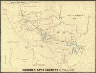 Hudson's Bay's country /
Contributor:
Kohl, J. G.
Site:
American Memory-cultural, Main Catalog
Original Format:
Map
Date:
1850
View catalog record
Hudson's Bay's country /
Contributor:
Kohl, J. G.
Site:
American Memory-cultural, Main Catalog
Original Format:
Map
Date:
1850
View catalog record
-
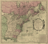 Bowles's new pocket map of the United States of America; the British possessions of Canada, Nova Scotia, and Newfoundland, with the French and Spanish territories ...
Contributor:
Bowles, Carington
Site:
American Memory-cultural, Main Catalog
Original Format:
Map
Date:
1783
View catalog record
Bowles's new pocket map of the United States of America; the British possessions of Canada, Nova Scotia, and Newfoundland, with the French and Spanish territories ...
Contributor:
Bowles, Carington
Site:
American Memory-cultural, Main Catalog
Original Format:
Map
Date:
1783
View catalog record
-
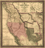 A new map of Texas, Oregon and California.
Contributor:
Mitchell, S. Augustus
Site:
American Memory-cultural, Main Catalog
Original Format:
Map
Date:
1846
View catalog record
A new map of Texas, Oregon and California.
Contributor:
Mitchell, S. Augustus
Site:
American Memory-cultural, Main Catalog
Original Format:
Map
Date:
1846
View catalog record
You might also like
-
-

 Your national parks,
Contributor:
Mills, Enos Abijah
Site:
Main Catalog
Original Format:
Book
Date:
1917
Your national parks,
Contributor:
Mills, Enos Abijah
Site:
Main Catalog
Original Format:
Book
Date:
1917
-
Wanderings in the western land.
Contributor:
Vivian, A. Pendarves
Site:
Main Catalog
Original Format:
Book
Date:
1879
-
Canadian nights;
Contributor:
Dunraven, Windham Thomas Wyndham-Quin
Site:
Main Catalog
Original Format:
Book
Date:
1914
-
Five months' fine weather in Canada, western U. S., and Mexico,
Contributor:
Carbutt, Mary Rhodes
Site:
Main Catalog
Original Format:
Book
Date:
1889
-
The boundary line between the British provinces and the United States.
Contributor:
Bird, William A.
Site:
Main Catalog
Original Format:
Book
Date:
1864