Featured Items
-
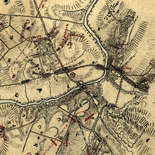
![[Sketch of the battles of Chancellorsville, Salem Church, and Fredericksburg], May 2, 3, and 4, 1863](https://cybercemetery.unt.edu/archive/oilspill/20130114051620im_/http://www.loc.gov/collections/static/civil-war-maps/images/cwh00129.jpg)
[Sketch of the battles of Chancellorsville, Salem Church, and ...
-
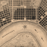
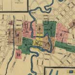
Plan of the city and suburbs of New Orleans: from an actual ...
-
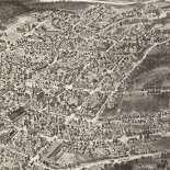
Aero view of Peekskill, New York 1911.
-

Great Smoky Mountains National Park, North Carolina-Tennessee, ...
-
Topographic map of the Grand Canyon National Park Arizona.
-
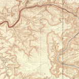
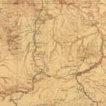
From Fort Smith to the Rio Grande : from explorations and ...
-
Seat of war in America, 6d.
-
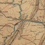
Battle of Monocacy.
-
![[December 23, 1944], HQ Twelfth Army Group situation map.](https://cybercemetery.unt.edu/archive/oilspill/20130114051620im_/http://www.loc.gov/collections/static/world-war-ii-maps-military-situation-maps-from-1944-to-1945/images/ict21202.jpg)
[December 23, 1944], HQ Twelfth Army Group situation map.
-
Maine.
-

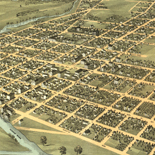
Bird's eye view of the city of Peru, Miami Co., Indiana 1868.
-
Railroad map showing the lands of the Standard Coal and Iron Co....
-
San Antonio, Bexar County, Texas.
-

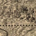
L'hydrographie françoise : recueil des cartes générales et ...
-

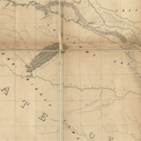
A map of the Internal Provinces of New Spain.
-

The United States of America laid down from the best ...
-

Bird's eye view of Key West, Fla., Key West Island, C.S. Monroe ...
-

Grand Canyon of the Colorado.
-
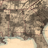
Map showing the distribution of slaves in the Southern States
-
Bird's eye view of the city of Mount Vernon
-
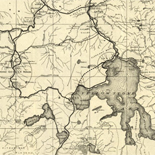
Map of the tourist routes, Yellowstone National Park.
-
Topographical map of the Yellowstone National Park, ...
-

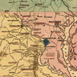
Washington, District of Columbia, District of Columbia.
-
Americae sive qvartae orbis partis nova et exactissima ...
-
Part of map of portions of the milit'y dep'ts of Washington, ...
-
![[January 18, 1945], HQ Twelfth Army Group situation map.](https://cybercemetery.unt.edu/archive/oilspill/20130114051620im_/http://www.loc.gov/collections/static/world-war-ii-maps-military-situation-maps-from-1944-to-1945/images/ict21228.jpg)
[January 18, 1945], HQ Twelfth Army Group situation map.
-
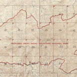
Proposed Great Smoky Mountains National Park
-

Montpelier, Washington County, Vermont.
-
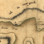
Reconnoissance, juillet 1781.
-

Carte de l'Amerique septentrionale pour servir à l'histoire de ...
↓ Refine your search
Results
-
Early European Maps | British Maps | Nineteenth Century Nautical Charts | Mount Desert Island | USGS Maps | National Park Service Maps of Acadia Map of the Discovery of the East ...
| Site: |
LOC.gov web pages |
| Original Format: |
Map - Web Page |
| Date: |
1999-06-02 |
-
Evolving European and American Conceptions of Louisiana to 1803 Until 1803 the exploration and mapping of the territory acquired by the United States in the Louisiana Purchase was undertaken by the major ...
| Site: |
LOC.gov web pages |
| Original Format: |
Map - Web Page |
| Date: |
2007-08-13 |
-
Early European Maps | American Maps and Map Makers | Exploration and Geological Mapping | Environmental Maps | Early USGS Maps | USGS and the TVA -- Topographic Quadrangle Maps | National ...
| Site: |
LOC.gov web pages |
| Original Format: |
Web Page - Map |
| Date: |
1999-06-02 |
Refine your search
Date
-
1650-1659

-
1659
-
1658
-
1657
-
1656
-
1655
-
1654
-
1653
-
1652
-
1651
-
1650

