Featured Items
-
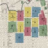
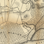
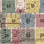
Chickasha, Grady County, Oklahoma.
-
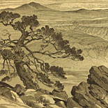
Grand Canyon of the Colorado.
-
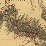
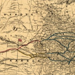
Map showing the Port Royal Railroad and its connections.
-
![[Map of Chancellorsville battlefield, May 3-4, 1863].](https://cybercemetery.unt.edu/archive/oilspill/20130120140748im_/http://www.loc.gov/collections/static/hotchkiss-maps/images/cwh00138.jpg)
[Map of Chancellorsville battlefield, May 3-4, 1863].
-
![Sketch-book of positions of forces of 2nd Corps A.N.Va., campaigns of 1864 : [Virginia]](https://cybercemetery.unt.edu/archive/oilspill/20130120140748im_/http://www.loc.gov/collections/static/hotchkiss-maps/images/cwh00003.jpg)
Sketch-book of positions of forces of 2nd Corps A.N.Va., ...
-
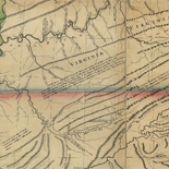
A new map of the western parts of Virginia, Pennsylvania, ...
-
Liberia and its vicinity.
-
Map showing the route and connections of the Wheeling and ...
-
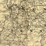
Map of the central portion of the United States showing the ...
-

Chicago, central business section.
-
Rebel defences, Mobile, Alabama occupied by Union forces under ...
-
![Map of the Rappahannock River from [sic] Port Royal to Richards Ferry](https://cybercemetery.unt.edu/archive/oilspill/20130120140748im_/http://www.loc.gov/collections/static/civil-war-maps/images/cw0619600.jpg)
Map of the Rappahannock River from [sic] Port Royal to Richards ...
-
Williams' commercial map of the United States and Canada with ...
-
![[December 23, 1944], HQ Twelfth Army Group situation map.](https://cybercemetery.unt.edu/archive/oilspill/20130120140748im_/http://www.loc.gov/collections/static/world-war-ii-maps-military-situation-maps-from-1944-to-1945/images/ict21202.jpg)
[December 23, 1944], HQ Twelfth Army Group situation map.
-

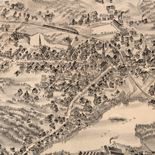
Plymouth, Mass., 1882.
-
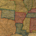
Louisiana.
-
Arlington, Massachusetts, 1884.
-
Cheyenne, Laramie County, Wyoming.
-
![[December 16, 1944], HQ Twelfth Army Group situation map.](https://cybercemetery.unt.edu/archive/oilspill/20130120140748im_/http://www.loc.gov/collections/static/world-war-ii-maps-military-situation-maps-from-1944-to-1945/images/ict21195.jpg)
[December 16, 1944], HQ Twelfth Army Group situation map.
-
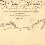
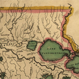
Map of the Red River in Louisiana from the Spanish camp where ...
-
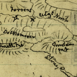
[Sketch of the vicinity of the Shenandoah Iron Works
-
![[Rough sketch of the Rich Mountain battle area extending from Beverly, W. Va. to Clarksburg].](https://cybercemetery.unt.edu/archive/oilspill/20130120140748im_/http://www.loc.gov/collections/static/hotchkiss-maps/images/cwh00078.jpg)
[Rough sketch of the Rich Mountain battle area extending from ...
-
![Boston its environs and harbour, with the rebels works raised against that town in 1775... Sir Thomas Hyde Page, [1775?].](https://cybercemetery.unt.edu/archive/oilspill/20130120140748im_/http://www.loc.gov/collections/static/american-revolutionary-war-maps/images/ct000070.jpg)
Boston its environs and harbour, with the rebels works raised ...
-
![[January 15, 1945], HQ Twelfth Army Group situation map.](https://cybercemetery.unt.edu/archive/oilspill/20130120140748im_/http://www.loc.gov/collections/static/world-war-ii-maps-military-situation-maps-from-1944-to-1945/images/ict21225.jpg)
[January 15, 1945], HQ Twelfth Army Group situation map.
-
Topographic map of the Grand Canyon National Park Arizona.
-

Jacksonville, Florida.
-
![[Sketch of the Manassas battlefield].](https://cybercemetery.unt.edu/archive/oilspill/20130120140748im_/http://www.loc.gov/collections/static/hotchkiss-maps/images/cwh00108.jpg)
[Sketch of the Manassas battlefield].
-
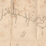
Map of the Washita river in Louisiana from the Hot Springs to ...
-
Topographic Map, Acadia National Park and vicinity, Hancock ...
-
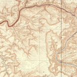
Route and Surveys of the Southern Journey Party, 1908-09.
↓ Refine your search
Results
-
Early European Maps | British Maps | Nineteenth Century Nautical Charts | Mount Desert Island | USGS Maps | National Park Service Maps of Acadia Map of the Discovery of the East ...
| Site: |
LOC.gov web pages |
| Original Format: |
Map - Web Page |
| Date: |
1999-06-02 |
-
Early European Maps | American Maps and Map Makers | Exploration and Geological Mapping | Environmental Maps | Early USGS Maps | USGS and the TVA -- Topographic Quadrangle Maps | National ...
| Site: |
LOC.gov web pages |
| Original Format: |
Web Page - Map |
| Date: |
1999-06-02 |