Featured Items
-
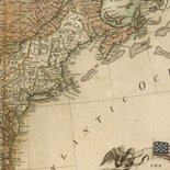
The United States of America laid down from the best ...
-
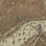
The city of New York.
-
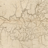
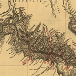
Reconnoissance, juillet 1781.
-
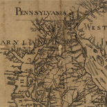
This map of the peninsula between Delaware & Chesopeak Bays,...
-
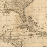
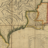
The West Indies, including part of Virginia, North Carolina, ...
-
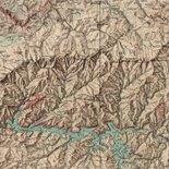
Great Smoky Mountains National Park and vicinity.
-
![[December 25, 1944], HQ Twelfth Army Group situation map.](https://cybercemetery.unt.edu/archive/oilspill/20121228013358im_/http://www.loc.gov/collections/static/world-war-ii-maps-military-situation-maps-from-1944-to-1945/images/ict21204.jpg)
[December 25, 1944], HQ Twelfth Army Group situation map.
-
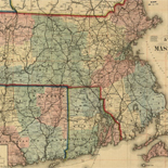
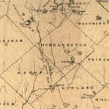
Rail road & township map of Massachusetts, published at the ...
-
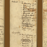
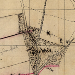
Memoranda of J. Hotchkiss
-
View of Greenfield, Mass.
-
A map of Kentucky from actual survey
-
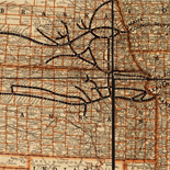
Chicago, central business section.
-
Hudson's Bay's country
-
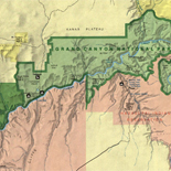
Grand Canyon of the Colorado.
-
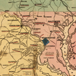
Map of the Maryland Campaign, Sept. 3rd to 29th 1862
-
A correct map of the United States showing the Union Pacific, ...
-
Topographic map of the Grand Canyon National Park Arizona.
-
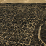
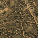
Fort Worth, Tex.,
-
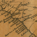
Map of rail road surveys from Worcester to Baldwinville & N.H. ...
-
Map of the United States of America : with the contiguous ...
-
Liberia and its vicinity.
-
Bird's eye view of Key West, Fla., Key West Island, C.S. Monroe ...
-
![Carte particulière d'une partie de la Louisianne ou les fleuve et rivierres [i.e. rivières] onts etés relevé a l'estime & les routtes [i.e. routes] par terre relevé & mesurées aux pas, par les Srs. Broutin, de Vergés, ingénieurs & Saucier dessinateur](https://cybercemetery.unt.edu/archive/oilspill/20121228013358im_/http://www.loc.gov/collections/static/louisiana-european-explorations-and-the-louisiana-purchase/images/ct000681.jpg)
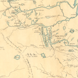
Carte particulière d'une partie de la Louisianne ou les fleuve ...
-
Map of the Yellowstone National Park, showing routes and ...
-
Map showing the route and connections of the Wheeling and ...
-
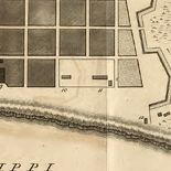
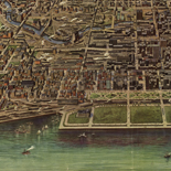
Plan of New Orleans.
-
Grand Canyon
-
[Sketch of a portion of the Antietam battlefield
-

Bird's eye view of the city of Mount Vernon
-
Seat of war in America, 6d.
↓ Refine your search
Results
-
The tradition of perspective mapping flowered in Europe in the late sixteenth and early seventeenth centuries. Mathias Merian, George Braun, Franz Hogenberg, and others produced perspective maps of European cities. These early ...
| Site: |
LOC.gov web pages |
| Original Format: |
Map - Web Page |
| Date: |
2007-05-17 |
-
Railways were introduced in England in the seventeenth century as a way to reduce friction in moving heavily loaded wheeled vehicles. The first North American "gravity road," as it was called, was ...
| Site: |
LOC.gov web pages |
| Original Format: |
Map - Web Page |
| Date: |
1998-10-19 |
-
War, like necessity, has been called the mother of invention. The same might be said of cartography, for with every war there is a great rush to produce maps to aid in ...
| Site: |
LOC.gov web pages |
| Original Format: |
Map - Web Page |
| Date: |
2008-08-04 |
-
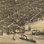
The Library of Congress, Geography and Map Division holds panoramic maps done by Albert Ruger, Thaddeus Mortimer Fowler, Lucien R. Burleigh, Henry Wellge, and Oakley H. Bailey who were among the most ...
| Site: |
LOC.gov web pages |
| Original Format: |
Map - Web Page |
| Date: |
2007-05-17 |


