| |
|||
|
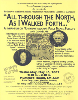
The American Folklife Center at the Library of Congress "All Through the North as I Walked Forth..."Northern Ireland Symposium Lectures
|
|
KAY MUHR
Richard Bartlett and Place-Names on his Maps of Ulster, 1600-1603
Mapmaker Richard Bartlett accompanied Charles Blount, Lord Deputy Mountjoy, on his campaign in Ulster to defeat Hugh O'Neill, Lord of Tyrone, in 1600-1602. Little is known of the mapmaker himself. A Richard Bartlett was mentioned as "employed in the north and at the siege of Kinsale", and a Mr.Bartlett was listed in the English army in Ireland 1601, as the "lord Deputy’s cornet." This officer’s post, as representative of cavalry with personal access to Mountjoy, may have been a cover for a brief to provide a visual record of the campaign, as Mountjoy’s secretary Fynes Morrison was doing in writing.
Unfortunately, almost the only other thing we know is the young man's end. After the Flight of the Earlsin September 1607, much of the land in the west of Ulster was confiscated or "escheated" to be allocated to new, English, owners. Sir John Davies was incharge of the Escheated County mapping, and he said his surveyors worked under guard in 1609, "for one Barkeley being appointed bythe late Earl of Devonshire [Lord Deputy Mountjoy] to draw a true and perfect map of the north parts of Ulster (the old maps beingfalse and defective), when he came into Tyrconnell [Donegal] the inhabitants took off his head, because they would not have their country discovered."
Three of Bartlett's manuscript maps of (probably) 1603 are thepresent subject, especially the South-East Ulster map, now published in Hayes McCoy’s atlas, 1964. The maps show Ulster districts and their boundaries, lakes, hills, woods, churches (often roofless), castles, and crannog islands. South-East Ulster adds routeways and campaigntents, star forts, and comment on events. Some types of names shown are: Ancient Ulster — ecclesiastical arrangements, plotting Ptolemy's map (150 AD), the Native political and cultural system and families, including inauguration sites, Settlements, and churches, Hills, Rivers, and Passes — which were of interest then for travel, now because they may preserve a record of names which have been lost.
Kay Muhr is Senior Research Fellow of the Northern Ireland Place-Name Project, Queen's University. She is chair of the Ulster Place-NameSociety; and past president of the Society for Name Studies in Britainand Ireland. She has written and lectured on early Irish literature, the useof place-names in Ulster Cycle tales, and early maps of Ireland.
HENRY GLASSIE
Ballymenone: The Power of Place and the Riddle of History
When he was collecting information for the Ordnance Survey, the antiquarian John O'Donovan passed through the County Fermanagh in 1835. He found that a name, reported centuries earlier in the Annals of the Four Masters (compiled between 1632and 1636 in a monastery in County Donegal), was used for the place where the Arney River flows into Upper Lough Erne. Though inscribed on no map, absent from official documents, and unknown beyond the district, that old name, Ballymenone, was still in use when I settled into Fermanagh for study in 1972.
I came to this place, just north of the border, to learn how country people endure through history. That year, 1972, was the bloodiest year of the Troubles, and during the decade that followed, I sat at the hearth with Hugh Nolan, Michael Boyle, Peter Flanagan, and Hugh Patrick Owens, learning their view of history. To hold to the truth, they restricted their responsibility to a small region that stretched eight miles north and east, ten miles south and west, from their home in Ballymenone. They ordered their history less chronologically than spatially. Places on the familiar, hilly landscape carried names, the names evoked events. The events were cast into narratives that the local historians arranged typologically into three great classes: saints, battles, and the neighbors. The stories of the saints who brought Christianity to Fermanagh placed upon the people the obligation of neighborly love. Their stories of battles taught them about violence and defeat. The tales they told of the neighbors revealed how people could prevail in the context of love and hate by adhering to the virtues of faith, courage and wit. The place they walked and worked was a place of deep, disturbing history. Their history, based in place and unfolding through tales that sketched the outlines of moral action, was a resource for endurance. The narrated landscape of Ballymenone drove them into engagement with the past and forced them into the knowledge that there is no human choice but choice.
Henry Glassie is the College Professor of Folklore at Indiana University. In 1972, he settled into a community in County Fermanagh, Northern Ireland. He gathered their stories, and five books were the result. Professor Glassie has served as the president of the American Folklore Society, and he has received many awards for his work.
Rediscover Northern Ireland:
In 2007, Washington D.C., the heart of the United States of America will have the opportunity to meet face to face with people from Northern Ireland - people who contribute meaningfully and creatively to the society which has emerged from a troubled past and is now looking outward and forward to the future. As a complement to the sights and sounds America will experience at the Smithsonian Folklife Festival, Northern Ireland has planned a program of events for Washington D.C., starting in March 2007, which will reflect other aspects of what happens here on a daily basis. This program is collectively entitled Rediscover Northern Ireland.
The American Folklife Center was created by Congress in 1976 and placed at the Library of Congress to "preserve and present American Folklife" through programs of research, documentation, archival preservation, reference service, live performance, exhibition, public programs, and training. The Center includes the American Folklife Center Archive of folk culture, which was established in 1928 and is now one of the largest collections of ethnographic material from the United States and around the world. Please visit our web site.
| ||||